1680 E Harstine Island Rd S Shelton, WA 98584
Estimated Value: $469,978 - $545,000
3
Beds
2
Baths
5,558
Sq Ft
$91/Sq Ft
Est. Value
About This Home
This home is located at 1680 E Harstine Island Rd S, Shelton, WA 98584 and is currently estimated at $505,245, approximately $90 per square foot. 1680 E Harstine Island Rd S is a home with nearby schools including Pioneer Primary School and Pioneer Intermediate/Middle School.
Ownership History
Date
Name
Owned For
Owner Type
Purchase Details
Closed on
Nov 18, 2016
Sold by
Lee Dale William
Bought by
Lee Dale William and Lee Sandra K
Current Estimated Value
Home Financials for this Owner
Home Financials are based on the most recent Mortgage that was taken out on this home.
Original Mortgage
$475,500
Interest Rate
3.83%
Mortgage Type
Reverse Mortgage Home Equity Conversion Mortgage
Purchase Details
Closed on
Dec 4, 2014
Sold by
Lee Sandra Kay
Bought by
Lee Dale William
Create a Home Valuation Report for This Property
The Home Valuation Report is an in-depth analysis detailing your home's value as well as a comparison with similar homes in the area
Home Values in the Area
Average Home Value in this Area
Purchase History
| Date | Buyer | Sale Price | Title Company |
|---|---|---|---|
| Lee Dale William | -- | Mason County Title Co | |
| Lee Dale William | -- | None Available |
Source: Public Records
Mortgage History
| Date | Status | Borrower | Loan Amount |
|---|---|---|---|
| Closed | Lee Dale William | $475,500 |
Source: Public Records
Tax History Compared to Growth
Tax History
| Year | Tax Paid | Tax Assessment Tax Assessment Total Assessment is a certain percentage of the fair market value that is determined by local assessors to be the total taxable value of land and additions on the property. | Land | Improvement |
|---|---|---|---|---|
| 2025 | $588 | $537,310 | $86,400 | $450,910 |
| 2024 | $588 | $523,485 | $86,400 | $437,085 |
| 2023 | $1,208 | $408,160 | $55,205 | $352,955 |
| 2022 | $1,218 | $404,980 | $54,120 | $350,860 |
| 2021 | $1,299 | $404,980 | $54,120 | $350,860 |
| 2020 | $1,407 | $316,510 | $55,220 | $261,290 |
| 2018 | $1,290 | $244,170 | $45,385 | $198,785 |
| 2017 | $1,475 | $244,170 | $45,385 | $198,785 |
| 2016 | $1,444 | $261,315 | $63,050 | $198,265 |
| 2015 | $2,681 | $257,160 | $61,750 | $195,410 |
| 2014 | -- | $269,765 | $65,000 | $204,765 |
| 2013 | -- | $260,010 | $65,000 | $195,010 |
Source: Public Records
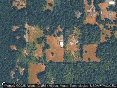
Map
Nearby Homes
- 160 Elin Ln
- 631 E Jared Rd
- 3600 E Harstine Island Rd S
- 480 E Hedlund Dr
- 140 E Beach Trail Ln
- 201 E Smith Cove Way
- 500 E Nicole Ln
- 110 E Smith Cove Way
- 600 E Nicole Ln
- 0 E E Camden Way
- 80 E Tamarack Ln
- 161 E Heron Cove
- 31 E Sylvan Rd
- 91 Sylvan Rd
- 4901 199th Avenue Ct SW
- 1415 208th Ave SW
- 181 SE Teagle Dr
- 2822 200th Ave SW
- 3234 Fishtrap Loop NE
- 9716 Hunter Point Rd NW
- 1680 E Harstine Island Rd S
- 1682 E Harstine Island Rd S
- 1686 E Harstine Island Rd S
- 1650 E Harstine Island Rd S
- 100 E Elin Ln
- 40 E Island West Place
- 1510 E Harstine Island Rd S
- 494 E Lansky Dr
- 260 E Lansky Dr
- 90 E Island West Dr
- 496 E Lansky Dr
- 91 E Island West Dr
- 1 E Lansky Dr
- 111 E Lansky Dr
- 311 E Lansky Dr
- 271 E Lansky Dr
- 501 E Lansky Dr
- 241 E Lansky Dr
- 921 E Lansky Dr
- 313 E Lansky Dr