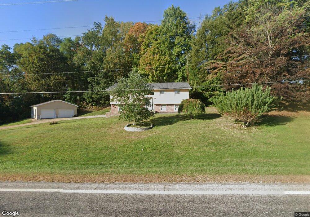
1680 State Route 89 Jeromesville, OH 44840
Estimated Value: $206,000 - $250,000
3
Beds
2
Baths
1,960
Sq Ft
$115/Sq Ft
Est. Value
About This Home
This home is located at 1680 State Route 89, Jeromesville, OH 44840 and is currently estimated at $225,606, approximately $115 per square foot. 1680 State Route 89 is a home located in Ashland County with nearby schools including Hillsdale Elementary School, Hillsdale Middle School, and Hillsdale High School.
Ownership History
Date
Name
Owned For
Owner Type
Purchase Details
Closed on
Jun 25, 2014
Sold by
Warren Charles W
Bought by
Cole Michael G and Cole Catherine B
Current Estimated Value
Home Financials for this Owner
Home Financials are based on the most recent Mortgage that was taken out on this home.
Original Mortgage
$101,530
Outstanding Balance
$77,451
Interest Rate
4.2%
Mortgage Type
New Conventional
Estimated Equity
$148,155
Purchase Details
Closed on
Mar 31, 1980
Bought by
Warren Charles W
Create a Home Valuation Report for This Property
The Home Valuation Report is an in-depth analysis detailing your home's value as well as a comparison with similar homes in the area
Home Values in the Area
Average Home Value in this Area
Purchase History
| Date | Buyer | Sale Price | Title Company |
|---|---|---|---|
| Cole Michael G | $99,500 | Service First Title Agcy Inc | |
| Warren Charles W | $57,000 | -- |
Source: Public Records
Mortgage History
| Date | Status | Borrower | Loan Amount |
|---|---|---|---|
| Open | Cole Michael G | $101,530 |
Source: Public Records
Tax History Compared to Growth
Tax History
| Year | Tax Paid | Tax Assessment Tax Assessment Total Assessment is a certain percentage of the fair market value that is determined by local assessors to be the total taxable value of land and additions on the property. | Land | Improvement |
|---|---|---|---|---|
| 2024 | $1,944 | $56,820 | $11,910 | $44,910 |
| 2023 | $1,944 | $56,820 | $11,910 | $44,910 |
| 2022 | $1,827 | $42,090 | $8,820 | $33,270 |
| 2021 | $1,830 | $42,090 | $8,820 | $33,270 |
| 2020 | $1,719 | $42,090 | $8,820 | $33,270 |
| 2019 | $1,525 | $36,550 | $7,720 | $28,830 |
| 2018 | $1,480 | $36,550 | $7,720 | $28,830 |
| 2017 | $1,478 | $36,550 | $7,720 | $28,830 |
| 2016 | $1,478 | $36,550 | $7,720 | $28,830 |
| 2015 | $1,460 | $36,550 | $7,720 | $28,830 |
| 2013 | $1,124 | $35,280 | $7,830 | $27,450 |
Source: Public Records
Map
Nearby Homes
- 14 E South St
- 144 Township Road 1650
- 1845 County Road 655
- 1346 Ohio 89
- 1346 State Route 89
- 156 U S 250
- 2057 Ohio 89
- 2057 State Route 89
- 2289 N Reedsburg Rd
- 1653 State Route 60
- 1653 Ohio 60
- 150 E Main St
- 10610 W Old Lincoln Way Unit 6201 Newkirk Rd.
- 1446 Township Road 805
- 486 Township Road 1275
- 0 Ashland County Road 2175
- 0 Ashland County Road 2175
- 0 Township Road 1275
- 0 Twp Rd 1806 Unit 11591470
- 1457 Township Road 853
- 1680 Sr 89
- 1674 Ohio 89
- 1674 State Route 89
- 1681 State Route 89
- 1670 State Route 89
- 1659 Ohio 89
- 1659 State Route 89
- 1656 Ohio 89
- 1656 State Route 89
- 1645 State Route 89
- 1645 State Route 89
- 1650B State Route 89
- 1650 State Route 89
- 1636 Township Road 395
- 1629 Township Road 395
- 1625 Township Road 395
- 0 Township Road 395
- 0 Township Road 395
- 0 Township Road 395
- 1619 395