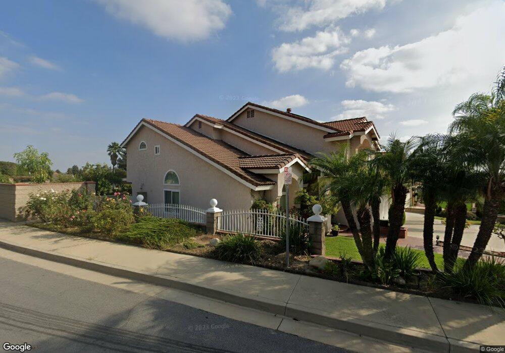
1698 S Lost Trail Dr Walnut, CA 91789
Estimated Value: $1,357,890 - $1,671,000
5
Beds
3
Baths
2,803
Sq Ft
$539/Sq Ft
Est. Value
About This Home
This home is located at 1698 S Lost Trail Dr, Walnut, CA 91789 and is currently estimated at $1,509,723, approximately $538 per square foot. 1698 S Lost Trail Dr is a home located in Los Angeles County with nearby schools including Collegewood Elementary School, Suzanne Middle School, and Walnut High School.
Ownership History
Date
Name
Owned For
Owner Type
Purchase Details
Closed on
Feb 26, 1997
Sold by
Bankers Trust Company
Bought by
Singh Anupam and Singh Ritu Khanna
Current Estimated Value
Home Financials for this Owner
Home Financials are based on the most recent Mortgage that was taken out on this home.
Original Mortgage
$214,600
Outstanding Balance
$26,185
Interest Rate
7.81%
Estimated Equity
$1,483,538
Purchase Details
Closed on
Aug 9, 1996
Sold by
Gammage James and Gammage Dorothy
Bought by
Bankers Trust Company
Create a Home Valuation Report for This Property
The Home Valuation Report is an in-depth analysis detailing your home's value as well as a comparison with similar homes in the area
Home Values in the Area
Average Home Value in this Area
Purchase History
| Date | Buyer | Sale Price | Title Company |
|---|---|---|---|
| Singh Anupam | $270,000 | First Southwestern Title Co | |
| Bankers Trust Company | $293,538 | Fidelity National Title Ins |
Source: Public Records
Mortgage History
| Date | Status | Borrower | Loan Amount |
|---|---|---|---|
| Open | Singh Anupam | $214,600 |
Source: Public Records
Tax History
| Year | Tax Paid | Tax Assessment Tax Assessment Total Assessment is a certain percentage of the fair market value that is determined by local assessors to be the total taxable value of land and additions on the property. | Land | Improvement |
|---|---|---|---|---|
| 2025 | $6,379 | $439,721 | $162,856 | $276,865 |
| 2024 | $6,379 | $431,100 | $159,663 | $271,437 |
| 2023 | $6,246 | $422,648 | $156,533 | $266,115 |
| 2022 | $6,133 | $414,362 | $153,464 | $260,898 |
| 2021 | $6,021 | $406,238 | $150,455 | $255,783 |
| 2019 | $5,858 | $394,192 | $145,994 | $248,198 |
| 2018 | $5,615 | $386,464 | $143,132 | $243,332 |
| 2016 | $5,246 | $371,459 | $137,575 | $233,884 |
| 2015 | $5,257 | $365,880 | $135,509 | $230,371 |
| 2014 | $5,280 | $358,714 | $132,855 | $225,859 |
Source: Public Records
Map
Nearby Homes
- 21029 Stoddard Wells Rd
- 21215 Granite Wells Dr
- 1359 Point Loma Place
- 16 Camelback
- 15 Camelback Dr
- 1941 N Onyx Dr
- 2117 S Buenos Aires Dr
- 2504 Martingail Dr
- 20033 E Skyline Dr
- 2333 N Coronet Ct
- 2651 Palomino Dr
- 3195 Hampton Dr
- 19742 Cameron Ave
- 19852 Moon Shadow Cir
- 20050 E Lorencita Dr
- 19803 Moon Shadow Cir
- 21300 E Via Verde St
- 805 Silver Valley Trail
- 19735 Arbor Ridge Dr
- 707 S Grand Ave
- 1694 S Lost Trail Dr
- 1686 S Lost Trail Dr Unit C
- 1702 N Winona Dr
- 1697 S Lost Trail Dr
- 1714 N Winona Dr
- 1680 S Lost Trail Dr
- 1708 N Winona Dr
- 1720 N Winona Dr
- 1689 S Lost Trail Dr
- 20945 Stoddard Wells Rd
- 1726 N Winona Dr
- 1681 S Lost Trail Dr
- 20951 Stoddard Wells Rd
- 1672 S Lost Trail Dr
- 1732 N Winona Dr
- 1668 N Timber Ridge Ln
- 1673 S Lost Trail Dr
- 20923 Stoddard Wells Rd
- 1738 N Winona Dr
- 1660 N Timber Ridge Ln
Your Personal Tour Guide
Ask me questions while you tour the home.