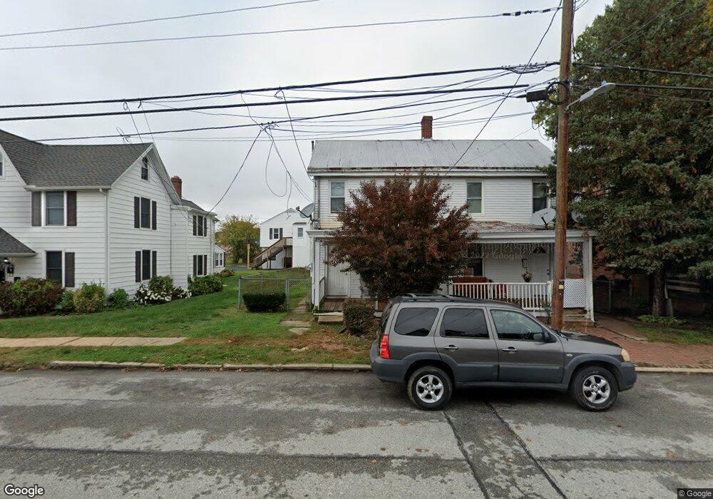
17 Crawford St Middletown, DE 19709
Estimated Value: $126,000 - $407,000
2
Beds
1
Bath
992
Sq Ft
$230/Sq Ft
Est. Value
About This Home
This home is located at 17 Crawford St, Middletown, DE 19709 and is currently estimated at $228,482, approximately $230 per square foot. 17 Crawford St is a home located in New Castle County with nearby schools including Silver Lake Elementary School, Louis L. Redding Middle School, and Appoquinimink High School.
Ownership History
Date
Name
Owned For
Owner Type
Purchase Details
Closed on
Jun 20, 2024
Sold by
Delisi Antonino
Bought by
Delisi Antonino and Delisi Margaret Moran
Current Estimated Value
Home Financials for this Owner
Home Financials are based on the most recent Mortgage that was taken out on this home.
Original Mortgage
$149,000
Outstanding Balance
$147,099
Interest Rate
7.02%
Mortgage Type
New Conventional
Estimated Equity
$81,383
Purchase Details
Closed on
Feb 12, 2004
Sold by
Walker Jodi L
Bought by
Delsi Antonio
Home Financials for this Owner
Home Financials are based on the most recent Mortgage that was taken out on this home.
Original Mortgage
$60,000
Interest Rate
5.82%
Mortgage Type
Purchase Money Mortgage
Purchase Details
Closed on
Mar 23, 2001
Sold by
Wheeler Norman F
Bought by
Walker Jodi L
Home Financials for this Owner
Home Financials are based on the most recent Mortgage that was taken out on this home.
Original Mortgage
$83,250
Interest Rate
6.96%
Create a Home Valuation Report for This Property
The Home Valuation Report is an in-depth analysis detailing your home's value as well as a comparison with similar homes in the area
Home Values in the Area
Average Home Value in this Area
Purchase History
| Date | Buyer | Sale Price | Title Company |
|---|---|---|---|
| Delisi Antonino | -- | None Listed On Document | |
| Delsi Antonio | $70,000 | -- | |
| Walker Jodi L | $92,500 | -- |
Source: Public Records
Mortgage History
| Date | Status | Borrower | Loan Amount |
|---|---|---|---|
| Open | Delisi Antonino | $149,000 | |
| Previous Owner | Delsi Antonio | $60,000 | |
| Previous Owner | Walker Jodi L | $83,250 |
Source: Public Records
Tax History Compared to Growth
Tax History
| Year | Tax Paid | Tax Assessment Tax Assessment Total Assessment is a certain percentage of the fair market value that is determined by local assessors to be the total taxable value of land and additions on the property. | Land | Improvement |
|---|---|---|---|---|
| 2024 | $66 | $21,900 | $5,200 | $16,700 |
| 2023 | $66 | $21,900 | $5,200 | $16,700 |
| 2022 | $673 | $21,900 | $5,200 | $16,700 |
| 2021 | $659 | $21,900 | $5,200 | $16,700 |
| 2020 | $651 | $21,900 | $5,200 | $16,700 |
| 2019 | $669 | $21,900 | $5,200 | $16,700 |
| 2018 | $577 | $21,900 | $5,200 | $16,700 |
| 2017 | $556 | $21,900 | $5,200 | $16,700 |
| 2016 | $499 | $21,900 | $5,200 | $16,700 |
| 2015 | $549 | $21,900 | $5,200 | $16,700 |
| 2014 | $547 | $21,900 | $5,200 | $16,700 |
Source: Public Records
Map
Nearby Homes
- 111 Anderson St
- 8 Redding Cir
- 84 Franklin Dr
- 12 E Cochran St
- 533 Janvier Dr
- 232 E Main St
- 236 E Main St
- Serenade Plan at Crossings at Silver Lake
- 701 S Broad St
- 40 S Cummings Dr
- 13 Brady Cir
- 722 Marian Dr
- 103 Bonnybrook Rd
- 40 Browning Cir
- 226 Horseshoe Dr
- 811 S Cass St
- 286 Vincent Cir
- 908 S Cass St
- 306 E Harvest Ln
- 16 E Shakespeare Dr