Estimated Value: $395,000 - $458,000
3
Beds
1
Bath
1,701
Sq Ft
$249/Sq Ft
Est. Value
About This Home
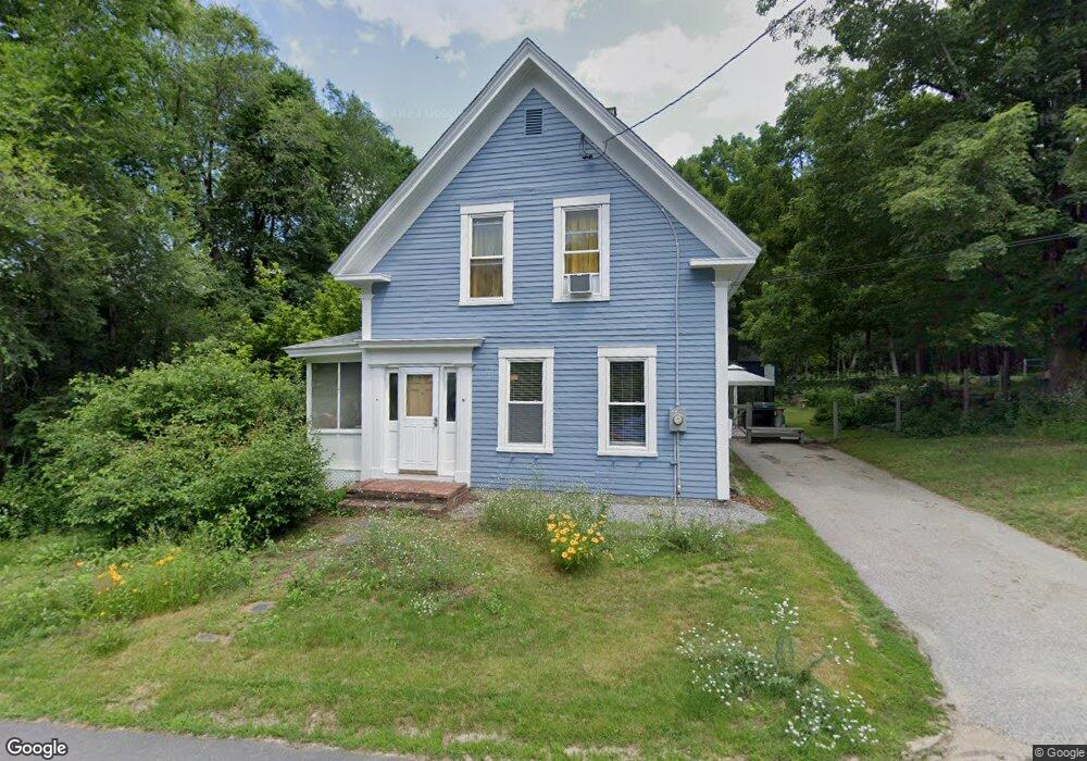
This home is located at 17 Depot St, Weare, NH 03281 and is currently estimated at $423,011, approximately $248 per square foot. 17 Depot St is a home with nearby schools including Center Woods Elementary School, Weare Middle School, and John Stark Regional High School.
Ownership History
Date
Name
Owned For
Owner Type
Purchase Details
Closed on
Aug 2, 2001
Sold by
Welsh Robert H
Bought by
Wojewoda James R and Wojewoda Daisy R
Current Estimated Value
Home Financials for this Owner
Home Financials are based on the most recent Mortgage that was taken out on this home.
Original Mortgage
$138,800
Interest Rate
7.14%
Create a Home Valuation Report for This Property
The Home Valuation Report is an in-depth analysis detailing your home's value as well as a comparison with similar homes in the area
Home Values in the Area
Average Home Value in this Area
Purchase History
| Date | Buyer | Sale Price | Title Company |
|---|---|---|---|
| Wojewoda James R | $139,900 | -- |
Source: Public Records
Mortgage History
| Date | Status | Borrower | Loan Amount |
|---|---|---|---|
| Open | Wojewoda James R | $142,850 | |
| Closed | Wojewoda James R | $25,250 | |
| Closed | Wojewoda James R | $158,100 | |
| Closed | Wojewoda James R | $138,800 |
Source: Public Records
Tax History Compared to Growth
Tax History
| Year | Tax Paid | Tax Assessment Tax Assessment Total Assessment is a certain percentage of the fair market value that is determined by local assessors to be the total taxable value of land and additions on the property. | Land | Improvement |
|---|---|---|---|---|
| 2024 | $6,048 | $296,600 | $118,600 | $178,000 |
| 2023 | $5,588 | $296,600 | $118,600 | $178,000 |
| 2022 | $5,161 | $296,600 | $118,600 | $178,000 |
| 2021 | $4,797 | $278,900 | $118,600 | $160,300 |
| 2020 | $4,572 | $190,900 | $83,900 | $107,000 |
| 2019 | $4,526 | $190,900 | $83,900 | $107,000 |
| 2018 | $4,396 | $190,900 | $83,900 | $107,000 |
| 2016 | $4,340 | $194,000 | $83,900 | $110,100 |
| 2015 | $4,365 | $194,800 | $83,400 | $111,400 |
| 2014 | $4,327 | $194,800 | $83,400 | $111,400 |
| 2013 | $4,237 | $194,800 | $83,400 | $111,400 |
Source: Public Records
Map
Nearby Homes
- 174 S Stark Hwy Unit 13
- 174 S Stark Hwy Unit 1
- 174 S Stark Hwy Unit 23
- 88 Saunders Rd
- 93 Daniels Rd
- 95 Wright Dr
- 16 Palmer Rd
- 77 Gould Rd
- 34 Lull Rd
- 103 Renshaw Rd
- 25 Pleasant St
- 450 Weare Rd
- 342 Weare Rd
- 12 S Mast St
- 22 Fairway Dr
- 39 S Mast St
- 3 Stephanie Rd
- 0 Fairway Dr Unit 11
- 624 S Stark Hwy
- 99 Elm St
- 6 River Rd
- 2 Depot St
- 29 Depot St
- 429 Riverdale Rd
- 437 Riverdale Rd
- 463 Riverdale Rd
- 417 Riverdale Rd
- 16 River Rd
- 412 Riverdale Rd
- 407 Riverdale Rd
- 476 Riverdale Rd
- 11 River Rd
- 422 Riverdale Rd
- 406 Riverdale Rd
- 401 Riverdale Rd
- 397 Riverdale Rd
- 36 River Rd
- 394 Riverdale Rd
- 389 Riverdale Rd
- 372 Riverdale Rd