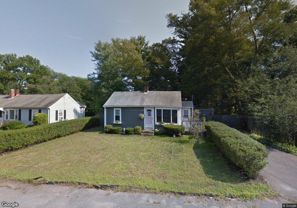
17 Ekstrom Cir Abington, MA 02351
Estimated Value: $372,000 - $440,000
2
Beds
1
Bath
534
Sq Ft
$758/Sq Ft
Est. Value
About This Home
This home is located at 17 Ekstrom Cir, Abington, MA 02351 and is currently estimated at $404,965, approximately $758 per square foot. 17 Ekstrom Cir is a home located in Plymouth County with nearby schools including Woodsdale School, Beaver Brook Elementary School, and Abington Middle School.
Ownership History
Date
Name
Owned For
Owner Type
Purchase Details
Closed on
Jul 24, 1998
Sold by
Dionne Keith J and Dionne Leeann M
Bought by
Murphy Allison M
Current Estimated Value
Home Financials for this Owner
Home Financials are based on the most recent Mortgage that was taken out on this home.
Original Mortgage
$87,400
Outstanding Balance
$17,870
Interest Rate
6.99%
Mortgage Type
Purchase Money Mortgage
Estimated Equity
$387,095
Purchase Details
Closed on
Mar 8, 1993
Sold by
Bertocchi Steven and Bertocchi Linda J
Bought by
Dionne Keith J and Dionne Leeann M
Home Financials for this Owner
Home Financials are based on the most recent Mortgage that was taken out on this home.
Original Mortgage
$68,400
Interest Rate
7.96%
Mortgage Type
Purchase Money Mortgage
Create a Home Valuation Report for This Property
The Home Valuation Report is an in-depth analysis detailing your home's value as well as a comparison with similar homes in the area
Home Values in the Area
Average Home Value in this Area
Purchase History
| Date | Buyer | Sale Price | Title Company |
|---|---|---|---|
| Murphy Allison M | $98,000 | -- | |
| Dionne Keith J | $76,000 | -- |
Source: Public Records
Mortgage History
| Date | Status | Borrower | Loan Amount |
|---|---|---|---|
| Open | Dionne Keith J | $31,000 | |
| Open | Dionne Keith J | $87,400 | |
| Previous Owner | Dionne Keith J | $68,400 | |
| Previous Owner | Dionne Keith J | $2,500 |
Source: Public Records
Tax History
| Year | Tax Paid | Tax Assessment Tax Assessment Total Assessment is a certain percentage of the fair market value that is determined by local assessors to be the total taxable value of land and additions on the property. | Land | Improvement |
|---|---|---|---|---|
| 2025 | $4,504 | $344,900 | $245,200 | $99,700 |
| 2024 | $4,223 | $315,600 | $222,900 | $92,700 |
| 2023 | $4,263 | $300,000 | $202,600 | $97,400 |
| 2022 | $3,966 | $260,600 | $168,800 | $91,800 |
| 2021 | $3,751 | $227,600 | $153,800 | $73,800 |
| 2020 | $3,718 | $218,700 | $142,200 | $76,500 |
| 2019 | $3,313 | $190,500 | $135,400 | $55,100 |
| 2018 | $6,527 | $189,000 | $135,400 | $53,600 |
| 2017 | $3,160 | $172,200 | $135,400 | $36,800 |
| 2016 | $2,921 | $162,900 | $129,000 | $33,900 |
| 2015 | $2,722 | $160,100 | $129,000 | $31,100 |
Source: Public Records
Map
Nearby Homes
- 14 Jamieson St
- 66 Coleman St
- 44 Old Forge Rd
- 22 Kingswood Dr Unit 6F
- 337 Randolph St
- 189 Sheri Ln
- 720 Hancock St
- 93 Patricia Ln
- 451 Lincoln St
- 1077 Bedford St
- 1065 Bedford St
- 1353 Washington St
- 7 Swan Ave
- 338 Adams St
- 0 Bedford St
- 120 Glen St
- 45-R Ernest St
- 332 Hancock St
- 35 Adams St
- 42 Van Buren Dr
- 23 Ekstrom Cir
- 42 Jamieson St
- 29 Ekstrom Cir
- 22 Ekstrom Cir
- 113 Ekstrom Cir
- 48 Jamieson St
- 105 Ekstrom Cir
- 16 Ekstrom Cir
- 54 Jamieson St
- 35 Ekstrom Cir
- 28 Ekstrom Cir
- 99 Ekstrom Cir
- 26 Jamieson St
- 34 Ekstrom Cir
- 93 Ekstrom Cir
- 39 Jamieson St
- 43 Ekstrom Cir
- 20 Jamieson St
- 112 Ekstrom Cir
- 64 Jamieson St
Your Personal Tour Guide
Ask me questions while you tour the home.