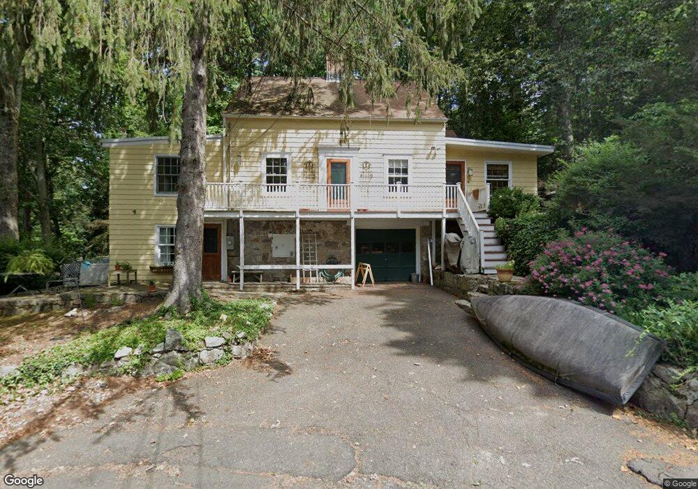
17 Forge Rd Wilton, CT 06897
Estimated Value: $1,110,041 - $1,374,000
4
Beds
3
Baths
2,595
Sq Ft
$486/Sq Ft
Est. Value
About This Home
This home is located at 17 Forge Rd, Wilton, CT 06897 and is currently estimated at $1,262,010, approximately $486 per square foot. 17 Forge Rd is a home located in Fairfield County with nearby schools including Miller-Driscoll School, Cider Mill School, and Middlebrook School.
Ownership History
Date
Name
Owned For
Owner Type
Purchase Details
Closed on
Apr 2, 2004
Sold by
Flick Lawrence A and Flick Margaret C
Bought by
Tripp William H and Masse-Berger Danielle
Current Estimated Value
Home Financials for this Owner
Home Financials are based on the most recent Mortgage that was taken out on this home.
Original Mortgage
$620,000
Interest Rate
5.56%
Create a Home Valuation Report for This Property
The Home Valuation Report is an in-depth analysis detailing your home's value as well as a comparison with similar homes in the area
Home Values in the Area
Average Home Value in this Area
Purchase History
| Date | Buyer | Sale Price | Title Company |
|---|---|---|---|
| Tripp William H | $775,000 | -- |
Source: Public Records
Mortgage History
| Date | Status | Borrower | Loan Amount |
|---|---|---|---|
| Open | Tripp William H | $480,000 | |
| Closed | Tripp William H | $50,000 | |
| Closed | Tripp William H | $620,000 | |
| Previous Owner | Tripp William H | $140,000 |
Source: Public Records
Tax History
| Year | Tax Paid | Tax Assessment Tax Assessment Total Assessment is a certain percentage of the fair market value that is determined by local assessors to be the total taxable value of land and additions on the property. | Land | Improvement |
|---|---|---|---|---|
| 2025 | $13,270 | $543,620 | $292,110 | $251,510 |
| 2024 | $13,014 | $543,620 | $292,110 | $251,510 |
| 2023 | $11,785 | $402,780 | $279,300 | $123,480 |
| 2022 | $11,370 | $402,780 | $279,300 | $123,480 |
| 2021 | $11,225 | $402,780 | $279,300 | $123,480 |
| 2020 | $11,060 | $402,780 | $279,300 | $123,480 |
| 2019 | $11,495 | $402,780 | $279,300 | $123,480 |
| 2018 | $11,151 | $395,570 | $293,930 | $101,640 |
| 2017 | $10,985 | $395,570 | $293,930 | $101,640 |
| 2016 | $10,815 | $395,570 | $293,930 | $101,640 |
| 2015 | $10,613 | $395,570 | $293,930 | $101,640 |
| 2014 | $10,487 | $395,570 | $293,930 | $101,640 |
Source: Public Records
Map
Nearby Homes
- 16 Trails End Rd
- 89 Pastures Ln
- 135 Comstock Hill Rd
- 24 Grey Hollow Rd
- 158L Carter St
- 35 Canoe Hill Rd
- 152L Carter St
- 433 Belden Hill Rd
- 136L Carter St
- 106A Comstock Hill Ave
- 140L Carter St
- 67 Carter St
- 30L Huckleberry Hill Rd
- 332 Belden Hill Rd
- 234 Silvermine Ave
- 9 Old Farm Rd
- 123 Old Belden Hill Rd Unit 19
- 196 Mariomi Rd
- 21 Woods End Dr
- 8 Oakwood Ave Unit B13
Your Personal Tour Guide
Ask me questions while you tour the home.