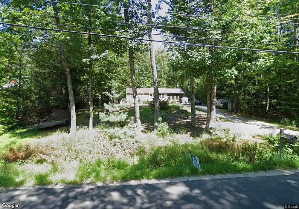
17 Long Point Rd Moultonborough, NH 03254
Estimated Value: $444,628 - $610,000
3
Beds
2
Baths
1,438
Sq Ft
$355/Sq Ft
Est. Value
About This Home
This home is located at 17 Long Point Rd, Moultonborough, NH 03254 and is currently estimated at $510,407, approximately $354 per square foot. 17 Long Point Rd is a home located in Carroll County with nearby schools including Moultonborough Central School and Moultonborough Academy High School.
Ownership History
Date
Name
Owned For
Owner Type
Purchase Details
Closed on
Jan 25, 1999
Sold by
Young Roger A and Young Linda F
Bought by
Sullivan Robert M
Current Estimated Value
Home Financials for this Owner
Home Financials are based on the most recent Mortgage that was taken out on this home.
Original Mortgage
$50,000
Interest Rate
6.7%
Mortgage Type
Purchase Money Mortgage
Create a Home Valuation Report for This Property
The Home Valuation Report is an in-depth analysis detailing your home's value as well as a comparison with similar homes in the area
Home Values in the Area
Average Home Value in this Area
Purchase History
| Date | Buyer | Sale Price | Title Company |
|---|---|---|---|
| Sullivan Robert M | $75,000 | -- |
Source: Public Records
Mortgage History
| Date | Status | Borrower | Loan Amount |
|---|---|---|---|
| Open | Sullivan Robert M | $25,000 | |
| Open | Sullivan Robert M | $127,000 | |
| Closed | Sullivan Robert M | $50,000 |
Source: Public Records
Tax History Compared to Growth
Tax History
| Year | Tax Paid | Tax Assessment Tax Assessment Total Assessment is a certain percentage of the fair market value that is determined by local assessors to be the total taxable value of land and additions on the property. | Land | Improvement |
|---|---|---|---|---|
| 2024 | $1,794 | $317,600 | $118,500 | $199,100 |
| 2023 | $1,713 | $300,600 | $105,700 | $194,900 |
| 2022 | $1,264 | $264,400 | $95,200 | $169,200 |
| 2021 | $1,668 | $238,900 | $91,900 | $147,000 |
| 2020 | $1,624 | $227,800 | $91,900 | $135,900 |
| 2019 | $1,629 | $227,800 | $91,900 | $135,900 |
| 2018 | $1,676 | $217,100 | $83,800 | $133,300 |
| 2017 | $1,689 | $205,500 | $83,800 | $121,700 |
| 2016 | $1,653 | $189,100 | $83,800 | $105,300 |
| 2015 | $1,581 | $175,500 | $83,800 | $91,700 |
| 2014 | $1,596 | $180,100 | $83,800 | $96,300 |
| 2013 | $1,514 | $174,200 | $83,800 | $90,400 |
Source: Public Records
Map
Nearby Homes
- 62 Boathouse Rd
- Lot 16 Long Point Rd
- 29 Kona Farm Rd
- 5 Ferry Rd
- 30 Leopards Leap
- 31 Rays Way
- 23 Harbourside Dr
- 67 Hoyt Mill Rd
- 203 Krainewood Dr
- 1 Little Beaver Island
- 4 Orton Ln
- 145 Hanson Dr
- 21 Orton Ln
- 320 Redding Ln
- 11 Geery Ln
- 122 Toltec Point Rd
- 16 Long Island Rd
- 26 Lovejoy Ln
- 46 Toltec Point Rd
- 00 Moultonboro Neck Rd Unit 2
- 15 Long Point Rd
- 27 Long Point Rd
- 20 Long Point Rd
- 32 Long Point Rd
- 18 40 Acre Field Rd
- 37 Long Point Rd
- 32 40 Acre Field Rd
- 53 Colby Rd
- 43 Colby Rd
- 14 Long Point Rd
- 12 40 Acre Field Rd
- 36 40 Acre Field Rd
- 39 Colby Rd
- 21 40 Acre Field Rd
- 61 Colby Rd
- 35 Forty Acre Field Rd
- 9 40 Acre Field Rd
- 38 40 Acre Field Rd
- 43 Long Point Rd
- 38 Forty Acre Field Rd