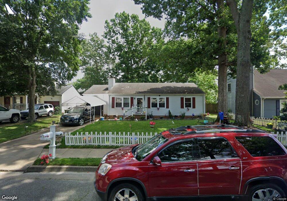
17 Roberts Trace Hampton, VA 23666
Northampton NeighborhoodEstimated Value: $265,000 - $289,000
3
Beds
2
Baths
1,138
Sq Ft
$243/Sq Ft
Est. Value
About This Home
This home is located at 17 Roberts Trace, Hampton, VA 23666 and is currently estimated at $276,531, approximately $242 per square foot. 17 Roberts Trace is a home located in Hampton City with nearby schools including Tucker-Capps Elementary School, Forrest Elementary School, and Cesar Tarrant Middle School.
Ownership History
Date
Name
Owned For
Owner Type
Purchase Details
Closed on
Mar 25, 2002
Sold by
Deas Andrew J
Bought by
Powell Willie H
Current Estimated Value
Home Financials for this Owner
Home Financials are based on the most recent Mortgage that was taken out on this home.
Original Mortgage
$108,199
Outstanding Balance
$44,625
Interest Rate
6.88%
Mortgage Type
FHA
Estimated Equity
$231,906
Create a Home Valuation Report for This Property
The Home Valuation Report is an in-depth analysis detailing your home's value as well as a comparison with similar homes in the area
Home Values in the Area
Average Home Value in this Area
Purchase History
| Date | Buyer | Sale Price | Title Company |
|---|---|---|---|
| Powell Willie H | $109,900 | -- |
Source: Public Records
Mortgage History
| Date | Status | Borrower | Loan Amount |
|---|---|---|---|
| Open | Powell Willie H | $108,199 |
Source: Public Records
Tax History
| Year | Tax Paid | Tax Assessment Tax Assessment Total Assessment is a certain percentage of the fair market value that is determined by local assessors to be the total taxable value of land and additions on the property. | Land | Improvement |
|---|---|---|---|---|
| 2025 | $2,894 | $257,700 | $70,000 | $187,700 |
| 2024 | $2,554 | $222,100 | $70,000 | $152,100 |
| 2023 | $2,446 | $210,900 | $60,000 | $150,900 |
| 2022 | $2,478 | $210,000 | $55,000 | $155,000 |
| 2021 | $2,461 | $188,000 | $50,000 | $138,000 |
| 2020 | $2,158 | $174,000 | $50,000 | $124,000 |
| 2019 | $2,133 | $172,000 | $50,000 | $122,000 |
| 2018 | $2,196 | $169,500 | $45,000 | $124,500 |
| 2017 | $2,196 | $0 | $0 | $0 |
| 2016 | $2,196 | $169,500 | $0 | $0 |
| 2015 | $2,196 | $0 | $0 | $0 |
| 2014 | $2,127 | $160,000 | $45,800 | $114,200 |
Source: Public Records
Map
Nearby Homes
- 15 Roberts Trace
- 19 Roberts Trace
- 21 Roberts Trace
- 13 Roberts Trace
- 2 Leahs Trace
- 16 Roberts Trace
- 23 Roberts Trace
- 14 Roberts Trace
- 11 Roberts Trace
- 1 Leahs Trace
- 12 Roberts Trace
- 25 Roberts Trace
- 6 Leahs Trace
- 3 Leahs Trace
- 9 Roberts Trace
- 839 Sharpley Ave
- 27 Roberts Trace
- 837 Sharpley Ave
- 7 Roberts Trace
- 2 Brantleys Trace
Your Personal Tour Guide
Ask me questions while you tour the home.