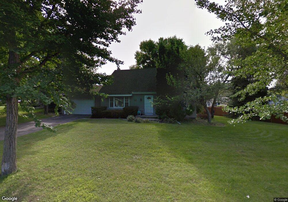
170 Valleyside Dr Saint Paul, MN 55119
Battle Creek NeighborhoodEstimated Value: $363,000 - $401,000
4
Beds
3
Baths
2,364
Sq Ft
$160/Sq Ft
Est. Value
About This Home
This home is located at 170 Valleyside Dr, Saint Paul, MN 55119 and is currently estimated at $379,151, approximately $160 per square foot. 170 Valleyside Dr is a home located in Ramsey County with nearby schools including Battle Creek Elementary School, Battle Creek Middle School, and Harding Senior High School.
Ownership History
Date
Name
Owned For
Owner Type
Purchase Details
Closed on
Apr 30, 2021
Sold by
Dier Paul and Dier Paul T
Bought by
Nebi Abda
Current Estimated Value
Home Financials for this Owner
Home Financials are based on the most recent Mortgage that was taken out on this home.
Original Mortgage
$289,750
Outstanding Balance
$219,366
Interest Rate
3.1%
Mortgage Type
Purchase Money Mortgage
Estimated Equity
$159,785
Purchase Details
Closed on
Aug 3, 2017
Sold by
Subart Michaele
Bought by
Derk Paul
Purchase Details
Closed on
Jul 21, 2016
Sold by
Dier Paul T and Dier Michele
Bought by
Dier Paul T
Purchase Details
Closed on
Dec 13, 2002
Sold by
Nelson Todd R and Nelson Kelly K
Bought by
Dier Paul T and Dier Michele L
Purchase Details
Closed on
Oct 10, 1997
Sold by
Firstar Bank Of Minnesota
Bought by
Nelson Todd R and Nelson Kelly K
Create a Home Valuation Report for This Property
The Home Valuation Report is an in-depth analysis detailing your home's value as well as a comparison with similar homes in the area
Home Values in the Area
Average Home Value in this Area
Purchase History
| Date | Buyer | Sale Price | Title Company |
|---|---|---|---|
| Nebi Abda | $305,000 | Results Title | |
| Derk Paul | -- | None Available | |
| Dier Paul T | -- | None Available | |
| Dier Paul T | $199,000 | -- | |
| Nelson Todd R | $107,900 | -- |
Source: Public Records
Mortgage History
| Date | Status | Borrower | Loan Amount |
|---|---|---|---|
| Open | Nebi Abda | $289,750 |
Source: Public Records
Tax History Compared to Growth
Tax History
| Year | Tax Paid | Tax Assessment Tax Assessment Total Assessment is a certain percentage of the fair market value that is determined by local assessors to be the total taxable value of land and additions on the property. | Land | Improvement |
|---|---|---|---|---|
| 2025 | $7,540 | $396,100 | $38,700 | $357,400 |
| 2023 | $7,540 | $399,200 | $38,700 | $360,500 |
| 2022 | $5,094 | $357,600 | $38,700 | $318,900 |
| 2021 | $4,800 | $310,000 | $38,700 | $271,300 |
| 2020 | $5,040 | $288,500 | $38,700 | $249,800 |
| 2019 | $4,958 | $281,800 | $38,700 | $243,100 |
| 2018 | $4,338 | $282,200 | $38,700 | $243,500 |
| 2017 | $4,090 | $260,400 | $34,100 | $226,300 |
| 2016 | $4,328 | $0 | $0 | $0 |
| 2015 | $3,920 | $240,100 | $34,100 | $206,000 |
| 2014 | $3,580 | $0 | $0 | $0 |
Source: Public Records
Map
Nearby Homes
- 1935 Warbler Ln
- 138 Ruth St N Unit 9
- 1989 N Park Dr
- 2059 Parkside Dr Unit 29
- 2069 Parkside Dr Unit G2
- 2063 N Park Dr Unit 6
- 125 Battle Creek Place
- 136 White Bear Ave N
- 49 Battle Creek Place
- 1821 Wilson Ave
- 465 Ruth St N
- 125 Mcknight Rd N Unit K
- 1935 Fremont Ave E
- 2138 3rd St E
- 1964 4th St E
- 237 Sigurd St
- 1600 Old Hudson Rd
- 267 Hazelwood St
- 2169 Glenridge Ave
- 2243 3rd St E
- 174 Valleyside Dr
- 1957 Warbler Ln
- 1963 Warbler Ln
- 178 Valleyside Dr
- 1948 Parkland Ct
- 1953 Parkland Ct
- 1951 Warbler Ln
- 171 Valleyside Dr
- 182 Valleyside Dr
- 175 Valleyside Dr
- 1975 Warbler Ln
- 1942 Parkland Ct
- 1947 Parkland Ct
- 179 Valleyside Dr
- 1941 Warbler Ln
- 184 Valleyside Dr
- 1981 Warbler Ln
- 1981 1981 Warbler-Lane-
- 1962 Warbler Ln
- 183 Valleyside Dr