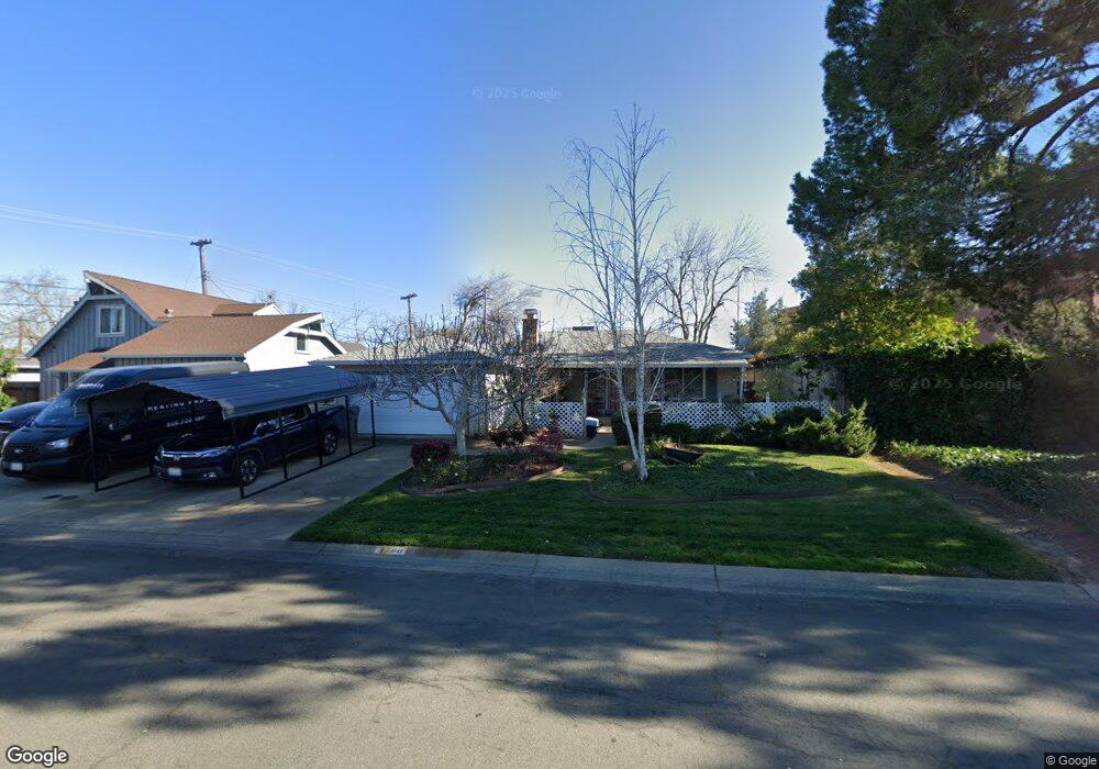
1700 Keith Way Sacramento, CA 95815
Swanston Estates NeighborhoodEstimated Value: $314,000 - $478,000
3
Beds
2
Baths
1,134
Sq Ft
$360/Sq Ft
Est. Value
About This Home
This home is located at 1700 Keith Way, Sacramento, CA 95815 and is currently estimated at $408,585, approximately $360 per square foot. 1700 Keith Way is a home located in Sacramento County with nearby schools including D. W. Babcock Elementary, Martin Luther King Jr. Technology Academy, and Grant Union High School.
Ownership History
Date
Name
Owned For
Owner Type
Purchase Details
Closed on
Aug 7, 2025
Sold by
Marker Nancy L
Bought by
Nancy L Marker Revocable Trust and Marker
Current Estimated Value
Purchase Details
Closed on
Mar 13, 2002
Sold by
Rocco Rookard Geoffrey W and Rocco Rookand Jacqueline
Bought by
Marker Nancy L
Home Financials for this Owner
Home Financials are based on the most recent Mortgage that was taken out on this home.
Original Mortgage
$147,910
Interest Rate
6.99%
Mortgage Type
FHA
Create a Home Valuation Report for This Property
The Home Valuation Report is an in-depth analysis detailing your home's value as well as a comparison with similar homes in the area
Home Values in the Area
Average Home Value in this Area
Purchase History
| Date | Buyer | Sale Price | Title Company |
|---|---|---|---|
| Nancy L Marker Revocable Trust | -- | None Listed On Document | |
| Nancy L Marker Revocable Trust | -- | None Listed On Document | |
| Marker Nancy L | $150,000 | Commonwealth Land Title Co |
Source: Public Records
Mortgage History
| Date | Status | Borrower | Loan Amount |
|---|---|---|---|
| Previous Owner | Marker Nancy L | $147,910 | |
| Closed | Marker Nancy L | $9,000 |
Source: Public Records
Tax History Compared to Growth
Tax History
| Year | Tax Paid | Tax Assessment Tax Assessment Total Assessment is a certain percentage of the fair market value that is determined by local assessors to be the total taxable value of land and additions on the property. | Land | Improvement |
|---|---|---|---|---|
| 2025 | $2,790 | $221,569 | $44,305 | $177,264 |
| 2024 | $2,790 | $217,226 | $43,437 | $173,789 |
| 2023 | $2,801 | $212,968 | $42,586 | $170,382 |
| 2022 | $2,647 | $208,793 | $41,751 | $167,042 |
| 2021 | $2,635 | $204,700 | $40,933 | $163,767 |
| 2020 | $2,608 | $202,602 | $40,514 | $162,088 |
| 2019 | $2,573 | $198,630 | $39,720 | $158,910 |
| 2018 | $2,440 | $194,737 | $38,942 | $155,795 |
| 2017 | $2,505 | $190,920 | $38,179 | $152,741 |
| 2016 | $2,492 | $187,178 | $37,431 | $149,747 |
| 2015 | $2,352 | $184,367 | $36,869 | $147,498 |
| 2014 | $2,394 | $180,756 | $36,147 | $144,609 |
Source: Public Records
Map
Nearby Homes
- 2104 Rockbridge Rd
- 2008 Bowling Green Dr
- 2001 Bowling Green Dr
- 2046 Edwin Way
- 2106 Keith Way
- 2100 Bowling Green Dr
- 2405 Ethan Way
- 2436 Connie Dr
- 1528 Orlando Way
- 2513 Anna Way
- 2653 Princeton St
- 1851 Glenrose Ave
- 1679 Glenrose Ave
- 2713 Plover St
- 2001 Woodstock Way
- 2314 Wyda Way
- 2313 Selma St
- 2410 Post Oak Ln
- 2736 Connie Dr
- 2350 Wyda Way
- 1704 Keith Way
- 1800 Jamestown Dr
- 1804 Jamestown Dr
- 1701 Keith Way
- 1705 Keith Way
- 1808 Jamestown Dr
- 1709 Keith Way
- 1812 Jamestown Dr
- 1601 Bowling Green Dr
- 1713 Keith Way
- 2100 Yorkshire Rd
- 2104 Yorkshire Rd
- 2108 Yorkshire Rd
- 1605 Bowling Green Dr
- 1717 Keith Way
- 2112 Yorkshire Rd
- 1805 Jamestown Dr
- 1801 Jamestown Dr
- 1820 Jamestown Dr
- 1809 Jamestown Dr