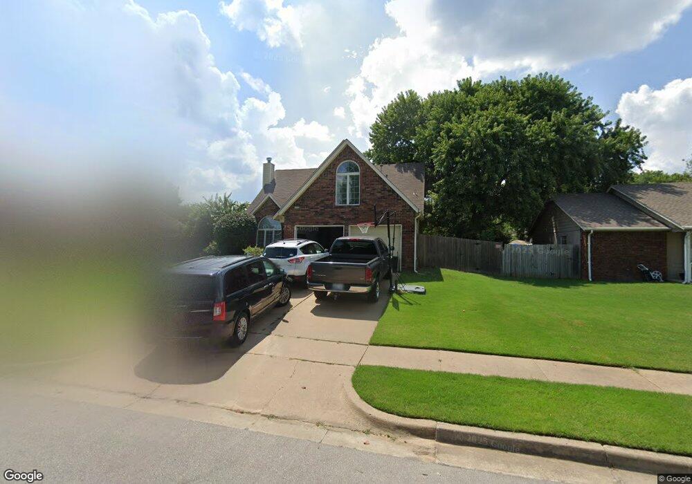
1700 S Aster Ave Broken Arrow, OK 74012
Wolf Creek Estates NeighborhoodEstimated Value: $267,940 - $292,000
4
Beds
2
Baths
2,184
Sq Ft
$128/Sq Ft
Est. Value
About This Home
This home is located at 1700 S Aster Ave, Broken Arrow, OK 74012 and is currently estimated at $279,735, approximately $128 per square foot. 1700 S Aster Ave is a home located in Tulsa County with nearby schools including Andersen Elementary School, Union 8th Grade Center, and Union 6th-7th Grade Center.
Ownership History
Date
Name
Owned For
Owner Type
Purchase Details
Closed on
May 28, 1999
Sold by
Wade Robert E and Wade Kristi K
Bought by
West John D and West Susan J
Current Estimated Value
Home Financials for this Owner
Home Financials are based on the most recent Mortgage that was taken out on this home.
Original Mortgage
$115,400
Outstanding Balance
$28,311
Interest Rate
6.91%
Mortgage Type
Purchase Money Mortgage
Estimated Equity
$251,424
Purchase Details
Closed on
May 1, 1996
Purchase Details
Closed on
Aug 1, 1988
Create a Home Valuation Report for This Property
The Home Valuation Report is an in-depth analysis detailing your home's value as well as a comparison with similar homes in the area
Home Values in the Area
Average Home Value in this Area
Purchase History
| Date | Buyer | Sale Price | Title Company |
|---|---|---|---|
| West John D | $119,000 | Tulsa Abstract & Title Co | |
| -- | $103,500 | -- | |
| -- | $81,500 | -- |
Source: Public Records
Mortgage History
| Date | Status | Borrower | Loan Amount |
|---|---|---|---|
| Open | West John D | $115,400 |
Source: Public Records
Tax History Compared to Growth
Tax History
| Year | Tax Paid | Tax Assessment Tax Assessment Total Assessment is a certain percentage of the fair market value that is determined by local assessors to be the total taxable value of land and additions on the property. | Land | Improvement |
|---|---|---|---|---|
| 2025 | $2,856 | $21,749 | $2,394 | $19,355 |
| 2024 | $2,546 | $20,712 | $2,804 | $17,908 |
| 2023 | $2,546 | $19,726 | $2,578 | $17,148 |
| 2022 | $2,445 | $18,787 | $2,982 | $15,805 |
| 2021 | $2,336 | $17,892 | $2,840 | $15,052 |
| 2020 | $2,239 | $17,040 | $3,164 | $13,876 |
| 2019 | $2,236 | $17,040 | $3,164 | $13,876 |
| 2018 | $2,229 | $17,040 | $3,164 | $13,876 |
| 2017 | $2,238 | $16,882 | $3,135 | $13,747 |
| 2016 | $2,103 | $16,078 | $3,164 | $12,914 |
| 2015 | $2,104 | $16,078 | $3,164 | $12,914 |
| 2014 | $2,092 | $16,078 | $3,164 | $12,914 |
Source: Public Records
Map
Nearby Homes
- 1805 S Aster Ave
- 1702 S Aster Ct
- 4409 W Toledo St
- 4208 W Urbana St
- 1312 S Desert Palm Ln
- 908 S Umbrella Cir
- 808 S Butternut Ave
- 9001 S Garnett Rd
- 2405 S Willow Ave
- 3405 W Richmond St
- 0 W Houston St Unit 2538461
- 3310 W Pittsburg Place
- 2429 S Umbrella Ave
- 3903 W Edgewater St
- 3843 W Galveston Place
- 418 S Butternut Ave
- 3704 W Boston Place
- 2449 S Tamarack Ave
- 3309 W Knoxville St
- 3607 W Boston Ct
- 1704 S Aster Ave
- 1608 S Aster Ave
- 1711 S Aster Ct
- 1707 S Aster Ct
- 1715 S Aster Ct
- 1708 S Aster Ave
- 1604 S Aster Ave
- 1701 S Aster Ave
- 1613 S Aster Ave
- 1719 S Aster Ct
- 1609 S Aster Ave
- 1703 S Aster Ct
- 1705 S Aster Ave
- 1800 S Aster Ave
- 1803 S Aster Ct
- 1605 S Aster Ave
- 4401 W Quincy St
- 4405 W Quincy St
- 1801 S Aster Ave
- 1704 S Yellowood Ave
