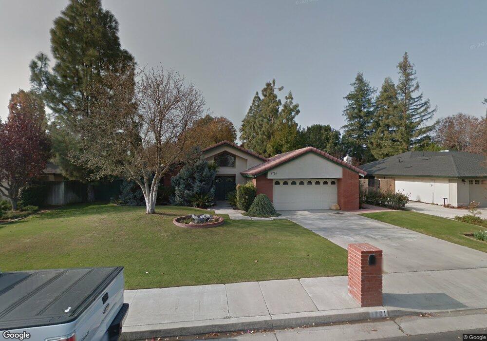
1701 Manning St Bakersfield, CA 93309
Amberton NeighborhoodEstimated Value: $425,000 - $465,000
3
Beds
2
Baths
1,782
Sq Ft
$250/Sq Ft
Est. Value
About This Home
This home is located at 1701 Manning St, Bakersfield, CA 93309 and is currently estimated at $445,804, approximately $250 per square foot. 1701 Manning St is a home located in Kern County with nearby schools including Stockdale Elementary School, O.J. Actis Junior High School, and Bakersfield High School.
Ownership History
Date
Name
Owned For
Owner Type
Purchase Details
Closed on
Oct 25, 2010
Sold by
Fowler Gregory L and Hylton Tamara
Bought by
Fowler Gregory L and Hylton Tamara
Current Estimated Value
Home Financials for this Owner
Home Financials are based on the most recent Mortgage that was taken out on this home.
Original Mortgage
$144,800
Outstanding Balance
$2,179
Interest Rate
4.33%
Mortgage Type
New Conventional
Estimated Equity
$443,625
Purchase Details
Closed on
Aug 7, 2007
Sold by
Reed John Alden and The Carl G Oblinger Trust
Bought by
Fowler Gregory L and Hylton Tamara
Home Financials for this Owner
Home Financials are based on the most recent Mortgage that was taken out on this home.
Original Mortgage
$210,000
Interest Rate
6.74%
Mortgage Type
Purchase Money Mortgage
Create a Home Valuation Report for This Property
The Home Valuation Report is an in-depth analysis detailing your home's value as well as a comparison with similar homes in the area
Home Values in the Area
Average Home Value in this Area
Purchase History
| Date | Buyer | Sale Price | Title Company |
|---|---|---|---|
| Fowler Gregory L | -- | Placer Title Company | |
| Fowler Gregory L | $310,000 | Ticor Title Company Of Ca |
Source: Public Records
Mortgage History
| Date | Status | Borrower | Loan Amount |
|---|---|---|---|
| Open | Fowler Gregory L | $144,800 | |
| Closed | Fowler Gregory L | $210,000 |
Source: Public Records
Tax History
| Year | Tax Paid | Tax Assessment Tax Assessment Total Assessment is a certain percentage of the fair market value that is determined by local assessors to be the total taxable value of land and additions on the property. | Land | Improvement |
|---|---|---|---|---|
| 2025 | $5,282 | $414,000 | $104,000 | $310,000 |
| 2024 | $5,449 | $384,000 | $96,000 | $288,000 |
| 2023 | $5,449 | $396,000 | $99,000 | $297,000 |
| 2022 | $4,622 | $337,000 | $84,000 | $253,000 |
| 2021 | $4,169 | $304,000 | $76,000 | $228,000 |
| 2020 | $3,854 | $280,000 | $70,000 | $210,000 |
| 2019 | $3,834 | $277,000 | $69,000 | $208,000 |
| 2018 | $3,687 | $274,000 | $69,000 | $205,000 |
| 2017 | $3,410 | $250,000 | $63,000 | $187,000 |
| 2016 | $3,150 | $242,000 | $61,000 | $181,000 |
| 2015 | $2,757 | $206,000 | $52,000 | $154,000 |
| 2014 | $2,734 | $206,000 | $52,000 | $154,000 |
Source: Public Records
Map
Nearby Homes
- 1807 Manning St
- 1504 Moraine Ct
- 7100 Tioga Ct
- 1304 Manning St
- 1808 El Portal Dr
- 7301 Calle Sagrada
- 1700 Ashe Rd Unit 15
- 7305 Calle Los Batiquitos
- 7108 Saint Andrews Dr
- 1217 Tam o Shanter Dr
- 6702 Edmund Way
- 2000 Ashe Rd Unit 21
- 2000 Ashe Rd Unit 18
- 1912 Glenbrea Ct
- 6500 Landfair Dr
- 6508 Landfair Dr
- 2600 Barrington St Unit 16
- 6600 Kane Way
- 7701 Shetland Dr
- 7401 Hilton Head Way Unit 21
- 1705 Manning St
- 1609 Manning St
- 1712 Placer Ct
- 1716 Placer Ct
- 1605 Manning St
- 1708 Placer Ct
- 1702 Manning St
- 1704 Manning St
- 1704 Placer Ct
- 1706 Manning St
- 1700 Manning St
- 1720 Placer Ct
- 1708 Manning St
- 6900 Murphys Ln
- 6904 Murphys Ln
- 1700 Placer Ct
- 6908 Murphys Ln
- 6721 Bridgeport Ln
- 1616 Manning St
Your Personal Tour Guide
Ask me questions while you tour the home.