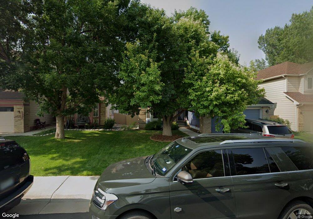
17015 Bennett Dr Parker, CO 80134
Clarke Farms NeighborhoodEstimated Value: $581,074 - $623,000
3
Beds
4
Baths
2,259
Sq Ft
$268/Sq Ft
Est. Value
About This Home
This home is located at 17015 Bennett Dr, Parker, CO 80134 and is currently estimated at $606,519, approximately $268 per square foot. 17015 Bennett Dr is a home located in Douglas County with nearby schools including Cherokee Trail Elementary School, Sierra Middle School, and Chaparral High School.
Ownership History
Date
Name
Owned For
Owner Type
Purchase Details
Closed on
Mar 21, 2001
Sold by
Barnaby Kenneth T and Barnaby Paulin L
Bought by
Morgans Dale and Morgans Deborah
Current Estimated Value
Home Financials for this Owner
Home Financials are based on the most recent Mortgage that was taken out on this home.
Original Mortgage
$198,000
Outstanding Balance
$69,176
Interest Rate
6.98%
Estimated Equity
$537,343
Purchase Details
Closed on
Jan 6, 1993
Sold by
Davis Rodney O and Davis Jere Lee
Bought by
Barnaby Kenneth T and Barnaby Paulin L
Purchase Details
Closed on
Dec 31, 1990
Sold by
Us Home Corp
Bought by
Davis Rodney O and Davis Jere Lee
Purchase Details
Closed on
Dec 30, 1988
Sold by
Mdc Land Corp
Bought by
Us Home Corp
Create a Home Valuation Report for This Property
The Home Valuation Report is an in-depth analysis detailing your home's value as well as a comparison with similar homes in the area
Home Values in the Area
Average Home Value in this Area
Purchase History
| Date | Buyer | Sale Price | Title Company |
|---|---|---|---|
| Morgans Dale | $247,500 | -- | |
| Barnaby Kenneth T | $130,000 | -- | |
| Davis Rodney O | $113,600 | -- | |
| Us Home Corp | $2,745,000 | -- | |
| Mdc Land Corp | -- | -- |
Source: Public Records
Mortgage History
| Date | Status | Borrower | Loan Amount |
|---|---|---|---|
| Open | Morgans Dale | $198,000 |
Source: Public Records
Tax History
| Year | Tax Paid | Tax Assessment Tax Assessment Total Assessment is a certain percentage of the fair market value that is determined by local assessors to be the total taxable value of land and additions on the property. | Land | Improvement |
|---|---|---|---|---|
| 2025 | $3,475 | $39,400 | $7,690 | $31,710 |
| 2024 | $3,475 | $43,460 | $8,020 | $35,440 |
| 2023 | $3,517 | $43,460 | $8,020 | $35,440 |
| 2022 | $2,702 | $31,250 | $4,910 | $26,340 |
| 2021 | $2,813 | $31,250 | $4,910 | $26,340 |
| 2020 | $2,697 | $30,470 | $4,570 | $25,900 |
| 2019 | $2,714 | $30,470 | $4,570 | $25,900 |
| 2018 | $2,398 | $26,240 | $4,730 | $21,510 |
| 2017 | $2,225 | $26,240 | $4,730 | $21,510 |
| 2016 | $2,028 | $23,470 | $4,220 | $19,250 |
| 2015 | $2,065 | $23,470 | $4,220 | $19,250 |
| 2014 | $1,997 | $20,240 | $4,220 | $16,020 |
Source: Public Records
Map
Nearby Homes
- 10370 Longleaf Dr
- 10505 Berthoud Way
- 17034 Wellington Dr
- 10318 Severance Dr
- 10518 Holyoke Dr
- 10607 Clarke Farms Dr
- 17130 Opal Hill Dr
- 17351 Cornerstone Dr
- 10617 Clarke Farms Dr
- 10612 Clarke Farms Dr
- 10626 Oakmoor Ct
- 10814 Shaw Ct
- 10738 Jordan Ct
- 10221 Amethyst Way
- 10858 Willow Reed Cir E
- 10635 Clarke Farms Dr
- 16351 Parkside Dr
- 16430 Amberstone Way
- 10749 Jordan Ct
- 10912 Clifford Ct
- 17013 Bennett Dr
- 17017 Bennett Dr
- 17016 Lamar Dr
- 17011 Bennett Dr
- 17014 Lamar Dr
- 17019 Bennett Dr
- 17018 Lamar Dr
- 17012 Lamar Dr
- 17020 Lamar Dr
- 17009 Bennett Dr
- 11522 Wray Ct
- 17016 Bennett Dr
- 17021 Bennett Dr
- 17018 Bennett Dr
- 17014 Bennett Dr
- 17010 Lamar Dr
- 17022 Lamar Dr
- 17007 Bennett Dr
- 11520 Wray Ct
- 17023 Bennett Dr
Your Personal Tour Guide
Ask me questions while you tour the home.