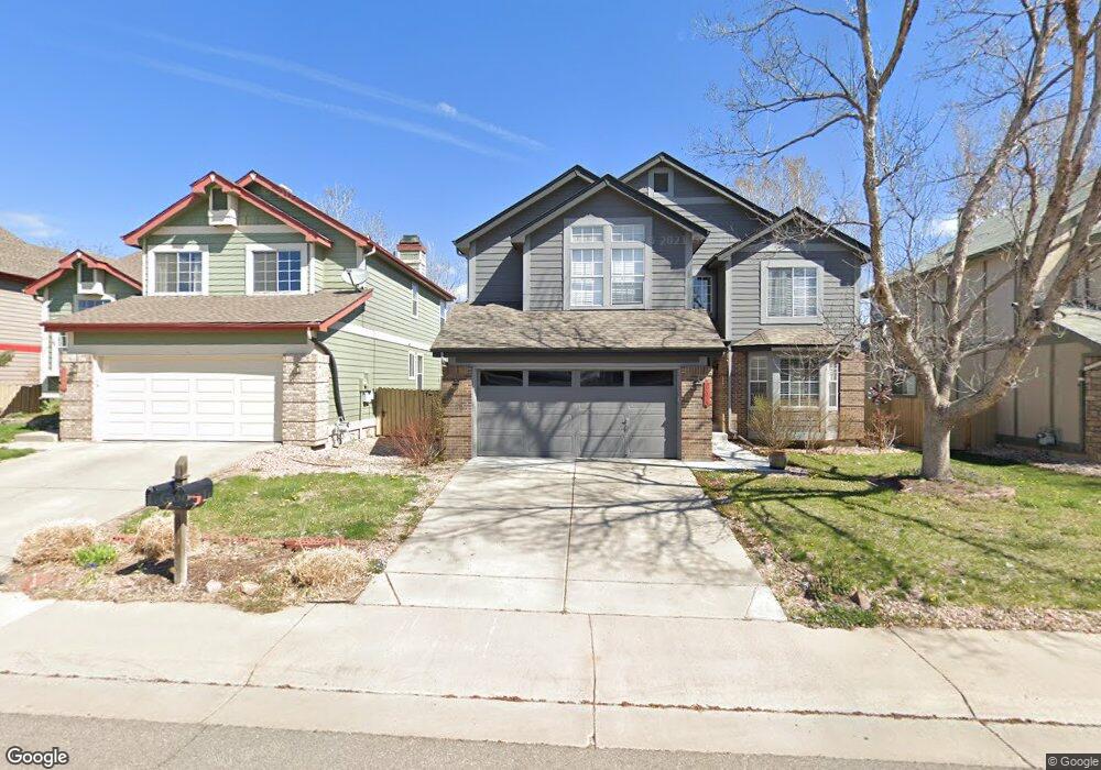
17015 Lamar Dr Parker, CO 80134
Clarke Farms NeighborhoodEstimated Value: $589,000 - $611,000
4
Beds
3
Baths
3,429
Sq Ft
$175/Sq Ft
Est. Value
About This Home
This home is located at 17015 Lamar Dr, Parker, CO 80134 and is currently estimated at $600,706, approximately $175 per square foot. 17015 Lamar Dr is a home located in Douglas County with nearby schools including Cherokee Trail Elementary School, Sierra Middle School, and Chaparral High School.
Ownership History
Date
Name
Owned For
Owner Type
Purchase Details
Closed on
Feb 4, 2023
Sold by
Widhalm Joann R
Bought by
Widhalm Lee A and Widhalm Kelley L
Current Estimated Value
Purchase Details
Closed on
Sep 27, 2016
Sold by
Mutual Equity Lp
Bought by
Widhalm Kelley L and Widhalm Joann R
Home Financials for this Owner
Home Financials are based on the most recent Mortgage that was taken out on this home.
Original Mortgage
$381,816
Interest Rate
3.37%
Mortgage Type
FHA
Purchase Details
Closed on
Apr 20, 2016
Sold by
Michael Richard and Zarba Janet S
Bought by
Mutual Equity Lp
Purchase Details
Closed on
Feb 19, 1991
Sold by
Us Home Corp
Bought by
Zarba Richard Michael and Zarba Janet S
Purchase Details
Closed on
Dec 30, 1988
Sold by
Mdc Land Corp
Bought by
Us Home Corp
Purchase Details
Closed on
Jul 2, 1986
Sold by
Silverado Elektra Venture Ltd
Bought by
Mdc Land Corp
Create a Home Valuation Report for This Property
The Home Valuation Report is an in-depth analysis detailing your home's value as well as a comparison with similar homes in the area
Home Values in the Area
Average Home Value in this Area
Purchase History
| Date | Buyer | Sale Price | Title Company |
|---|---|---|---|
| Widhalm Lee A | -- | -- | |
| Widhalm Kelley L | $395,000 | First American | |
| Mutual Equity Lp | -- | None Available | |
| Zarba Richard Michael | $113,900 | -- | |
| Us Home Corp | $2,745,000 | -- | |
| Mdc Land Corp | $1,295,300 | -- |
Source: Public Records
Mortgage History
| Date | Status | Borrower | Loan Amount |
|---|---|---|---|
| Previous Owner | Widhalm Kelley L | $381,816 |
Source: Public Records
Tax History Compared to Growth
Tax History
| Year | Tax Paid | Tax Assessment Tax Assessment Total Assessment is a certain percentage of the fair market value that is determined by local assessors to be the total taxable value of land and additions on the property. | Land | Improvement |
|---|---|---|---|---|
| 2024 | $3,433 | $42,990 | $8,160 | $34,830 |
| 2023 | $3,474 | $42,990 | $8,160 | $34,830 |
| 2022 | $2,608 | $30,160 | $4,980 | $25,180 |
| 2021 | $2,715 | $30,160 | $4,980 | $25,180 |
| 2020 | $2,606 | $29,440 | $4,640 | $24,800 |
| 2019 | $2,623 | $29,440 | $4,640 | $24,800 |
| 2018 | $2,280 | $24,950 | $4,780 | $20,170 |
| 2017 | $2,116 | $24,950 | $4,780 | $20,170 |
| 2016 | $1,910 | $22,110 | $4,220 | $17,890 |
| 2015 | $1,945 | $22,110 | $4,220 | $17,890 |
| 2014 | $1,878 | $19,030 | $4,220 | $14,810 |
Source: Public Records
Map
Nearby Homes
- 10371 Knollside Dr
- 17071 Knollside Ave
- 11626 Masonville Dr
- 10414 Stonewillow Dr
- 17109 Campion Way
- 11613 Masonville Dr
- 17046 Wellington Dr
- 17130 Opal Hill Dr
- 10505 Berthoud Way
- 10251 Hedge Ln
- 16642 Autumn Rock Cove
- 16745 Rockledge Cove
- 10318 Severance Dr
- 17351 Cornerstone Dr
- 17235 Opal Hill Dr
- 10607 Clarke Farms Dr
- 10721 Kimball St
- 16641 Martingale Dr
- 16382 Maple Rock Ct
- 17033 Numa Place
- 17017 Lamar Dr
- 17013 Lamar Dr
- 17019 Lamar Dr
- 17011 Lamar Dr
- 17078 Knollside Ave
- 17068 Knollside Ave
- 17088 Knollside Ave
- 17014 Lamar Dr
- 17012 Lamar Dr
- 17009 Lamar Dr
- 17021 Lamar Dr
- 17058 Knollside Ave
- 17016 Lamar Dr
- 17010 Lamar Dr
- 17098 Knollside Ave
- 17018 Lamar Dr
- 17008 Lamar Dr
- 17007 Lamar Dr
- 17023 Lamar Dr
- 17048 Knollside Ave