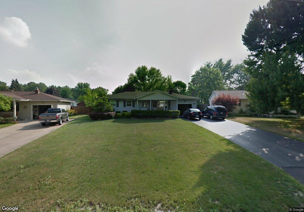
1702 Laurie Dr Youngstown, OH 44511
Austintown NeighborhoodEstimated Value: $150,000 - $161,000
3
Beds
1
Bath
1,040
Sq Ft
$150/Sq Ft
Est. Value
About This Home
This home is located at 1702 Laurie Dr, Youngstown, OH 44511 and is currently estimated at $155,481, approximately $149 per square foot. 1702 Laurie Dr is a home located in Mahoning County with nearby schools including Austintown Elementary School, Austintown Intermediate School, and Austintown Middle School.
Ownership History
Date
Name
Owned For
Owner Type
Purchase Details
Closed on
Apr 25, 2018
Sold by
Yohman William S
Bought by
Yohman Daniel E
Current Estimated Value
Home Financials for this Owner
Home Financials are based on the most recent Mortgage that was taken out on this home.
Original Mortgage
$45,787
Interest Rate
4.25%
Mortgage Type
FHA
Purchase Details
Closed on
Feb 3, 2012
Sold by
Yohman Daniel E and Yohman Jeanna
Bought by
Yohman William S
Purchase Details
Closed on
May 12, 2008
Sold by
Yohman Carolyn A
Bought by
Yohman William S and Yohman Daniel E
Purchase Details
Closed on
Apr 27, 2004
Sold by
Yohman William Steve and Yohman Carolyn Ann
Bought by
Yohman William S and Yohman Carolyn A
Purchase Details
Closed on
Jul 11, 1961
Bought by
Yohman Wm S and C A
Create a Home Valuation Report for This Property
The Home Valuation Report is an in-depth analysis detailing your home's value as well as a comparison with similar homes in the area
Home Values in the Area
Average Home Value in this Area
Purchase History
| Date | Buyer | Sale Price | Title Company |
|---|---|---|---|
| Yohman Daniel E | $57,000 | None Available | |
| Yohman William S | -- | None Available | |
| Yohman William S | -- | Attorney | |
| Yohman William S | -- | -- | |
| Yohman Wm S | -- | -- |
Source: Public Records
Mortgage History
| Date | Status | Borrower | Loan Amount |
|---|---|---|---|
| Previous Owner | Yohman Daniel E | $45,787 |
Source: Public Records
Tax History Compared to Growth
Tax History
| Year | Tax Paid | Tax Assessment Tax Assessment Total Assessment is a certain percentage of the fair market value that is determined by local assessors to be the total taxable value of land and additions on the property. | Land | Improvement |
|---|---|---|---|---|
| 2024 | $1,906 | $41,070 | $7,570 | $33,500 |
| 2023 | $1,872 | $41,070 | $7,570 | $33,500 |
| 2022 | $1,449 | $25,420 | $6,480 | $18,940 |
| 2021 | $1,450 | $25,420 | $6,480 | $18,940 |
| 2020 | $1,456 | $25,420 | $6,480 | $18,940 |
| 2019 | $1,448 | $22,690 | $5,780 | $16,910 |
| 2018 | $1,395 | $22,690 | $5,780 | $16,910 |
| 2017 | $1,372 | $22,690 | $5,780 | $16,910 |
| 2016 | $1,499 | $24,560 | $6,060 | $18,500 |
| 2015 | $1,449 | $24,560 | $6,060 | $18,500 |
| 2014 | $1,455 | $24,560 | $6,060 | $18,500 |
| 2013 | $1,439 | $24,560 | $6,060 | $18,500 |
Source: Public Records
Map
Nearby Homes
- 4235 Patricia Ave
- 4241 Wedgewood Dr
- 4289 Wedgewood Dr
- 4262 Pembrook Rd
- 40 Woodleigh Ct
- 3913 Claridge Dr
- 4234 Burkey Rd
- 2414 Ardenwood Place
- 3890 Ayrshire Dr
- 2699 Hamman Dr
- 2493 Frostwood Dr
- 4102 Burkey Rd
- 3852 Edinburgh Dr
- 2430 Redgate Ln
- 532 Westgate Blvd
- 4674 Barrington Dr
- 2388 Innwood Dr
- 425 Southward Dr
- 1439 Bexley Dr
- 603 S Raccoon Rd Unit 9
- 1692 Laurie Dr
- 1708 Laurie Dr
- 1686 Laurie Dr
- 1714 Laurie Dr
- 4320 Kerrybrook Dr
- 4308 Kerrybrook Dr
- 1685 Laurie Dr
- 4326 Kerrybrook Dr
- 1707 Laurie Dr
- 1680 Laurie Dr
- 4302 Kerrybrook Dr
- 1679 Laurie Dr
- 1713 Laurie Dr
- 4296 Kerrybrook Dr
- 4332 Kerrybrook Dr
- 1674 Laurie Dr
- 1726 Laurie Dr
- 1719 Laurie Dr
- 1673 Laurie Dr
- 4290 Kerrybrook Dr