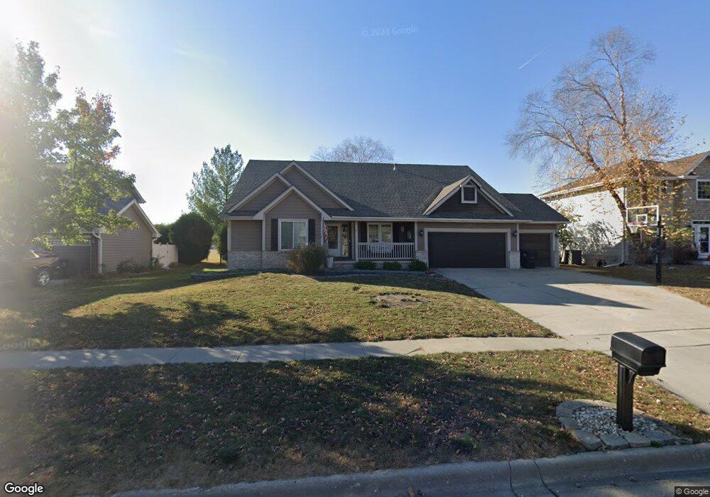
1702 NE Michael Dr Ankeny, IA 50021
Northeast Ankeny NeighborhoodEstimated Value: $399,000 - $443,000
3
Beds
3
Baths
2,500
Sq Ft
$169/Sq Ft
Est. Value
About This Home
This home is located at 1702 NE Michael Dr, Ankeny, IA 50021 and is currently estimated at $422,813, approximately $169 per square foot. 1702 NE Michael Dr is a home located in Polk County with nearby schools including Northeast Elementary School, Northview Middle School, and Prairie Ridge Middle School.
Ownership History
Date
Name
Owned For
Owner Type
Purchase Details
Closed on
Jul 21, 2010
Sold by
Decker Christopher J
Bought by
Decker Deann M
Current Estimated Value
Purchase Details
Closed on
May 16, 1997
Sold by
Jerrys Homes Inc
Bought by
Decker Christopher J and Decker Deann M
Home Financials for this Owner
Home Financials are based on the most recent Mortgage that was taken out on this home.
Original Mortgage
$183,625
Outstanding Balance
$25,739
Interest Rate
8.27%
Mortgage Type
Balloon
Estimated Equity
$397,074
Create a Home Valuation Report for This Property
The Home Valuation Report is an in-depth analysis detailing your home's value as well as a comparison with similar homes in the area
Home Values in the Area
Average Home Value in this Area
Purchase History
| Date | Buyer | Sale Price | Title Company |
|---|---|---|---|
| Decker Deann M | -- | None Available | |
| Decker Christopher J | $204,000 | -- |
Source: Public Records
Mortgage History
| Date | Status | Borrower | Loan Amount |
|---|---|---|---|
| Open | Decker Christopher J | $183,625 |
Source: Public Records
Tax History Compared to Growth
Tax History
| Year | Tax Paid | Tax Assessment Tax Assessment Total Assessment is a certain percentage of the fair market value that is determined by local assessors to be the total taxable value of land and additions on the property. | Land | Improvement |
|---|---|---|---|---|
| 2025 | $6,330 | $434,500 | $69,500 | $365,000 |
| 2024 | $6,330 | $381,700 | $60,400 | $321,300 |
| 2023 | $6,370 | $381,700 | $60,400 | $321,300 |
| 2022 | $6,302 | $316,200 | $51,200 | $265,000 |
| 2021 | $6,396 | $316,200 | $51,200 | $265,000 |
| 2020 | $6,312 | $302,800 | $49,000 | $253,800 |
| 2019 | $5,976 | $302,800 | $49,000 | $253,800 |
| 2018 | $5,960 | $273,900 | $43,500 | $230,400 |
| 2017 | $6,106 | $273,900 | $43,500 | $230,400 |
| 2016 | $6,102 | $264,600 | $41,100 | $223,500 |
| 2015 | $6,102 | $264,600 | $41,100 | $223,500 |
| 2014 | $5,340 | $227,600 | $34,600 | $193,000 |
Source: Public Records
Map
Nearby Homes
- 620 NE Oak Ridge Dr
- 1080 NE 18th St
- 529 NE 16th St
- 718 NE Brook Haven Dr
- 602 NE 15th St
- 2106 NE Garland Ct
- 1001 NE Lake View Ct
- 2001 NE Innsbruck Dr
- 1130 NE 17th Ln
- 1605 NE Cortina Dr
- 2210 NE Trilein Dr
- 1115 NE 15th Ln
- 505 NE 21st St
- 413 NE 17th St
- 1014 NE 9th St
- 2107 NE Bel Aire Dr
- 1917 NE 25th Ct
- 1913 NE 25th Ct
- 1811 NE 25th Ct
- 1717 NE 25th Ct
- 1706 NE Michael Dr
- 1610 NE Michael Dr
- 1606 NE Michael Dr
- 1710 NE Michael Dr
- 1701 NE Michael Dr
- 1705 NE Michael Dr
- 1609 NE Michael Dr
- 1605 NE Michael Dr
- 1602 NE Michael Dr
- 1709 NE Michael Dr
- 1702 NE Hayes Dr
- 1601 NE Michael Dr
- 1706 NE Hayes Dr
- 1614 NE Hayes Dr
- 1518 NE Michael Dr
- 1610 NE Hayes Dr
- 809 NE Bristol Dr
- 1513 NE Michael Dr
- 805 NE Bristol Dr
- 801 NE Bristol Dr