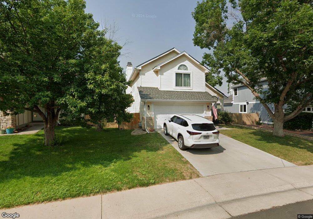
17029 Lamar Dr Parker, CO 80134
Clarke Farms NeighborhoodEstimated Value: $566,258 - $602,000
3
Beds
3
Baths
2,761
Sq Ft
$212/Sq Ft
Est. Value
About This Home
This home is located at 17029 Lamar Dr, Parker, CO 80134 and is currently estimated at $584,565, approximately $211 per square foot. 17029 Lamar Dr is a home located in Douglas County with nearby schools including Cherokee Trail Elementary School, Sierra Middle School, and Chaparral High School.
Ownership History
Date
Name
Owned For
Owner Type
Purchase Details
Closed on
Mar 23, 2020
Sold by
Flynn Stephanie A
Bought by
Flynn Stephanie
Current Estimated Value
Home Financials for this Owner
Home Financials are based on the most recent Mortgage that was taken out on this home.
Original Mortgage
$345,267
Outstanding Balance
$299,105
Interest Rate
2.75%
Mortgage Type
FHA
Estimated Equity
$285,460
Purchase Details
Closed on
Apr 29, 2016
Sold by
Baird Lori K and Baird Steven L
Bought by
Flynn Stephanie A
Home Financials for this Owner
Home Financials are based on the most recent Mortgage that was taken out on this home.
Original Mortgage
$366,244
Interest Rate
3.62%
Mortgage Type
FHA
Purchase Details
Closed on
Mar 28, 2014
Sold by
Smith Gregory S and Mathies Leigh B
Bought by
Baird Lori K and Baird Steven L
Home Financials for this Owner
Home Financials are based on the most recent Mortgage that was taken out on this home.
Original Mortgage
$256,668
Interest Rate
4.32%
Mortgage Type
VA
Purchase Details
Closed on
Jun 26, 2009
Sold by
Mcirvin Kimberly L and Mc Irvin Jason R
Bought by
Smith Gregory S and Mathies Leigh B
Home Financials for this Owner
Home Financials are based on the most recent Mortgage that was taken out on this home.
Original Mortgage
$240,842
Interest Rate
4.97%
Mortgage Type
FHA
Purchase Details
Closed on
Aug 31, 2005
Sold by
Vento Frank
Bought by
Mcirvin Kimberly L and Mcirvin Jason R
Home Financials for this Owner
Home Financials are based on the most recent Mortgage that was taken out on this home.
Original Mortgage
$183,000
Interest Rate
5.78%
Mortgage Type
Purchase Money Mortgage
Purchase Details
Closed on
Feb 23, 2005
Sold by
Vento Joanne
Bought by
Vento Frank
Purchase Details
Closed on
Apr 30, 1990
Sold by
Us Home Corp
Bought by
Vento Frank and Vento Joanne
Purchase Details
Closed on
Dec 30, 1988
Sold by
Mdc Land Corp
Bought by
Us Home Corp
Purchase Details
Closed on
Jul 2, 1986
Sold by
Silverado Elektra Venture Ltd
Bought by
Mdc Land Corp
Create a Home Valuation Report for This Property
The Home Valuation Report is an in-depth analysis detailing your home's value as well as a comparison with similar homes in the area
Home Values in the Area
Average Home Value in this Area
Purchase History
| Date | Buyer | Sale Price | Title Company |
|---|---|---|---|
| Flynn Stephanie | -- | Canyon Title | |
| Flynn Stephanie A | $373,000 | First American Title Ins Co | |
| Baird Lori K | $298,500 | Land Title Guarantee Company | |
| Smith Gregory S | $263,000 | Htco | |
| Mcirvin Kimberly L | $236,000 | -- | |
| Vento Frank | -- | -- | |
| Vento Frank | $104,000 | -- | |
| Us Home Corp | $2,745,000 | -- | |
| Mdc Land Corp | $1,295,300 | -- |
Source: Public Records
Mortgage History
| Date | Status | Borrower | Loan Amount |
|---|---|---|---|
| Open | Flynn Stephanie | $345,267 | |
| Closed | Flynn Stephanie A | $366,244 | |
| Previous Owner | Baird Lori K | $256,668 | |
| Previous Owner | Smith Gregory S | $240,842 | |
| Previous Owner | Mcirvin Kimberly L | $183,000 |
Source: Public Records
Tax History
| Year | Tax Paid | Tax Assessment Tax Assessment Total Assessment is a certain percentage of the fair market value that is determined by local assessors to be the total taxable value of land and additions on the property. | Land | Improvement |
|---|---|---|---|---|
| 2025 | $3,359 | $37,690 | $9,750 | $27,940 |
| 2024 | $3,359 | $42,140 | $9,990 | $32,150 |
| 2023 | $3,399 | $42,140 | $9,990 | $32,150 |
| 2022 | $2,605 | $30,130 | $5,850 | $24,280 |
| 2021 | $2,712 | $30,130 | $5,850 | $24,280 |
| 2020 | $2,552 | $28,830 | $5,550 | $23,280 |
| 2019 | $2,568 | $28,830 | $5,550 | $23,280 |
| 2018 | $2,275 | $24,890 | $5,320 | $19,570 |
| 2017 | $2,111 | $24,890 | $5,320 | $19,570 |
| 2016 | $1,885 | $21,820 | $4,220 | $17,600 |
| 2015 | $1,919 | $21,820 | $4,220 | $17,600 |
| 2014 | $1,810 | $18,340 | $4,220 | $14,120 |
Source: Public Records
Map
Nearby Homes
- 10505 Berthoud Way
- 10370 Longleaf Dr
- 10318 Severance Dr
- 10518 Holyoke Dr
- 17034 Wellington Dr
- 17130 Opal Hill Dr
- 10607 Clarke Farms Dr
- 17351 Cornerstone Dr
- 10612 Clarke Farms Dr
- 10617 Clarke Farms Dr
- 10221 Amethyst Way
- 10635 Clarke Farms Dr
- 10626 Oakmoor Ct
- 10814 Shaw Ct
- 10738 Jordan Ct
- 10858 Willow Reed Cir E
- 16351 Parkside Dr
- 16430 Amberstone Way
- 10749 Jordan Ct
- 10912 Clifford Ct
- 17031 Lamar Dr
- 17027 Lamar Dr
- 17025 Lamar Dr
- 17138 Knollside Ave
- 17148 Knollside Ave
- 17505 Lamar Ct
- 17128 Knollside Ave
- 17501 Lamar Ct
- 17503 Lamar Ct
- 17158 Knollside Ave
- 17023 Lamar Dr
- 17024 Lamar Dr
- 17028 Lamar Dr
- 17507 Lamar Ct
- 17022 Lamar Dr
- 17030 Lamar Dr
- 17168 Knollside Ave
- 17108 Knollside Ave
- 17021 Lamar Dr
- 17020 Lamar Dr
Your Personal Tour Guide
Ask me questions while you tour the home.