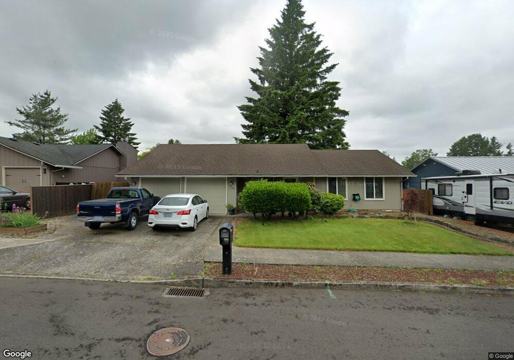
1703 SW Mawrcrest Ave Gresham, OR 97080
Southwest Gresham NeighborhoodEstimated Value: $419,000 - $437,000
3
Beds
2
Baths
1,302
Sq Ft
$328/Sq Ft
Est. Value
About This Home
This home is located at 1703 SW Mawrcrest Ave, Gresham, OR 97080 and is currently estimated at $426,659, approximately $327 per square foot. 1703 SW Mawrcrest Ave is a home located in Multnomah County with nearby schools including Hollydale Elementary School, Dexter McCarty Middle School, and Gresham High School.
Ownership History
Date
Name
Owned For
Owner Type
Purchase Details
Closed on
Dec 16, 2002
Sold by
Adams Leonard
Bought by
Adams Peggy A
Current Estimated Value
Home Financials for this Owner
Home Financials are based on the most recent Mortgage that was taken out on this home.
Original Mortgage
$90,000
Interest Rate
6.03%
Mortgage Type
Purchase Money Mortgage
Create a Home Valuation Report for This Property
The Home Valuation Report is an in-depth analysis detailing your home's value as well as a comparison with similar homes in the area
Home Values in the Area
Average Home Value in this Area
Purchase History
| Date | Buyer | Sale Price | Title Company |
|---|---|---|---|
| Adams Peggy A | $40,000 | Oregon Title Insurance Co |
Source: Public Records
Mortgage History
| Date | Status | Borrower | Loan Amount |
|---|---|---|---|
| Closed | Adams Peggy A | $90,000 |
Source: Public Records
Tax History
| Year | Tax Paid | Tax Assessment Tax Assessment Total Assessment is a certain percentage of the fair market value that is determined by local assessors to be the total taxable value of land and additions on the property. | Land | Improvement |
|---|---|---|---|---|
| 2025 | $4,423 | $217,330 | -- | -- |
| 2024 | $4,233 | $211,000 | -- | -- |
| 2023 | $3,857 | $204,860 | $0 | $0 |
| 2022 | $3,749 | $198,900 | $0 | $0 |
| 2021 | $3,655 | $193,110 | $0 | $0 |
| 2020 | $3,439 | $187,490 | $0 | $0 |
| 2019 | $3,349 | $182,030 | $0 | $0 |
| 2018 | $3,193 | $176,730 | $0 | $0 |
| 2017 | $3,064 | $171,590 | $0 | $0 |
| 2016 | $2,701 | $166,600 | $0 | $0 |
Source: Public Records
Map
Nearby Homes
- 1963 SW Myers Place
- 1960 SW 13th Ct
- 3198 SW 16th Cir
- 3079 SW 22nd St
- 2398 SW Tegart Ave
- 1175 SW Chastain Dr
- 2160 SW 26th St
- 1421 SW Binford Lake Pkwy
- 1441 SW 23rd Ct
- 0 SW Battaglia Ave
- 1333 SW 19th Dr
- 2520 SW Towle Ave
- 2092 SW Thomas Place
- 1645 SW 27th St
- 2294 SW Wallula Ln
- 404 SW Riverview Ave
- 2715 SW 31st St
- 317 SW Angeline Ave
- 3605 SW 25th St
- 3519 SW 28th Terrace
- 1723 SW Mawrcrest Ave
- 1683 SW Mawrcrest Ave
- 1704 SW Battaglia Ave
- 1684 SW Battaglia Ave
- 1724 SW Battaglia Ave
- 1702 SW Mawrcrest Ave
- 1743 SW Mawrcrest Ave
- 1673 SW Mawrcrest Ave
- 1692 SW Mawrcrest Ave
- 1744 SW Battaglia Ave
- 1674 SW Battaglia Ave
- 1732 SW Mawrcrest Ave
- 1682 SW Mawrcrest Ave
- 1753 SW Mawrcrest Ave
- 1643 SW Mawrcrest Ave
- 1742 SW Mawrcrest Ave
- 1754 SW Battaglia Ave
- 1701 SW Lillyben Ave
- 1644 SW Battaglia Ave
- 1705 SW Battaglia Ave
Your Personal Tour Guide
Ask me questions while you tour the home.