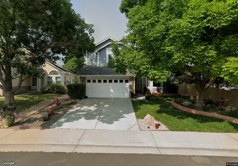
17031 Lamar Dr Parker, CO 80134
Clarke Farms NeighborhoodEstimated Value: $554,000 - $624,000
3
Beds
4
Baths
2,355
Sq Ft
$254/Sq Ft
Est. Value
About This Home
This home is located at 17031 Lamar Dr, Parker, CO 80134 and is currently estimated at $598,934, approximately $254 per square foot. 17031 Lamar Dr is a home located in Douglas County with nearby schools including Cherokee Trail Elementary School, Sierra Middle School, and Chaparral High School.
Ownership History
Date
Name
Owned For
Owner Type
Purchase Details
Closed on
Apr 2, 2019
Sold by
Agosta Joseph S D and Agosta Lestra J D
Bought by
Agosta Joseph S D and Agosta Lestra J D
Current Estimated Value
Purchase Details
Closed on
Mar 14, 1992
Sold by
Scheer John Robert and Scheer Ronda L
Bought by
Dagosta Joseph S and Dagosta Lestra J
Purchase Details
Closed on
Dec 8, 1989
Sold by
Us Home Corp
Bought by
Scheer John Robert and Scheer Ronda L
Purchase Details
Closed on
Dec 30, 1988
Sold by
Mdc Land Corp
Bought by
Us Home Corp
Purchase Details
Closed on
Jul 2, 1986
Sold by
Silverado Elektra Venture Ltd
Bought by
Mdc Land Corp
Create a Home Valuation Report for This Property
The Home Valuation Report is an in-depth analysis detailing your home's value as well as a comparison with similar homes in the area
Home Values in the Area
Average Home Value in this Area
Purchase History
| Date | Buyer | Sale Price | Title Company |
|---|---|---|---|
| Agosta Joseph S D | -- | None Available | |
| Dagosta Joseph S | $130,500 | -- | |
| Scheer John Robert | $116,400 | -- | |
| Us Home Corp | $2,745,000 | -- | |
| Mdc Land Corp | $1,295,300 | -- |
Source: Public Records
Tax History
| Year | Tax Paid | Tax Assessment Tax Assessment Total Assessment is a certain percentage of the fair market value that is determined by local assessors to be the total taxable value of land and additions on the property. | Land | Improvement |
|---|---|---|---|---|
| 2025 | $2,898 | $40,000 | $9,410 | $30,590 |
| 2024 | $2,898 | $43,550 | $9,670 | $33,880 |
| 2023 | $2,932 | $43,550 | $9,670 | $33,880 |
| 2022 | $2,162 | $31,960 | $5,700 | $26,260 |
| 2021 | $2,876 | $31,960 | $5,700 | $26,260 |
| 2020 | $2,734 | $30,880 | $5,390 | $25,490 |
| 2019 | $2,751 | $30,880 | $5,390 | $25,490 |
| 2018 | $2,396 | $26,220 | $5,230 | $20,990 |
| 2017 | $2,223 | $26,220 | $5,230 | $20,990 |
| 2016 | $2,029 | $23,480 | $4,220 | $19,260 |
| 2015 | $2,066 | $23,480 | $4,220 | $19,260 |
| 2014 | $2,005 | $20,320 | $4,220 | $16,100 |
Source: Public Records
Map
Nearby Homes
- 10505 Berthoud Way
- 10370 Longleaf Dr
- 10318 Severance Dr
- 10518 Holyoke Dr
- 17034 Wellington Dr
- 17130 Opal Hill Dr
- 10607 Clarke Farms Dr
- 17351 Cornerstone Dr
- 10612 Clarke Farms Dr
- 10617 Clarke Farms Dr
- 10221 Amethyst Way
- 10635 Clarke Farms Dr
- 10626 Oakmoor Ct
- 10814 Shaw Ct
- 10738 Jordan Ct
- 10858 Willow Reed Cir E
- 16351 Parkside Dr
- 16430 Amberstone Way
- 10749 Jordan Ct
- 10912 Clifford Ct
- 17029 Lamar Dr
- 17503 Lamar Ct
- 17501 Lamar Ct
- 17505 Lamar Ct
- 17027 Lamar Dr
- 17507 Lamar Ct
- 17148 Knollside Ave
- 17138 Knollside Ave
- 17028 Lamar Dr
- 17158 Knollside Ave
- 17025 Lamar Dr
- 17024 Lamar Dr
- 17030 Lamar Dr
- 17128 Knollside Ave
- 17168 Knollside Ave
- 17509 Lamar Ct
- 17022 Lamar Dr
- 17023 Lamar Dr
- 17032 Lamar Dr
- 17504 Lamar Ct
Your Personal Tour Guide
Ask me questions while you tour the home.