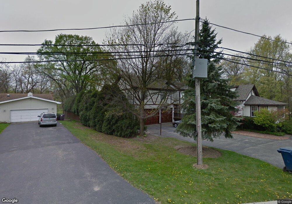
1704 Happ Rd Northbrook, IL 60062
Estimated Value: $1,194,987 - $1,415,000
5
Beds
3
Baths
2,913
Sq Ft
$431/Sq Ft
Est. Value
About This Home
This home is located at 1704 Happ Rd, Northbrook, IL 60062 and is currently estimated at $1,256,247, approximately $431 per square foot. 1704 Happ Rd is a home located in Cook County with nearby schools including Middlefork Primary School, Sunset Ridge Elementary School, and New Trier Township High School - Northfield.
Ownership History
Date
Name
Owned For
Owner Type
Purchase Details
Closed on
May 25, 2023
Sold by
Macdonell Keith B and Macdonell Margaret M
Bought by
Macdonell Family Trust
Current Estimated Value
Purchase Details
Closed on
Jul 16, 2007
Sold by
Castino Roger A and Castino Christine M
Bought by
Macdonell Keith E and Macdonell Margaret M
Home Financials for this Owner
Home Financials are based on the most recent Mortgage that was taken out on this home.
Original Mortgage
$320,000
Interest Rate
6.73%
Mortgage Type
Unknown
Purchase Details
Closed on
Apr 1, 2003
Sold by
Castino Roger A
Bought by
Castino Christine M
Create a Home Valuation Report for This Property
The Home Valuation Report is an in-depth analysis detailing your home's value as well as a comparison with similar homes in the area
Home Values in the Area
Average Home Value in this Area
Purchase History
| Date | Buyer | Sale Price | Title Company |
|---|---|---|---|
| Macdonell Family Trust | -- | None Listed On Document | |
| Macdonell Keith E | $998,000 | Lawyers Title Insurance Corp | |
| Castino Christine M | -- | -- |
Source: Public Records
Mortgage History
| Date | Status | Borrower | Loan Amount |
|---|---|---|---|
| Previous Owner | Macdonell Keith E | $320,000 |
Source: Public Records
Tax History
| Year | Tax Paid | Tax Assessment Tax Assessment Total Assessment is a certain percentage of the fair market value that is determined by local assessors to be the total taxable value of land and additions on the property. | Land | Improvement |
|---|---|---|---|---|
| 2025 | $16,611 | $100,000 | $29,821 | $70,179 |
| 2024 | $16,611 | $81,000 | $25,561 | $55,439 |
| 2023 | $15,845 | $81,000 | $25,561 | $55,439 |
| 2022 | $15,845 | $81,000 | $25,561 | $55,439 |
| 2021 | $14,796 | $64,617 | $32,661 | $31,956 |
| 2020 | $14,574 | $64,617 | $32,661 | $31,956 |
| 2019 | $14,368 | $71,008 | $32,661 | $38,347 |
| 2018 | $16,570 | $77,689 | $28,401 | $49,288 |
| 2017 | $16,088 | $77,689 | $28,401 | $49,288 |
| 2016 | $15,265 | $77,689 | $28,401 | $49,288 |
| 2015 | $13,752 | $64,280 | $22,720 | $41,560 |
| 2014 | $13,423 | $64,280 | $22,720 | $41,560 |
| 2013 | $12,870 | $64,280 | $22,720 | $41,560 |
Source: Public Records
Map
Nearby Homes
- 1930 Sunset Ridge Rd
- 2154 Northgate Rd
- 898 Bridlegate Ln
- 24 Bridlewood Rd
- 849 Country Club Ln
- 4 Steeple Chase Ln
- 831 Balmoral Ln
- 1013 Longaker Rd
- 1000 Dell Rd
- 759 Strawberry Hill Dr
- 590 Briar Ln
- 808 Prairie Rd
- 985 Pine Tree Ln
- 2185 New Willow Rd
- 2150 Founders Dr Unit 247
- 2150 Founders Dr Unit 234
- 2220 Founders Dr Unit 213
- 2220 Founders Dr Unit P102
- 2220 Founders Dr Unit 107
- 2220 Founders Dr Unit 316
Your Personal Tour Guide
Ask me questions while you tour the home.