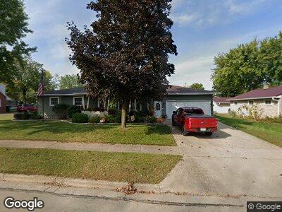
1705 Lawrence St New London, WI 54961
Estimated Value: $245,000 - $275,575
--
Bed
--
Bath
--
Sq Ft
0.25
Acres
About This Home
This home is located at 1705 Lawrence St, New London, WI 54961 and is currently estimated at $264,394. 1705 Lawrence St is a home located in Waupaca County with nearby schools including Lincoln Elementary School, New London Middle School, and New London High School.
Ownership History
Date
Name
Owned For
Owner Type
Purchase Details
Closed on
Oct 23, 2018
Sold by
Bruehl Karl G
Bought by
Karl G And Mary L Bruehl Living
Current Estimated Value
Purchase Details
Closed on
Jan 27, 2006
Sold by
Schlueter Joel B and Schlueter Kandi L
Bought by
Bruehl Karl G and Bruehl Kathryn L
Home Financials for this Owner
Home Financials are based on the most recent Mortgage that was taken out on this home.
Original Mortgage
$32,000
Outstanding Balance
$18,769
Interest Rate
5.97%
Mortgage Type
New Conventional
Estimated Equity
$245,424
Create a Home Valuation Report for This Property
The Home Valuation Report is an in-depth analysis detailing your home's value as well as a comparison with similar homes in the area
Home Values in the Area
Average Home Value in this Area
Purchase History
| Date | Buyer | Sale Price | Title Company |
|---|---|---|---|
| Karl G And Mary L Bruehl Living | -- | None Available | |
| Bruehl Karl G | $135,000 | None Available |
Source: Public Records
Mortgage History
| Date | Status | Borrower | Loan Amount |
|---|---|---|---|
| Closed | Bruehl Karl G | $32,000 | |
| Previous Owner | Schlueter Joel B | $255,000 |
Source: Public Records
Tax History Compared to Growth
Tax History
| Year | Tax Paid | Tax Assessment Tax Assessment Total Assessment is a certain percentage of the fair market value that is determined by local assessors to be the total taxable value of land and additions on the property. | Land | Improvement |
|---|---|---|---|---|
| 2024 | $3,900 | $165,800 | $21,900 | $143,900 |
| 2023 | $3,900 | $165,800 | $21,900 | $143,900 |
| 2022 | $3,819 | $165,800 | $21,900 | $143,900 |
| 2021 | $3,901 | $165,800 | $21,900 | $143,900 |
| 2020 | $3,777 | $165,800 | $21,900 | $143,900 |
| 2019 | $3,715 | $165,800 | $21,900 | $143,900 |
| 2018 | $3,550 | $165,800 | $21,900 | $143,900 |
| 2017 | $3,202 | $165,800 | $21,900 | $143,900 |
| 2016 | $3,079 | $134,300 | $21,800 | $112,500 |
| 2015 | $3,161 | $134,300 | $21,800 | $112,500 |
| 2014 | $3,105 | $134,300 | $21,800 | $112,500 |
| 2013 | $3,182 | $134,300 | $21,800 | $112,500 |
Source: Public Records
Map
Nearby Homes
- 508 W Martin St
- 1104 Nassau St
- 1820 Pershing Rd
- 709 Robin St
- 629 Douglas St
- 214 E Washington St
- 410 E Washington St
- 419 E Washington St
- 603 E Washington St
- 0 Beckert Rd Unit 50303102
- 1900 Southland Ln
- 1835 Southland Ln
- 1931 Southland Ln
- 1930 Southland Ln
- 706 S Shawano St
- 319 E Beacon Ave
- 312 S Pearl St Unit 314
- 2077 Pershing Rd
- 0 Shawano St Unit 50295803
- 0 Shawano St Unit 50257475
- 1705 Lawrence St
- 114 E Laura St
- 108 E Laura St
- 1713 Lawrence St
- 106 E Laura St
- 1717 Lawrence St
- 1706 Lawrence St
- 115 E Laura St
- 1710 Lawrence St
- 1702 Lawrence St
- 1618 Lawrence St
- 1721 Lawrence St
- 1718 Lawrence St
- 109 E Laura St
- 1704 S Pearl St
- 1710 S Pearl St
- 1613 Lawrence St
- 1714 S Pearl St
- 115 E Martin St
- 1718 S Pearl St