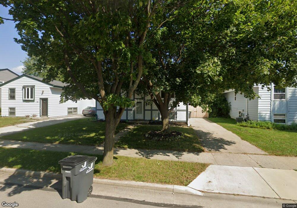
1705 Michael Dr Waukesha, WI 53189
Estimated Value: $340,000 - $389,000
4
Beds
2
Baths
1,412
Sq Ft
$250/Sq Ft
Est. Value
About This Home
This home is located at 1705 Michael Dr, Waukesha, WI 53189 and is currently estimated at $353,038, approximately $250 per square foot. 1705 Michael Dr is a home located in Waukesha County with nearby schools including Waukesha STEM Academy, Horning Middle School, and South High School.
Ownership History
Date
Name
Owned For
Owner Type
Purchase Details
Closed on
Sep 8, 2016
Sold by
Wagner Michael G and Wagner Virginia L
Bought by
Colon Lisett G and Pardi Juanita
Current Estimated Value
Home Financials for this Owner
Home Financials are based on the most recent Mortgage that was taken out on this home.
Original Mortgage
$186,459
Outstanding Balance
$148,069
Interest Rate
3.25%
Mortgage Type
FHA
Estimated Equity
$204,969
Create a Home Valuation Report for This Property
The Home Valuation Report is an in-depth analysis detailing your home's value as well as a comparison with similar homes in the area
Home Values in the Area
Average Home Value in this Area
Purchase History
| Date | Buyer | Sale Price | Title Company |
|---|---|---|---|
| Colon Lisett G | $189,900 | None Available |
Source: Public Records
Mortgage History
| Date | Status | Borrower | Loan Amount |
|---|---|---|---|
| Open | Colon Lisett G | $186,459 |
Source: Public Records
Tax History Compared to Growth
Tax History
| Year | Tax Paid | Tax Assessment Tax Assessment Total Assessment is a certain percentage of the fair market value that is determined by local assessors to be the total taxable value of land and additions on the property. | Land | Improvement |
|---|---|---|---|---|
| 2024 | $4,027 | $273,900 | $56,100 | $217,800 |
| 2023 | $3,908 | $273,900 | $56,100 | $217,800 |
| 2022 | $3,570 | $188,700 | $44,600 | $144,100 |
| 2021 | $3,647 | $188,700 | $44,600 | $144,100 |
| 2020 | $3,534 | $188,700 | $44,600 | $144,100 |
| 2019 | $3,418 | $188,700 | $44,600 | $144,100 |
| 2018 | $3,140 | $170,000 | $39,600 | $130,400 |
| 2017 | $3,139 | $170,000 | $39,600 | $130,400 |
| 2016 | $3,066 | $156,100 | $39,600 | $116,500 |
| 2015 | $3,070 | $156,100 | $39,600 | $116,500 |
| 2014 | $3,012 | $151,600 | $39,600 | $112,000 |
| 2013 | $3,086 | $151,600 | $39,600 | $112,000 |
Source: Public Records
Map
Nearby Homes
- 1936 Cliff Alex Ct N
- 1906 Marliz Dr
- 414 Standing Stone Dr Unit 8-16
- 412 Standing Stone Dr Unit 8-15
- 421 Standing Stone Dr Unit 17-39
- 424 Standing Stone Dr Unit 9-17
- 455 Standing Stone Dr
- 435 Standing Stone Dr Unit 16-37
- 1432 Big Bend Rd Unit E
- 2004 Smart Ct
- 2005 Smart Ct
- 2017 Smart Ct
- 613 Standing Stone Dr
- 609 Standing Stone Dr
- 605 Standing Stone Dr
- 621 Standing Stone Dr
- 625 Standing Stone Dr
- 633 Standing Stone Dr
- The Beryl Plan at Tenny Woods
- The Elaine Plan at Tenny Woods
- 1701 Michael Dr
- 1709 Michael Dr
- 1713 Michael Dr
- 1621 Michael Dr
- 1717 Michael Dr
- 1801 Michael Dr
- 111 Richard St
- 1617 Michael Dr
- 1805 Michael Dr
- 115 Richard St
- 1712 Michael Dr
- 119 Richard St
- 118 Richard St
- 1928 Cliff Alex Ct N
- 1612 Michael Dr
- 1800 Michael Dr
- 1924 Cliff Alex Ct N
- 1809 Michael Dr
- 1609 Michael Dr
- 123 Richard St