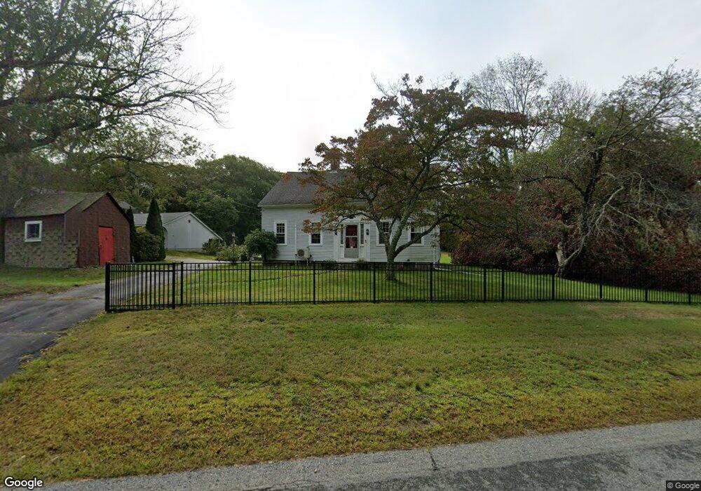
1706 Scituate Ave Cranston, RI 02921
Western Cranston NeighborhoodEstimated Value: $579,213 - $748,000
5
Beds
1
Bath
1,964
Sq Ft
$341/Sq Ft
Est. Value
About This Home
This home is located at 1706 Scituate Ave, Cranston, RI 02921 and is currently estimated at $668,803, approximately $340 per square foot. 1706 Scituate Ave is a home located in Providence County with nearby schools including Orchard Farms El. School, Western Hills Middle School, and Cranston High School West.
Ownership History
Date
Name
Owned For
Owner Type
Purchase Details
Closed on
Jun 29, 2023
Sold by
Linda M Shaw Ret and Shaw
Bought by
Bianca Eric C
Current Estimated Value
Home Financials for this Owner
Home Financials are based on the most recent Mortgage that was taken out on this home.
Original Mortgage
$432,000
Outstanding Balance
$420,448
Interest Rate
6.39%
Mortgage Type
Purchase Money Mortgage
Estimated Equity
$248,355
Create a Home Valuation Report for This Property
The Home Valuation Report is an in-depth analysis detailing your home's value as well as a comparison with similar homes in the area
Home Values in the Area
Average Home Value in this Area
Purchase History
| Date | Buyer | Sale Price | Title Company |
|---|---|---|---|
| Bianca Eric C | $540,000 | None Available |
Source: Public Records
Mortgage History
| Date | Status | Borrower | Loan Amount |
|---|---|---|---|
| Open | Bianca Eric C | $432,000 |
Source: Public Records
Tax History Compared to Growth
Tax History
| Year | Tax Paid | Tax Assessment Tax Assessment Total Assessment is a certain percentage of the fair market value that is determined by local assessors to be the total taxable value of land and additions on the property. | Land | Improvement |
|---|---|---|---|---|
| 2025 | $6,272 | $451,900 | $201,200 | $250,700 |
| 2024 | $6,150 | $451,900 | $201,200 | $250,700 |
| 2023 | $6,723 | $355,700 | $139,000 | $216,700 |
| 2022 | $6,584 | $355,700 | $139,000 | $216,700 |
| 2021 | $9,069 | $335,900 | $119,200 | $216,700 |
| 2020 | $8,896 | $285,500 | $113,600 | $171,900 |
| 2019 | $8,896 | $285,500 | $113,600 | $171,900 |
| 2018 | $8,691 | $285,500 | $113,600 | $171,900 |
| 2017 | $9,260 | $269,100 | $102,300 | $166,800 |
| 2016 | $9,063 | $269,100 | $102,300 | $166,800 |
| 2015 | $9,063 | $269,100 | $102,300 | $166,800 |
| 2014 | $8,470 | $247,300 | $102,300 | $145,000 |
Source: Public Records
Map
Nearby Homes
- 02 Paula Ln
- 01 Paula Ln
- 12 Beechwood Dr
- 121 Ashbrook Dr
- 11 Raven Cir
- 2202 Scituate Ave
- 129 Valerie Ct
- 9 Gray Coach E
- 2 Mulberry Dr
- 3 Equestrian Ln
- 0 W Bluebird Ln
- 10 Honey Lou Ct
- 80 Tomahawk Trail
- 321 Laten Knight Rd
- 191 Pippin Orchard Rd
- 2073 Plainfield Pike
- 560 Seven Mile Rd
- 2 Elizabeth Ln
- 5 Braeburn Cir
- 5 Elizabeth Ln
- 1776 Scituate Ave
- 1656 Scituate Ave
- 1636 Scituate Ave
- 880 Pippin Orchard Rd
- 1616 Scituate Ave
- 800 Pippin Orchard Rd
- 1626 Scituate Ave
- 950 Pippin Orchard Rd
- 899 Pippin Orchard Rd
- 1800 Scituate Ave
- 780 Pippin Orchard Rd
- 829 Pippin Orchard Rd
- 03 Annie Dr
- 02 Annie Dr
- 01 Annie Dr
- 929 Pippin Orchard Rd
- 960 Pippin Orchard Rd
- 1584 Scituate Ave
- 801 Pippin Orchard Rd
- 961 Pippin Orchard Rd