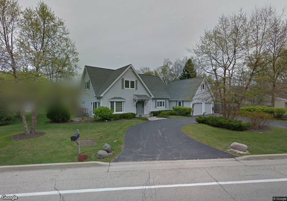
1707 Happ Rd Northbrook, IL 60062
Estimated Value: $1,026,000 - $1,188,000
4
Beds
3
Baths
3,223
Sq Ft
$336/Sq Ft
Est. Value
About This Home
This home is located at 1707 Happ Rd, Northbrook, IL 60062 and is currently estimated at $1,081,951, approximately $335 per square foot. 1707 Happ Rd is a home located in Cook County with nearby schools including Middlefork Primary School, Sunset Ridge Elementary School, and New Trier Township High School - Northfield.
Ownership History
Date
Name
Owned For
Owner Type
Purchase Details
Closed on
Aug 22, 2024
Sold by
Chicago Trust Company Na
Bought by
William R Gurolnick Revocable Trust and Peggy A Bartelstein Trust
Current Estimated Value
Purchase Details
Closed on
Jun 20, 2005
Sold by
Bartelstein Peggy
Bought by
Wayne Hummer Trust Co Na and Trust #Lft2061
Purchase Details
Closed on
Jul 13, 1999
Sold by
Bartelstein Peggy
Bought by
Bartelstein Peggy and Peggy Bartelstein Trust
Purchase Details
Closed on
Aug 21, 1996
Sold by
Sands Edward J and Sands Tracey F
Bought by
Bartelstein Peggy Anne
Home Financials for this Owner
Home Financials are based on the most recent Mortgage that was taken out on this home.
Original Mortgage
$135,000
Interest Rate
8.44%
Create a Home Valuation Report for This Property
The Home Valuation Report is an in-depth analysis detailing your home's value as well as a comparison with similar homes in the area
Home Values in the Area
Average Home Value in this Area
Purchase History
| Date | Buyer | Sale Price | Title Company |
|---|---|---|---|
| William R Gurolnick Revocable Trust | -- | None Listed On Document | |
| Wayne Hummer Trust Co Na | -- | -- | |
| Bartelstein Peggy | -- | -- | |
| Bartelstein Peggy Anne | $199,000 | -- |
Source: Public Records
Mortgage History
| Date | Status | Borrower | Loan Amount |
|---|---|---|---|
| Previous Owner | Bartelstein Peggy Anne | $135,000 |
Source: Public Records
Tax History
| Year | Tax Paid | Tax Assessment Tax Assessment Total Assessment is a certain percentage of the fair market value that is determined by local assessors to be the total taxable value of land and additions on the property. | Land | Improvement |
|---|---|---|---|---|
| 2025 | $14,329 | $110,000 | $9,641 | $100,359 |
| 2024 | $14,329 | $69,180 | $8,264 | $60,916 |
| 2023 | $13,649 | $72,982 | $8,264 | $64,718 |
| 2022 | $13,649 | $72,982 | $8,264 | $64,718 |
| 2021 | $11,995 | $55,681 | $10,559 | $45,122 |
| 2020 | $12,919 | $60,113 | $10,559 | $49,554 |
| 2019 | $12,732 | $66,059 | $10,559 | $55,500 |
| 2018 | $17,305 | $83,731 | $9,182 | $74,549 |
| 2017 | $16,811 | $83,731 | $9,182 | $74,549 |
| 2016 | $16,129 | $83,731 | $9,182 | $74,549 |
| 2015 | $13,151 | $63,463 | $7,345 | $56,118 |
| 2014 | $12,846 | $63,463 | $7,345 | $56,118 |
| 2013 | $12,817 | $65,903 | $7,345 | $58,558 |
Source: Public Records
Map
Nearby Homes
- 405 Voltz Rd
- 2154 Northgate Rd
- 1930 Sunset Ridge Rd
- 1990 Southridge Terrace
- 898 Bridlegate Ln
- 24 Bridlewood Rd
- 2122 Middlefork Rd
- 34 Bridlewood Rd
- 1025 Longaker Rd
- 831 Balmoral Ln
- 1013 Longaker Rd
- 759 Strawberry Hill Dr
- 754 Woodridge Ln
- 590 Briar Ln
- 808 Prairie Rd
- 1135 Buttonwood Ln
- 737 York Ct
- 985 Pine Tree Ln
- 908 Elm Place
- 947 Kensington Dr Unit 7E3
- 230 Carter Ct
- 238 Carter Ct
- 238 Carter Ct Unit SI ID1285056P
- 238 Carter Ct Unit ID1285056P
- 1711 Happ Rd
- 224 Carter Ct
- 1706 Happ Rd
- 1705 Happ Rd
- 1704 Happ Rd
- 220 Carter Ct
- 1708 Happ Rd
- 1716 Happ Rd
- 220 Erin Ln
- 216 Carter Ct
- 1717 Happ Rd
- 233 Voltz Rd
- 237 Voltz Rd
- 227 Voltz Rd
- 1703 Happ Rd
- 221 Voltz Rd
Your Personal Tour Guide
Ask me questions while you tour the home.