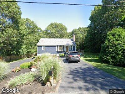
171 Commons Way Brewster, MA 02631
Estimated Value: $508,000 - $596,000
3
Beds
1
Bath
800
Sq Ft
$693/Sq Ft
Est. Value
About This Home
This home is located at 171 Commons Way, Brewster, MA 02631 and is currently estimated at $554,276, approximately $692 per square foot. 171 Commons Way is a home located in Barnstable County with nearby schools including Stony Brook Elementary School, Eddy Elementary School, and Nauset Regional Middle School.
Ownership History
Date
Name
Owned For
Owner Type
Purchase Details
Closed on
Aug 6, 1985
Bought by
Trombi Joseph J and Trombi Sandra A
Current Estimated Value
Create a Home Valuation Report for This Property
The Home Valuation Report is an in-depth analysis detailing your home's value as well as a comparison with similar homes in the area
Home Values in the Area
Average Home Value in this Area
Purchase History
| Date | Buyer | Sale Price | Title Company |
|---|---|---|---|
| Trombi Joseph J | -- | -- |
Source: Public Records
Mortgage History
| Date | Status | Borrower | Loan Amount |
|---|---|---|---|
| Open | Trombi Joseph J | $130,000 | |
| Closed | Trombi Joseph J | $67,000 | |
| Closed | Trombi Joseph J | $60,000 | |
| Closed | Trombi Joseph J | $50,000 | |
| Closed | Trombi Joseph J | $85,000 | |
| Closed | Trombi Joseph J | $85,000 |
Source: Public Records
Tax History Compared to Growth
Tax History
| Year | Tax Paid | Tax Assessment Tax Assessment Total Assessment is a certain percentage of the fair market value that is determined by local assessors to be the total taxable value of land and additions on the property. | Land | Improvement |
|---|---|---|---|---|
| 2025 | $3,119 | $453,400 | $176,000 | $277,400 |
| 2024 | $2,919 | $428,600 | $166,100 | $262,500 |
| 2023 | $2,701 | $386,400 | $148,200 | $238,200 |
| 2022 | $2,784 | $354,700 | $154,400 | $200,300 |
| 2021 | $2,750 | $320,500 | $134,200 | $186,300 |
| 2020 | $2,682 | $311,100 | $134,200 | $176,900 |
| 2019 | $2,591 | $302,000 | $129,100 | $172,900 |
| 2018 | $2,442 | $295,600 | $129,100 | $166,500 |
| 2017 | $2,321 | $276,600 | $129,100 | $147,500 |
| 2016 | $2,288 | $271,400 | $126,600 | $144,800 |
| 2015 | $2,205 | $267,000 | $124,100 | $142,900 |
Source: Public Records
Map
Nearby Homes
- 393 Thousand Oaks Dr
- 0 Commons Way Unit 73372154
- 0 Commons Way Unit 22502090
- 214 Eaton Ln Unit 214
- 214 Eaton Ln
- 178 Eaton Ln Unit 178
- 178 Eaton Ln
- 158 Eaton Ln
- 73 Eaton Ln Unit 73
- 73 Eaton Ln
- 217 Freemans Way
- 737 Thousand Oaks Dr
- 40 Eaton Ln
- 0 Old Chatham Rd
- 286 Fletcher Ln
- 101 Fletcher Ln Unit G
- 2 Trevor Ln
- 62 Fletcher Ln Unit I
- 75 Trevor Ln Unit 75
- 75 Trevor Ln
- 171 Commons Way
- 179 Commons Way
- 161 Commons Way
- 153 Commons Way
- 191 Commons Way
- 176 Commons Way
- 442 Thousand Oaks Dr
- 164 Commons Way
- 442 1000 Oaks Dr
- 432 1000 Oaks Dr
- 154 Commons Way
- 141 Commons Way
- 199 Commons Way
- 196 Commons Way
- 148 Commons Way
- 378 1000 Oaks Dr
- 466 Thousand Oaks Dr
- 135 Commons Way
- 211 Commons Way
- 422 Thousand Oaks Dr