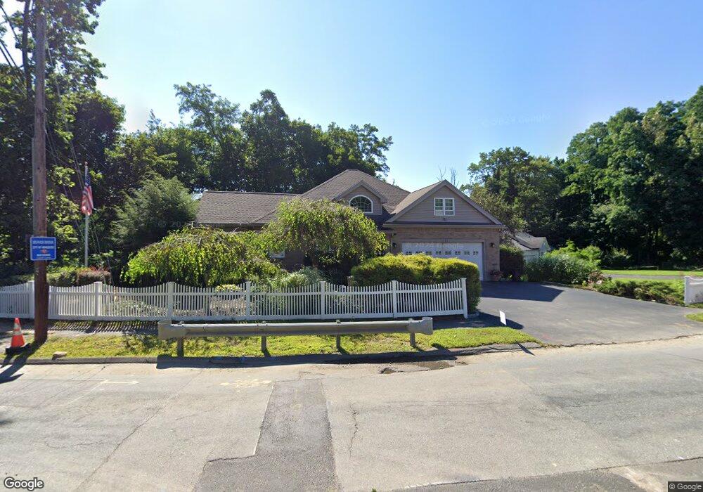
171 Flagg St Worcester, MA 01609
Salisbury Street NeighborhoodEstimated Value: $566,000 - $735,000
3
Beds
3
Baths
1,943
Sq Ft
$326/Sq Ft
Est. Value
About This Home
This home is located at 171 Flagg St, Worcester, MA 01609 and is currently estimated at $633,933, approximately $326 per square foot. 171 Flagg St is a home located in Worcester County with nearby schools including Chandler Magnet, Jacob Hiatt Magnet School, and Flagg Street School.
Ownership History
Date
Name
Owned For
Owner Type
Purchase Details
Closed on
May 27, 2016
Sold by
Brothers Francis X and Brothers Sandra A
Bought by
F X & S A Brothers Irt
Current Estimated Value
Purchase Details
Closed on
Jan 21, 2004
Sold by
Toscano Frank A
Bought by
Brothers Francis X and Brothers Sandra A
Create a Home Valuation Report for This Property
The Home Valuation Report is an in-depth analysis detailing your home's value as well as a comparison with similar homes in the area
Home Values in the Area
Average Home Value in this Area
Purchase History
| Date | Buyer | Sale Price | Title Company |
|---|---|---|---|
| F X & S A Brothers Irt | -- | -- | |
| Brothers Francis X | $80,000 | -- |
Source: Public Records
Tax History
| Year | Tax Paid | Tax Assessment Tax Assessment Total Assessment is a certain percentage of the fair market value that is determined by local assessors to be the total taxable value of land and additions on the property. | Land | Improvement |
|---|---|---|---|---|
| 2025 | $8,162 | $618,800 | $126,600 | $492,200 |
| 2024 | $7,905 | $574,900 | $126,600 | $448,300 |
| 2023 | $7,698 | $536,800 | $108,000 | $428,800 |
| 2022 | $6,934 | $455,900 | $86,300 | $369,600 |
| 2021 | $7,147 | $439,000 | $69,100 | $369,900 |
| 2020 | $7,055 | $415,000 | $68,800 | $346,200 |
| 2019 | $7,025 | $390,300 | $69,000 | $321,300 |
| 2018 | $6,711 | $354,900 | $69,000 | $285,900 |
| 2017 | $6,819 | $354,800 | $69,000 | $285,800 |
| 2016 | $7,082 | $343,600 | $59,700 | $283,900 |
| 2015 | $6,896 | $343,600 | $59,700 | $283,900 |
| 2014 | $6,696 | $342,700 | $59,700 | $283,000 |
Source: Public Records
Map
Nearby Homes
- 9 Dennison Rd
- 493 Salisbury St
- 32 Aylesbury Rd
- 6 Paul Revere Rd
- 8 Old Colony Rd
- 3 Old English Rd
- 40 Westwood Dr
- 23 Orrison St
- 22 Audubon Rd
- 163 Moreland St
- 14 Balder Rd
- 85 Camelot Dr Unit 118
- 31 Lenox St
- 28 Lynnwood Ln
- 18 Merlin Ct Unit 18
- 93 Newton Ave N
- 577 Grove St
- 59 Beechmont St
- 19 Kenilworth Rd
- 83 Newton Ave N
- 171A Flagg St
- 159 Flagg St
- 10 Rollingwood Dr
- 12 Rollingwood Dr
- 173 Flagg St
- 162 Flagg St
- 1 Meadowbrook Rd
- 164 Flagg St
- 140 Flagg St
- 168 Flagg St
- 3 Meadowbrook Rd
- 3 Meadowbrook Rd
- 8 Rollingwood Dr
- 175 Flagg St
- 6 Oak Hill Rd
- 0 Confidential Unit 71388163
- 0 Confidential Unit 71415140
- 0 Confidential Unit 72188738
- 0 Confidential Unit 71580603
- 0 Confidential Unit 71708106
Your Personal Tour Guide
Ask me questions while you tour the home.