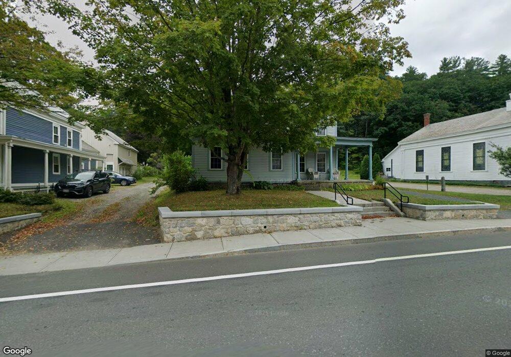
171 Main St Charlemont, MA 01339
Estimated Value: $327,000 - $360,000
6
Beds
3
Baths
1,921
Sq Ft
$176/Sq Ft
Est. Value
About This Home
This home is located at 171 Main St, Charlemont, MA 01339 and is currently estimated at $338,896, approximately $176 per square foot. 171 Main St is a home located in Franklin County with nearby schools including Hawlemont Regional, Mohawk Trail Regional High School, and The Academy At Charlemont.
Ownership History
Date
Name
Owned For
Owner Type
Purchase Details
Closed on
Feb 11, 2004
Sold by
Mtg Elec Registration
Bought by
Peabody Charles A and Peabody Sharyn H
Current Estimated Value
Home Financials for this Owner
Home Financials are based on the most recent Mortgage that was taken out on this home.
Original Mortgage
$109,600
Outstanding Balance
$51,222
Interest Rate
5.67%
Estimated Equity
$287,674
Purchase Details
Closed on
Sep 1, 2000
Sold by
Chittenden Tr Co
Bought by
Jamieson Wiliam S and Grover Mary F
Purchase Details
Closed on
May 15, 2000
Sold by
Taylor Susan S
Bought by
Chittenton T Co
Purchase Details
Closed on
May 26, 1995
Sold by
United Sb
Bought by
Taylor Susan S
Purchase Details
Closed on
Aug 16, 1994
Sold by
Mcdowell Ruth A and Mcdowell James P
Bought by
United St
Create a Home Valuation Report for This Property
The Home Valuation Report is an in-depth analysis detailing your home's value as well as a comparison with similar homes in the area
Home Values in the Area
Average Home Value in this Area
Purchase History
| Date | Buyer | Sale Price | Title Company |
|---|---|---|---|
| Peabody Charles A | $92,000 | -- | |
| Peabody Charles A | $92,000 | -- | |
| Jamieson Wiliam S | $48,400 | -- | |
| Jamieson Wiliam S | $48,400 | -- | |
| Chittenton T Co | $35,000 | -- | |
| Taylor Susan S | $58,000 | -- | |
| United St | $79,850 | -- |
Source: Public Records
Mortgage History
| Date | Status | Borrower | Loan Amount |
|---|---|---|---|
| Open | United St | $109,600 | |
| Previous Owner | United St | $74,095 |
Source: Public Records
Tax History
| Year | Tax Paid | Tax Assessment Tax Assessment Total Assessment is a certain percentage of the fair market value that is determined by local assessors to be the total taxable value of land and additions on the property. | Land | Improvement |
|---|---|---|---|---|
| 2025 | $44 | $239,400 | $28,400 | $211,000 |
| 2024 | $4,548 | $219,700 | $25,800 | $193,900 |
| 2023 | $4,299 | $208,400 | $23,700 | $184,700 |
| 2022 | $4,252 | $205,100 | $23,700 | $181,400 |
| 2021 | $4,200 | $205,100 | $23,700 | $181,400 |
| 2020 | $3,492 | $179,000 | $23,700 | $155,300 |
| 2019 | $3,532 | $179,000 | $23,700 | $155,300 |
| 2018 | $3,569 | $174,800 | $23,700 | $151,100 |
| 2017 | $3,531 | $174,800 | $23,700 | $151,100 |
| 2016 | $3,210 | $163,800 | $23,700 | $140,100 |
| 2015 | $2,929 | $163,800 | $23,700 | $140,100 |
Source: Public Records
Map
Nearby Homes
- 168 Main St
- 14 E Harmony Ln
- 0 Warfield Rd
- 2153 Massachusetts 2
- 49 East Rd
- 766 Tea St
- 0, Lot 7 East Rd
- Lot 3.2 East Rd
- 63 W Hawley Rd
- 0 Schaefer Way
- 0 Potters Rd Unit 248445
- 0 Potters Rd Unit 73439831
- 559 Tea St Unit 9
- 559 Tea St
- 90 W Hawley Rd
- 0 W Oxbow Rd Unit 73453651
- 0 W Oxbow Rd Unit 248444
- 14 South Rd
- 24 W Oxbow Rd
- 0 Upper St
Your Personal Tour Guide
Ask me questions while you tour the home.