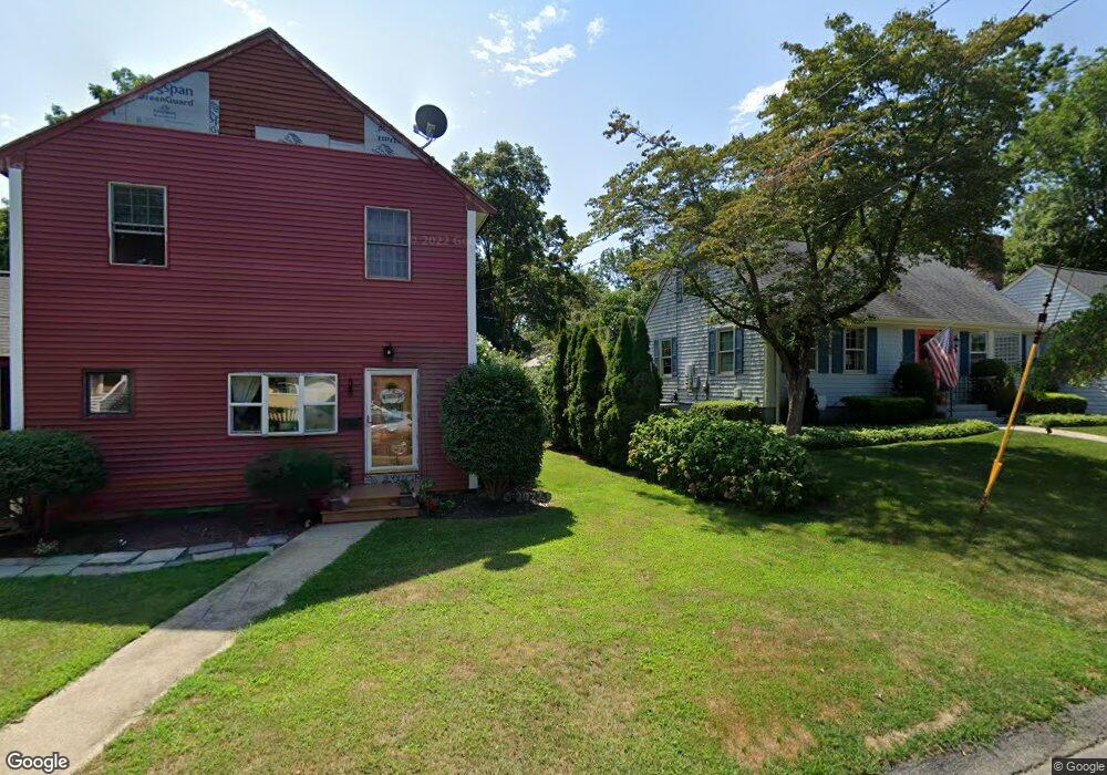
171 Seymour Ave Somerset, MA 02726
Pottersville NeighborhoodEstimated Value: $516,000 - $600,000
3
Beds
3
Baths
1,858
Sq Ft
$294/Sq Ft
Est. Value
About This Home
This home is located at 171 Seymour Ave, Somerset, MA 02726 and is currently estimated at $546,165, approximately $293 per square foot. 171 Seymour Ave is a home located in Bristol County with nearby schools including North Elementary School, Somerset Middle School, and St. Michael's School.
Ownership History
Date
Name
Owned For
Owner Type
Purchase Details
Closed on
Sep 11, 2024
Sold by
Brassard Doris
Bought by
Doris Brassard T and Doris Brassard
Current Estimated Value
Purchase Details
Closed on
Aug 19, 1982
Bought by
Vaz Doris
Create a Home Valuation Report for This Property
The Home Valuation Report is an in-depth analysis detailing your home's value as well as a comparison with similar homes in the area
Home Values in the Area
Average Home Value in this Area
Purchase History
| Date | Buyer | Sale Price | Title Company |
|---|---|---|---|
| Doris Brassard T | -- | None Available | |
| Doris Brassard T | -- | None Available | |
| Doris Brassard T | -- | None Available | |
| Vaz Doris | $77,000 | -- |
Source: Public Records
Mortgage History
| Date | Status | Borrower | Loan Amount |
|---|---|---|---|
| Previous Owner | Vaz Doris | $50,000 |
Source: Public Records
Tax History Compared to Growth
Tax History
| Year | Tax Paid | Tax Assessment Tax Assessment Total Assessment is a certain percentage of the fair market value that is determined by local assessors to be the total taxable value of land and additions on the property. | Land | Improvement |
|---|---|---|---|---|
| 2025 | $5,986 | $450,100 | $189,000 | $261,100 |
| 2024 | $5,583 | $436,500 | $189,000 | $247,500 |
| 2023 | $4,891 | $385,700 | $164,400 | $221,300 |
| 2022 | $4,529 | $340,800 | $143,000 | $197,800 |
| 2021 | $4,574 | $311,600 | $130,000 | $181,600 |
| 2020 | $4,549 | $298,900 | $130,000 | $168,900 |
| 2019 | $5,147 | $282,000 | $130,000 | $152,000 |
| 2018 | $4,608 | $271,700 | $130,000 | $141,700 |
| 2017 | $4,498 | $258,500 | $124,000 | $134,500 |
| 2016 | $4,526 | $258,500 | $124,000 | $134,500 |
| 2015 | $4,292 | $247,400 | $122,000 | $125,400 |
| 2014 | $6,050 | $250,500 | $122,000 | $128,500 |
Source: Public Records
Map
Nearby Homes
- 2714 Riverside Ave
- 50 Pratt Ave
- 34 Barry Ave
- 224 Chace St
- 138 Bourn Ave
- 190 Gibbs St
- 604 Lafayette St
- 95 Brookside Rd
- 64 Midland Rd
- 2546 County St
- 50 Clark St Unit 19
- 701 Prospect St
- 112 Rounseville Ave
- 3063 N Main St
- 4700 N Main St Unit 3E
- 0 Bark St Unit 73152576
- 0 Bark St Unit 1342599
- 287 Bark St
- 601 Eastview Ave
- 61 Stevens Rd
- 147 Seymour Ave
- 147 Grove Ave
- 177 Grove Ave
- 135 Grove Ave
- 133 Seymour Ave
- 121 Grove Ave
- 118 Seymour Ave
- 148 Grove Ave
- 188 Centre St
- 188 Centre St Unit 2
- 188 Centre St Unit 1
- 168 Centre St
- 182 Centre St
- 126 Grove Ave
- 199 Grove Ave
- 109 Seymour Ave
- 134 Centre St
- 174 Grove Ave
- 204 Centre St
- 146 Centre St