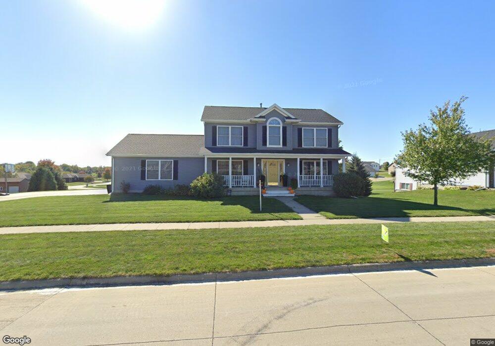
1710 W Prairie St Creston, IA 50801
Estimated Value: $338,000 - $398,000
4
Beds
4
Baths
2,032
Sq Ft
$184/Sq Ft
Est. Value
About This Home
This home is located at 1710 W Prairie St, Creston, IA 50801 and is currently estimated at $373,060, approximately $183 per square foot. 1710 W Prairie St is a home located in Union County with nearby schools including Creston Early Childhood Center, Creston Elementary School, and Creston Middle School.
Ownership History
Date
Name
Owned For
Owner Type
Purchase Details
Closed on
Dec 28, 2012
Sold by
Wolverton Todd F and Wolverton Tammy S
Bought by
Baird Dustin T and Willets Samantha S
Current Estimated Value
Home Financials for this Owner
Home Financials are based on the most recent Mortgage that was taken out on this home.
Original Mortgage
$191,522
Outstanding Balance
$132,130
Interest Rate
3.28%
Mortgage Type
New Conventional
Estimated Equity
$240,930
Create a Home Valuation Report for This Property
The Home Valuation Report is an in-depth analysis detailing your home's value as well as a comparison with similar homes in the area
Home Values in the Area
Average Home Value in this Area
Purchase History
| Date | Buyer | Sale Price | Title Company |
|---|---|---|---|
| Baird Dustin T | $197,500 | None Available |
Source: Public Records
Mortgage History
| Date | Status | Borrower | Loan Amount |
|---|---|---|---|
| Open | Baird Dustin T | $191,522 |
Source: Public Records
Tax History Compared to Growth
Tax History
| Year | Tax Paid | Tax Assessment Tax Assessment Total Assessment is a certain percentage of the fair market value that is determined by local assessors to be the total taxable value of land and additions on the property. | Land | Improvement |
|---|---|---|---|---|
| 2025 | $6,046 | $364,870 | $45,360 | $319,510 |
| 2024 | $6,046 | $334,770 | $45,360 | $289,410 |
| 2023 | $6,256 | $313,190 | $40,450 | $272,740 |
| 2022 | $6,198 | $268,030 | $40,450 | $227,580 |
| 2021 | $6,198 | $250,490 | $37,800 | $212,690 |
| 2020 | $5,270 | $221,540 | $25,520 | $196,020 |
| 2019 | $5,380 | $221,540 | $0 | $0 |
| 2018 | $5,132 | $221,540 | $0 | $0 |
| 2017 | $5,044 | $215,280 | $0 | $0 |
| 2016 | $4,962 | $215,280 | $0 | $0 |
| 2015 | $4,962 | $197,500 | $0 | $0 |
| 2014 | $4,658 | $217,780 | $0 | $0 |
Source: Public Records
Map
Nearby Homes
- 900 Cottonwood Rd
- 1107 W Prairie St
- 1423 165th St
- 500 N Bureau St
- 803 W Prairie St
- 907 W Howard St
- 1011 Crest Dr
- 902 N Spruce St
- 1705 Port Rd
- 101 S Stone St
- 915 W Montgomery St
- 1104 W Adams St
- 1688 Summit Lake Ave
- 103 N Sumner Ave
- 1100 W Jefferson St
- 1109 W Mills St
- 203 N Jarvis St
- 104 S Sumner Ave
- 1102 N Division St
- 609 W Montgomery St
- 1712 W Prairie St
- 1708 W Prairie St
- 1707 W Devoe St
- 1709 W de Voe St
- 1705 Devoe St
- 1705 W de Voe St
- 1714 W Prairie St
- 1706 W Prairie St
- 1711 W de Voe St
- 1704 W Prairie St
- 0 Devoe St
- 1702 W de Voe St
- 1703 W de Voe St
- 1716 W Prairie St
- 1700 W de Voe St
- 1704 W de Voe St
- 1713 W Devoe St
- 1702 W Prairie St
- 1706 W de Voe St
- 1718 W Prairie St