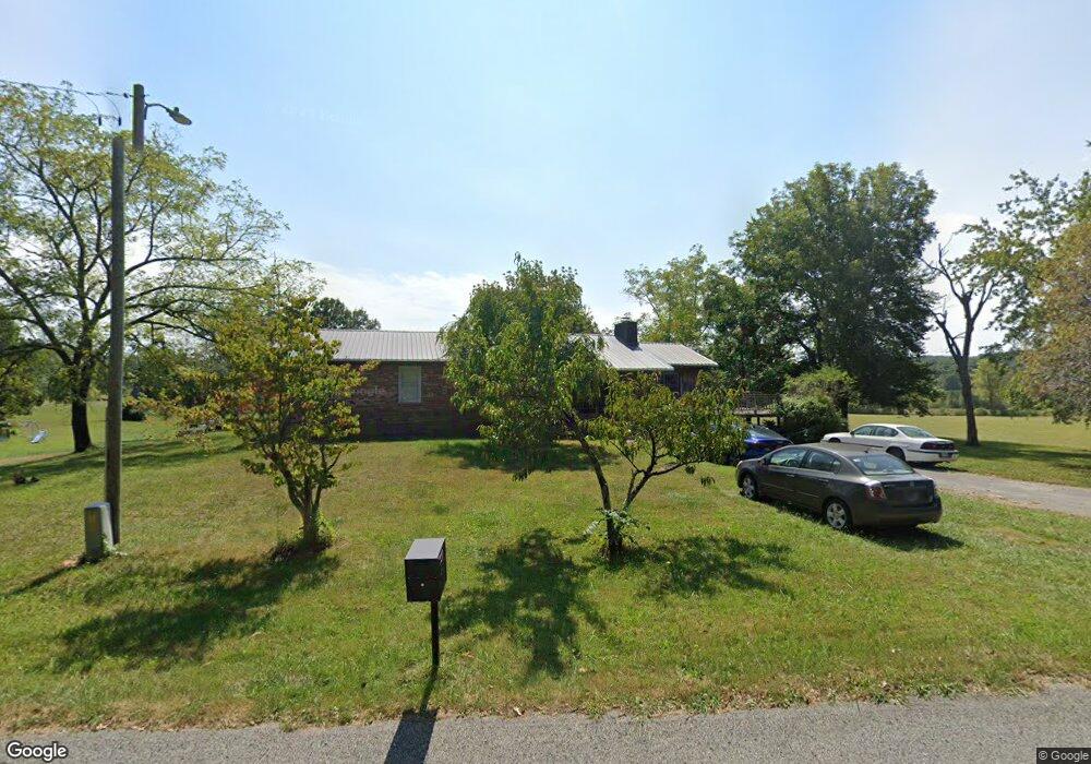
1711 Anderson Rd Monterey, TN 38574
Estimated Value: $303,000 - $365,101
3
Beds
2
Baths
2,011
Sq Ft
$162/Sq Ft
Est. Value
About This Home
This home is located at 1711 Anderson Rd, Monterey, TN 38574 and is currently estimated at $326,525, approximately $162 per square foot. 1711 Anderson Rd is a home located in Putnam County with nearby schools including Burks Elementary School, Monterey High School, and Heritage Academy.
Ownership History
Date
Name
Owned For
Owner Type
Purchase Details
Closed on
Jan 4, 2018
Sold by
Buckner Benton Lee
Bought by
Hargis Ruben J S
Current Estimated Value
Purchase Details
Closed on
Jan 30, 2012
Sold by
Geer Billy A
Bought by
Hargis Ruben Johnny Shann
Home Financials for this Owner
Home Financials are based on the most recent Mortgage that was taken out on this home.
Original Mortgage
$111,596
Interest Rate
4.4%
Mortgage Type
FHA
Purchase Details
Closed on
Feb 16, 1974
Bought by
Geer Billy A and Geer Shelby G
Create a Home Valuation Report for This Property
The Home Valuation Report is an in-depth analysis detailing your home's value as well as a comparison with similar homes in the area
Home Values in the Area
Average Home Value in this Area
Purchase History
| Date | Buyer | Sale Price | Title Company |
|---|---|---|---|
| Hargis Ruben J S | -- | -- | |
| Hargis Ruben Johnny Shann | $114,500 | -- | |
| Geer Billy A | -- | -- |
Source: Public Records
Mortgage History
| Date | Status | Borrower | Loan Amount |
|---|---|---|---|
| Previous Owner | Hargis Ruben Johnny Shann | $111,596 |
Source: Public Records
Tax History Compared to Growth
Tax History
| Year | Tax Paid | Tax Assessment Tax Assessment Total Assessment is a certain percentage of the fair market value that is determined by local assessors to be the total taxable value of land and additions on the property. | Land | Improvement |
|---|---|---|---|---|
| 2024 | $1,289 | $48,475 | $4,375 | $44,100 |
| 2023 | $1,289 | $48,475 | $4,375 | $44,100 |
| 2022 | $1,198 | $48,475 | $4,375 | $44,100 |
| 2021 | $1,198 | $48,475 | $4,375 | $44,100 |
| 2020 | $1,121 | $48,475 | $4,375 | $44,100 |
| 2019 | $1,121 | $38,325 | $4,375 | $33,950 |
| 2018 | $971 | $38,325 | $4,375 | $33,950 |
| 2017 | $971 | $35,550 | $1,850 | $33,700 |
| 2016 | $971 | $35,550 | $1,850 | $33,700 |
| 2015 | $997 | $35,550 | $1,850 | $33,700 |
| 2014 | $980 | $34,921 | $0 | $0 |
Source: Public Records
Map
Nearby Homes
- 1180 Lake Hill Rd
- 2066 Anderson Rd
- 0 Harris Rd
- 8.13 ac Harris Rd
- 1047 Phillips Dr
- 1383 Buckner Rd
- 156 Ridge Rd
- 303 W Cleveland Ave
- 309 W Cleveland Ave
- 303 W Steward Ave
- 206 W Commercial Ave
- 106 N Oak St
- 301 W Commercial Ave
- 0 Crystal Pointe Point Unit 1285186
- 912 Jackson Ave
- 209 Reed Place
- 315 W Stewart Ave
- 371 W Meadow Creek Rd
- 209 E Welch Ave
- 1757 Anderson Rd
- 1660 Anderson Rd
- 1799 Anderson Rd
- 2180 Hanging Limb Hwy
- 2224 Hanging Limb Rd
- 0 Hanging Limb Hwy
- 1868 Anderson Rd
- 1885 Anderson Rd
- 1900 Anderson Rd
- 3190 Buckner Rd
- 1720 Appletree Ln
- 1870 Hanging Limb Rd
- 1963 Anderson Rd
- 1849 Hanging Limb Rd
- 1601 Hanging Limb Hwy
- 15034 Lakeside Dr
- 1287 Lake Hill Rd
- 1825 Hanging Limb Rd
- 1825 Hanging Limb Hwy
- 1.4 AC Highway 70