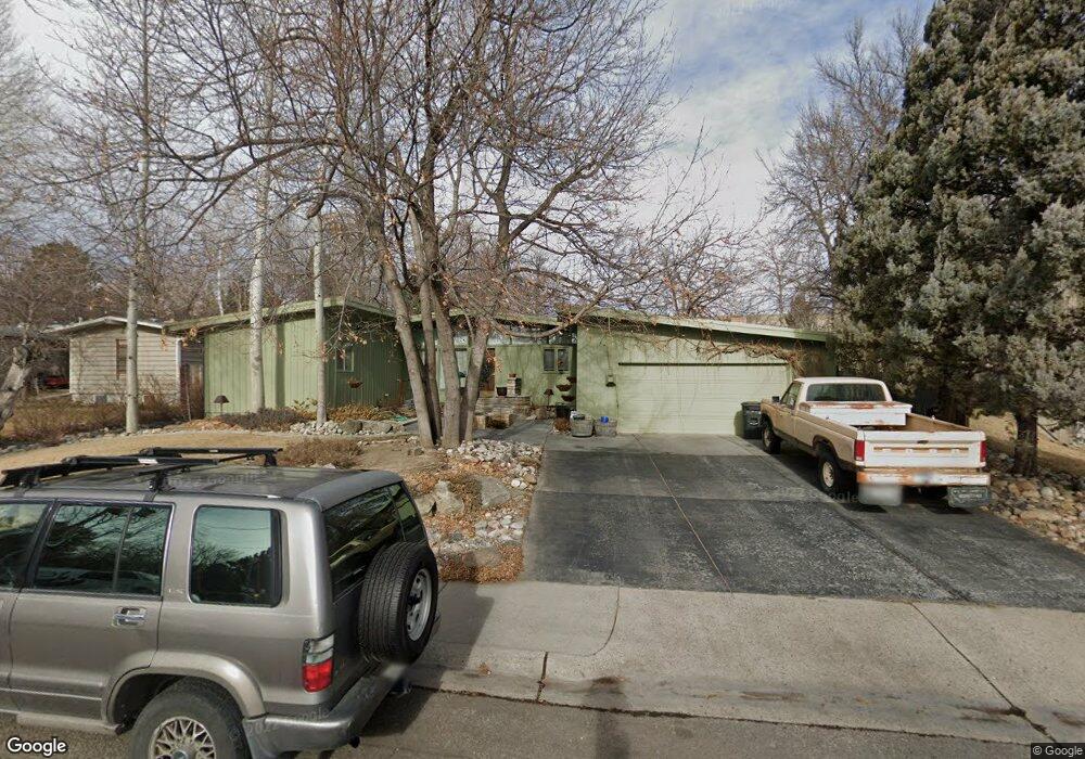
1711 Iris Ln Billings, MT 59102
North Central Billings NeighborhoodEstimated Value: $556,000 - $669,000
3
Beds
3
Baths
4,338
Sq Ft
$137/Sq Ft
Est. Value
About This Home
This home is located at 1711 Iris Ln, Billings, MT 59102 and is currently estimated at $592,446, approximately $136 per square foot. 1711 Iris Ln is a home located in Yellowstone County with nearby schools including Rose Park School, Lewis & Clark Junior High School, and Billings Senior High School.
Ownership History
Date
Name
Owned For
Owner Type
Purchase Details
Closed on
Dec 5, 2022
Sold by
Lois Ann Nordstog Administrative Trust
Bought by
Klutts Ellen O and Klutts James R
Current Estimated Value
Home Financials for this Owner
Home Financials are based on the most recent Mortgage that was taken out on this home.
Original Mortgage
$303,700
Outstanding Balance
$294,587
Interest Rate
6.95%
Mortgage Type
New Conventional
Estimated Equity
$297,859
Purchase Details
Closed on
Jul 15, 2016
Sold by
Nordstog Lois Ann
Bought by
Nordstog Lois Ann and Lois Ann Nordstog Living Trust
Create a Home Valuation Report for This Property
The Home Valuation Report is an in-depth analysis detailing your home's value as well as a comparison with similar homes in the area
Home Values in the Area
Average Home Value in this Area
Purchase History
| Date | Buyer | Sale Price | Title Company |
|---|---|---|---|
| Klutts Ellen O | -- | Stewart Title | |
| Nordstog Lois Ann | -- | None Available |
Source: Public Records
Mortgage History
| Date | Status | Borrower | Loan Amount |
|---|---|---|---|
| Open | Klutts Ellen O | $303,700 |
Source: Public Records
Tax History Compared to Growth
Tax History
| Year | Tax Paid | Tax Assessment Tax Assessment Total Assessment is a certain percentage of the fair market value that is determined by local assessors to be the total taxable value of land and additions on the property. | Land | Improvement |
|---|---|---|---|---|
| 2025 | $4,480 | $536,800 | $59,996 | $476,804 |
| 2024 | $4,480 | $459,400 | $56,919 | $402,481 |
| 2023 | $4,472 | $459,400 | $56,919 | $402,481 |
| 2022 | $4,001 | $360,200 | $0 | $0 |
| 2021 | $3,802 | $360,200 | $0 | $0 |
| 2020 | $4,149 | $379,000 | $0 | $0 |
| 2019 | $3,960 | $379,000 | $0 | $0 |
| 2018 | $3,883 | $364,600 | $0 | $0 |
| 2017 | $3,774 | $364,600 | $0 | $0 |
| 2016 | $3,575 | $348,600 | $0 | $0 |
| 2015 | $3,497 | $348,600 | $0 | $0 |
| 2014 | $3,552 | $189,475 | $0 | $0 |
Source: Public Records
Map
Nearby Homes
- 2414 Ivy Ln
- 1734 Mariposa Ln
- 9 Stanford Ct
- 1833 Iris Ln
- 2510 Terrace Dr
- 2020 Plaza Dr
- 46 Shadow Place Unit 6B
- 2718 Terrace Dr
- 6 Heatherwood Ln
- 2124 Dahlia Ln
- 24 Heatherwood Ln Unit 12D
- 1944 Colton Blvd
- 1505 Avenue F
- 41 Heatherwood Ln
- 2910 Glacier Dr
- 1400 Poly Dr Unit 4D
- 1418 Avenue F
- 2030 Rimrock Rd
- 1329 Parkhill Dr
- 2042 Green Terrace Dr
- 1717 Iris Ln
- 1701 Iris Ln
- 2420 17th St W
- 1705 Iris Ln
- 1723 Iris Ln
- 1722 Poly Dr
- 1720 Iris Ln
- 2358 Bonnevue Square
- 2350 Bonnevue Square
- 2304 17th St W
- 2366 Bonnevue Square
- 1726 Poly Dr
- 2415 Ivy Ln
- 1728 Iris Ln
- 2370 Bonnevue Square
- 2409 Ivy Ln
- 1728 Poly Dr
- 1734 Poly Dr
- 2311 Ivy Ln
- 2349 Bonnevue Square