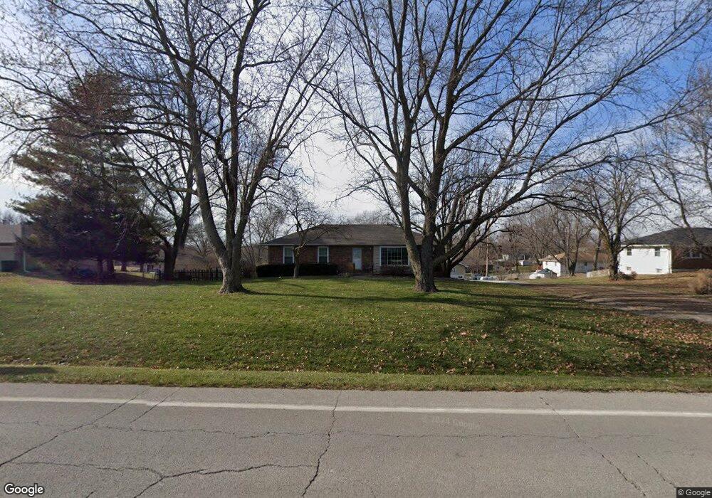
17116 33 Hwy Kearney, MO 64048
Estimated Value: $325,124 - $422,000
3
Beds
3
Baths
1,468
Sq Ft
$258/Sq Ft
Est. Value
About This Home
This home is located at 17116 33 Hwy, Kearney, MO 64048 and is currently estimated at $378,281, approximately $257 per square foot. 17116 33 Hwy is a home located in Clay County with nearby schools including Kearney Junior High School, Kearney High School, and Northern Hills Christian Academy.
Ownership History
Date
Name
Owned For
Owner Type
Purchase Details
Closed on
Jul 8, 2022
Sold by
Babb Robert L and Peggy Suzanne Babb Trust
Bought by
Juncture Holdings Llc
Current Estimated Value
Purchase Details
Closed on
Jan 12, 2016
Sold by
Melia Pamela J
Bought by
Hunt Leslia R
Home Financials for this Owner
Home Financials are based on the most recent Mortgage that was taken out on this home.
Original Mortgage
$167,832
Interest Rate
4.16%
Mortgage Type
VA
Purchase Details
Closed on
May 26, 2011
Sold by
Fink Pamela J and Melia Pamela J
Bought by
Melia Pamela J
Home Financials for this Owner
Home Financials are based on the most recent Mortgage that was taken out on this home.
Original Mortgage
$95,000
Interest Rate
4.85%
Mortgage Type
New Conventional
Purchase Details
Closed on
Sep 24, 1997
Sold by
P Michael
Bought by
Fink Pamela J
Create a Home Valuation Report for This Property
The Home Valuation Report is an in-depth analysis detailing your home's value as well as a comparison with similar homes in the area
Home Values in the Area
Average Home Value in this Area
Purchase History
| Date | Buyer | Sale Price | Title Company |
|---|---|---|---|
| Juncture Holdings Llc | -- | Stewart Title | |
| Hunt Leslia R | -- | Stewart Title Co | |
| Melia Pamela J | -- | First American Title | |
| Fink Pamela J | -- | Chicago Title Insurance Co |
Source: Public Records
Mortgage History
| Date | Status | Borrower | Loan Amount |
|---|---|---|---|
| Previous Owner | Hunt Leslia R | $167,832 | |
| Previous Owner | Melia Pamela J | $95,000 |
Source: Public Records
Tax History Compared to Growth
Tax History
| Year | Tax Paid | Tax Assessment Tax Assessment Total Assessment is a certain percentage of the fair market value that is determined by local assessors to be the total taxable value of land and additions on the property. | Land | Improvement |
|---|---|---|---|---|
| 2025 | $2,752 | $47,410 | -- | -- |
| 2024 | $2,752 | $43,490 | -- | -- |
| 2023 | $2,741 | $43,490 | $0 | $0 |
| 2022 | $2,262 | $34,750 | $0 | $0 |
| 2021 | $2,213 | $34,751 | $2,850 | $31,901 |
| 2020 | $2,161 | $30,820 | $0 | $0 |
| 2019 | $2,148 | $30,818 | $2,850 | $27,968 |
| 2018 | $2,048 | $28,390 | $0 | $0 |
| 2017 | $2,023 | $28,390 | $2,850 | $25,540 |
| 2016 | $2,023 | $28,390 | $2,850 | $25,540 |
| 2015 | $2,023 | $28,390 | $2,850 | $25,540 |
| 2014 | $1,956 | $27,300 | $2,850 | $24,450 |
Source: Public Records
Map
Nearby Homes
- 0 N Jefferson St Mo-33 Hwy Unit HMS2578203
- 17017 NE 180th St
- 15806 NE 176th St
- 16806 NE 180th St
- Tract 2 Nation Rd
- 0 Lot 5 Arnold Park Lot N A Unit HMS2572371
- 16411 NE 162nd St
- 0 Lot 3 Arnold Park Lot N A Unit HMS2572330
- 15404 NE 181st St
- 608 Woodson St
- 1108 W 10th Ave
- 1008 W 10th Ave
- 1004 W 10th Ave
- 1000 W 10th Ave
- 404 N Grove St
- 102 W Lawrence St
- Lot 15 Melinda Dr
- Lot 14 Melinda Dr
- Lot 13 Melinda Dr
- Lot 12 Melinda Dr
- 17116 State Route 33
- 17108 State Route 33
- 17118 State Route 33
- 17115 Jackson Ave
- 17119 Jackson Ave
- 17109 Jackson Ave
- 17123 Jackson Ave
- 17100 State Route 33
- 17126 State Route 33
- 17103 Jackson Ave
- 17127 Jackson Ave
- 17207 NE 172nd St
- 17112 Jackson Ave
- 17118 Jackson Ave
- 17108 Jackson Ave
- 17122 Jackson Ave
- 17020 State Route 33
- 17021 Jackson Ave
- 17104 Jackson Ave
- 17126 Jackson Ave