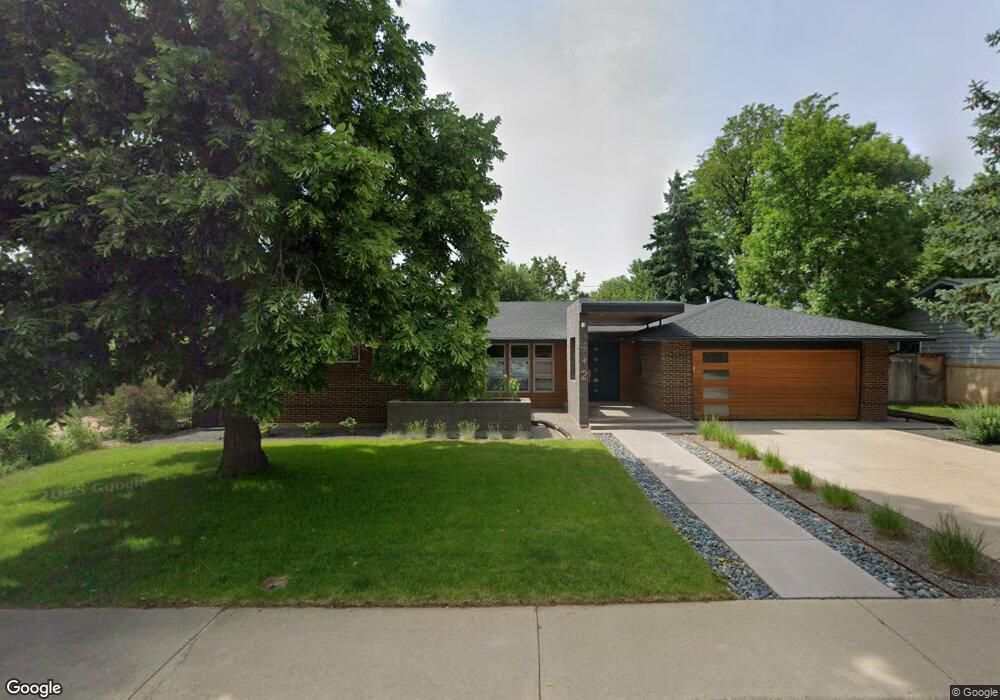
1712 Garland Ln Boulder, CO 80304
Central Boulder NeighborhoodEstimated Value: $1,458,942 - $1,801,000
4
Beds
3
Baths
2,627
Sq Ft
$609/Sq Ft
Est. Value
About This Home
This home is located at 1712 Garland Ln, Boulder, CO 80304 and is currently estimated at $1,599,486, approximately $608 per square foot. 1712 Garland Ln is a home located in Boulder County with nearby schools including Columbine Elementary School, Casey Middle School, and Boulder High School.
Ownership History
Date
Name
Owned For
Owner Type
Purchase Details
Closed on
Oct 29, 2008
Sold by
Bartels Joseph G and Teigen Jeanette
Bought by
Rendos Nancy S and Rendos Thomas A
Current Estimated Value
Home Financials for this Owner
Home Financials are based on the most recent Mortgage that was taken out on this home.
Original Mortgage
$417,000
Interest Rate
5.83%
Mortgage Type
Purchase Money Mortgage
Purchase Details
Closed on
Dec 15, 1999
Sold by
Dahlgren Nancy E
Bought by
Bartels Joseph G
Home Financials for this Owner
Home Financials are based on the most recent Mortgage that was taken out on this home.
Original Mortgage
$206,000
Interest Rate
7.86%
Purchase Details
Closed on
Aug 30, 1978
Bought by
Rendos Nancy S and Rendos Thomas A
Purchase Details
Closed on
Jun 19, 1978
Bought by
Rendos Nancy S and Rendos Thomas A
Purchase Details
Closed on
Apr 15, 1975
Bought by
Rendos Nancy S and Rendos Thomas A
Create a Home Valuation Report for This Property
The Home Valuation Report is an in-depth analysis detailing your home's value as well as a comparison with similar homes in the area
Home Values in the Area
Average Home Value in this Area
Purchase History
| Date | Buyer | Sale Price | Title Company |
|---|---|---|---|
| Rendos Nancy S | $670,000 | Utc Colorado | |
| Bartels Joseph G | $304,300 | -- | |
| Rendos Nancy S | $78,000 | -- | |
| Rendos Nancy S | $70,200 | -- | |
| Rendos Nancy S | $48,000 | -- |
Source: Public Records
Mortgage History
| Date | Status | Borrower | Loan Amount |
|---|---|---|---|
| Closed | Rendos Nancy S | $417,000 | |
| Previous Owner | Bartels Joseph G | $206,000 |
Source: Public Records
Tax History Compared to Growth
Tax History
| Year | Tax Paid | Tax Assessment Tax Assessment Total Assessment is a certain percentage of the fair market value that is determined by local assessors to be the total taxable value of land and additions on the property. | Land | Improvement |
|---|---|---|---|---|
| 2025 | $9,239 | $98,619 | $53,506 | $45,113 |
| 2024 | $9,239 | $98,619 | $53,506 | $45,113 |
| 2023 | $9,078 | $105,123 | $56,662 | $52,146 |
| 2022 | $7,443 | $80,154 | $42,770 | $37,384 |
| 2021 | $7,098 | $82,461 | $44,001 | $38,460 |
| 2020 | $6,447 | $74,060 | $58,559 | $15,501 |
| 2019 | $6,348 | $74,060 | $58,559 | $15,501 |
| 2018 | $5,484 | $63,252 | $35,064 | $28,188 |
| 2017 | $5,312 | $69,928 | $38,765 | $31,163 |
| 2016 | $5,151 | $59,509 | $28,417 | $31,092 |
| 2015 | $4,878 | $50,259 | $25,472 | $24,787 |
| 2014 | $4,226 | $50,259 | $25,472 | $24,787 |
Source: Public Records
Map
Nearby Homes
- 1930 Grape Ave
- 1707 Grape Ave
- 3010 14th St
- 1717 Iris Ave
- 2006 Joslyn Place
- 2935 19th St
- 2941 21st St
- 3505 19th St
- 2870 18th St
- 1237 Elder Ave Unit 1
- 1525 Jennine Place
- 3055 23rd St
- 3360 Broadway St
- 3000 Broadway St Unit 10
- 3000 Broadway St Unit 10 & 11
- 3315 Broadway St
- 2283 Nicholl St E
- 3319 Broadway
- 2917 13th St
- 3025 Broadway St Unit 7
- 1722 Garland Ln
- 1702 Garland Ln
- 1755 Forest Ave
- 1775 Forest Ave
- 1705 Forest Ave
- 1715 Garland Ln
- 1742 Garland Ln
- 1725 Garland Ln
- 1805 Forest Ave
- 1735 Garland Ln
- 1705 Garland Ln
- 1790 Forest Ave
- 1762 Garland Ln
- 1825 Forest Ave
- 3190 17th St
- 1760 Grape Ave
- 1755 Garland Ln
- 3185 18th St
- 1780 Grape Ave
- 3190 18th St