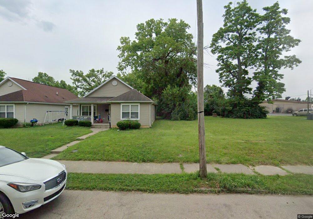
1712 W 1st St Dayton, OH 45402
Wolf Creek NeighborhoodEstimated Value: $115,000
--
Bed
2
Baths
2,718
Sq Ft
$42/Sq Ft
Est. Value
About This Home
This home is located at 1712 W 1st St, Dayton, OH 45402 and is currently estimated at $115,000, approximately $42 per square foot. 1712 W 1st St is a home located in Montgomery County with nearby schools including International School at Residence Park, Louise Troy Elementary, and Westwood Elementary.
Ownership History
Date
Name
Owned For
Owner Type
Purchase Details
Closed on
Sep 22, 2021
Sold by
Montgomery Cnty Land Reutilization Corp
Bought by
County Corp
Current Estimated Value
Purchase Details
Closed on
May 7, 2021
Sold by
Yavorski Michael and Montgomery County
Bought by
Montgomery Cnty Land Reutilization Corp
Purchase Details
Closed on
Jun 9, 2011
Sold by
Atfh Real Property Llc
Bought by
Yavorski Michael
Purchase Details
Closed on
Oct 29, 2009
Sold by
Green David E
Bought by
Atfh Real Property Llc
Purchase Details
Closed on
Aug 10, 1998
Sold by
Robert Brooks
Bought by
Green David E
Create a Home Valuation Report for This Property
The Home Valuation Report is an in-depth analysis detailing your home's value as well as a comparison with similar homes in the area
Home Values in the Area
Average Home Value in this Area
Purchase History
| Date | Buyer | Sale Price | Title Company |
|---|---|---|---|
| County Corp | -- | None Available | |
| Montgomery Cnty Land Reutilization Corp | -- | None Available | |
| Yavorski Michael | $2,001 | None Available | |
| Atfh Real Property Llc | -- | Attorney | |
| Green David E | $1,500 | Midwest Abstract Company |
Source: Public Records
Tax History Compared to Growth
Tax History
| Year | Tax Paid | Tax Assessment Tax Assessment Total Assessment is a certain percentage of the fair market value that is determined by local assessors to be the total taxable value of land and additions on the property. | Land | Improvement |
|---|---|---|---|---|
| 2024 | $61 | $1,050 | $1,050 | -- |
| 2023 | $61 | $1,050 | $1,050 | $0 |
| 2022 | $78 | $1,050 | $1,050 | $0 |
| 2021 | $78 | $1,050 | $1,050 | $0 |
| 2020 | $78 | $1,050 | $1,050 | $0 |
| 2019 | $1,297 | $1,050 | $1,050 | $0 |
| 2018 | $158 | $1,050 | $1,050 | $0 |
| 2017 | $630 | $1,050 | $1,050 | $0 |
| 2016 | $398 | $1,050 | $1,050 | $0 |
| 2015 | $428 | $1,050 | $1,050 | $0 |
| 2014 | $428 | $1,050 | $1,050 | $0 |
| 2012 | -- | $21,790 | $2,340 | $19,450 |
Source: Public Records
Map
Nearby Homes
- 1568 W 2nd St
- 1540 W 2nd St
- 1527 W 1st St
- 40 S Mathison St
- 200 N Orchard Ave
- 42 S Mathison St
- 369 N Mathison St
- 235 Mercer Ave
- 1515 Ingomar Ave
- 1412 Oakridge Dr
- 401 S Euclid Ave Unit 403
- 436 N Orchard Ave
- 403 S Euclid Ave
- 149 Edison St
- 408 N Conover St
- 721 Kumler Ave
- 30 S Kilmer St
- 146 N Marion St
- 121 Gordon Ave
- 508 S Paul Laurence Dunbar St
- 1708 W 1st St
- 1718 W 1st St
- 1706 W 1st St
- 1724 W 1st St
- 1715 W 2nd St
- 1711 W 2nd St
- 1721 & 1717 W First St
- 1717 W 1st St
- 1707 W 2nd St
- 1721 W 1st St
- 1732 W 1st St
- 1701 W 2nd St
- 1725 W 1st St
- 1733 W 1st St
- 112 N Antioch St
- 1654 W 1st St
- 1659 W 1st St
- 1714 W 2nd St
- 1650 W 1st St
- 206 N James H McGee Blvd