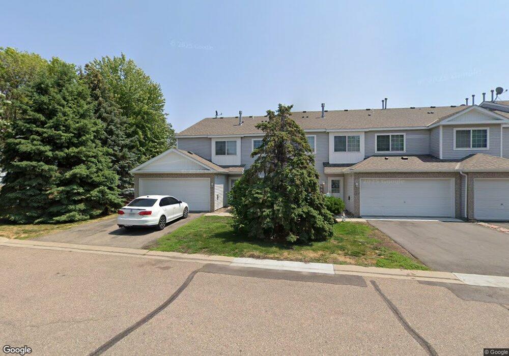
1712 Weston Ln Unit 81 Shakopee, MN 55379
Estimated Value: $246,000 - $257,000
2
Beds
2
Baths
1,276
Sq Ft
$197/Sq Ft
Est. Value
About This Home
This home is located at 1712 Weston Ln Unit 81, Shakopee, MN 55379 and is currently estimated at $251,950, approximately $197 per square foot. 1712 Weston Ln Unit 81 is a home located in Scott County with nearby schools including Jackson Elementary School, East Middle School, and Shakopee Senior High School.
Ownership History
Date
Name
Owned For
Owner Type
Purchase Details
Closed on
Sep 12, 2019
Sold by
Iverson Bruce L
Bought by
Manthel Joseph L
Current Estimated Value
Home Financials for this Owner
Home Financials are based on the most recent Mortgage that was taken out on this home.
Original Mortgage
$191,369
Outstanding Balance
$167,279
Interest Rate
3.5%
Mortgage Type
FHA
Estimated Equity
$84,671
Purchase Details
Closed on
Oct 19, 1999
Sold by
Pulte Homes Of Minnesota Corp
Bought by
Iverson Bruce L
Create a Home Valuation Report for This Property
The Home Valuation Report is an in-depth analysis detailing your home's value as well as a comparison with similar homes in the area
Home Values in the Area
Average Home Value in this Area
Purchase History
| Date | Buyer | Sale Price | Title Company |
|---|---|---|---|
| Manthel Joseph L | $140,354 | North American Title Company | |
| Iverson Bruce L | $111,030 | -- |
Source: Public Records
Mortgage History
| Date | Status | Borrower | Loan Amount |
|---|---|---|---|
| Open | Manthel Joseph L | $191,369 |
Source: Public Records
Tax History Compared to Growth
Tax History
| Year | Tax Paid | Tax Assessment Tax Assessment Total Assessment is a certain percentage of the fair market value that is determined by local assessors to be the total taxable value of land and additions on the property. | Land | Improvement |
|---|---|---|---|---|
| 2025 | $2,192 | $239,100 | $76,100 | $163,000 |
| 2024 | $2,274 | $228,100 | $72,400 | $155,700 |
| 2023 | $2,340 | $224,800 | $71,000 | $153,800 |
| 2022 | $2,282 | $227,400 | $72,700 | $154,700 |
| 2021 | $1,934 | $194,100 | $57,000 | $137,100 |
| 2020 | $2,150 | $183,500 | $47,300 | $136,200 |
| 2019 | $1,954 | $179,900 | $50,000 | $129,900 |
| 2018 | $1,822 | $0 | $0 | $0 |
| 2016 | $1,688 | $0 | $0 | $0 |
| 2014 | -- | $0 | $0 | $0 |
Source: Public Records
Map
Nearby Homes
- 1022 Providence Dr
- 1590 Countryside Dr Unit 5108
- 849 Providence Dr
- 826 Princeton Ave
- 668 Cobblestone Way
- 1820 Mockingbird Ave
- 1844 Mockingbird Ave Unit 1102
- 1562 Liberty Cir Unit 2403
- 291 Appleblossom Ln
- 793 Lupine Ct
- 1552 Dublin Ct
- 335 Bluestem Ave
- 1573 Creekside Ln
- 2052 Wilhelm Ct
- 2312 Vierling Dr E
- 1076 Sibley St S
- 2471 Tyrone Dr
- 2447 Tyrone Dr
- 1164 Merrifield Ct
- 2399 Tyrone Dr
- 1239 Elmwood Ave
- 1716 Weston Ln Unit 82
- 1235 Elmwood Ave Unit 87
- 1720 Weston Ln
- 1231 Elmwood Ave Unit 86
- 1724 Weston Ln Unit 84
- 1227 Elmwood Ave Unit 85
- 1223 Elmwood Ave Unit 89
- 1219 Elmwood Ave
- 1215 Elmwood Ave
- 1207 Elmwood Ave Unit 96
- 1203 Elmwood Ave Unit 95
- 1211 Elmwood Ave
- 1199 Elmwood Ave Unit 94
- 1711 Weston Ln
- 1707 Weston Ln
- 1195 Elmwood Ave
- 1715 Weston Ln Unit 20
- 1719 Weston Ln
- 1719 Weston Ln Unit 19