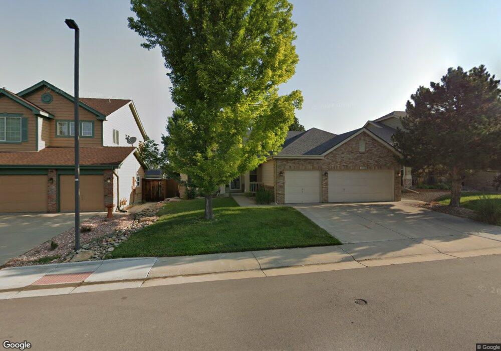
17121 Opal Hill Dr Parker, CO 80134
Estimated Value: $651,926 - $714,000
2
Beds
2
Baths
1,814
Sq Ft
$384/Sq Ft
Est. Value
About This Home
This home is located at 17121 Opal Hill Dr, Parker, CO 80134 and is currently estimated at $696,232, approximately $383 per square foot. 17121 Opal Hill Dr is a home located in Douglas County with nearby schools including Cherokee Trail Elementary School, Sierra Middle School, and Chaparral High School.
Ownership History
Date
Name
Owned For
Owner Type
Purchase Details
Closed on
Mar 31, 2006
Sold by
Quinn Ernest W and Quinn Virginia L
Bought by
Mccollum Michelle and Hodson Debra
Current Estimated Value
Home Financials for this Owner
Home Financials are based on the most recent Mortgage that was taken out on this home.
Original Mortgage
$264,900
Outstanding Balance
$151,172
Interest Rate
6.24%
Mortgage Type
Fannie Mae Freddie Mac
Estimated Equity
$545,060
Purchase Details
Closed on
Jul 15, 1998
Sold by
The Ryland Group Inc
Bought by
Quinn Ernest W and Quinn Virginia L
Home Financials for this Owner
Home Financials are based on the most recent Mortgage that was taken out on this home.
Original Mortgage
$194,300
Interest Rate
7.09%
Create a Home Valuation Report for This Property
The Home Valuation Report is an in-depth analysis detailing your home's value as well as a comparison with similar homes in the area
Home Values in the Area
Average Home Value in this Area
Purchase History
| Date | Buyer | Sale Price | Title Company |
|---|---|---|---|
| Mccollum Michelle | $364,900 | Fahtco | |
| Quinn Ernest W | $220,468 | Land Title |
Source: Public Records
Mortgage History
| Date | Status | Borrower | Loan Amount |
|---|---|---|---|
| Open | Mccollum Michelle | $264,900 | |
| Previous Owner | Quinn Ernest W | $194,300 |
Source: Public Records
Tax History Compared to Growth
Tax History
| Year | Tax Paid | Tax Assessment Tax Assessment Total Assessment is a certain percentage of the fair market value that is determined by local assessors to be the total taxable value of land and additions on the property. | Land | Improvement |
|---|---|---|---|---|
| 2024 | $5,186 | $52,110 | $8,670 | $43,440 |
| 2023 | $5,231 | $52,110 | $8,670 | $43,440 |
| 2022 | $3,924 | $35,550 | $5,930 | $29,620 |
| 2021 | $4,038 | $35,550 | $5,930 | $29,620 |
| 2020 | $3,864 | $34,900 | $6,550 | $28,350 |
| 2019 | $3,771 | $34,900 | $6,550 | $28,350 |
| 2018 | $3,454 | $31,540 | $5,900 | $25,640 |
| 2017 | $3,258 | $31,540 | $5,900 | $25,640 |
| 2016 | $3,125 | $29,780 | $5,570 | $24,210 |
| 2015 | $1,593 | $29,780 | $5,570 | $24,210 |
| 2014 | $1,519 | $25,610 | $5,410 | $20,200 |
Source: Public Records
Map
Nearby Homes
- 17130 Opal Hill Dr
- 17235 Opal Hill Dr
- 17351 Cornerstone Dr
- 17071 Knollside Ave
- 10371 Knollside Dr
- 16745 Rockledge Cove
- 10414 Stonewillow Dr
- 10318 Severance Dr
- 10251 Hedge Ln
- 10107 Riverstone Dr
- 10505 Berthoud Way
- 16642 Autumn Rock Cove
- 11626 Masonville Dr
- 16382 Maple Rock Ct
- 17109 Campion Way
- 11613 Masonville Dr
- 16341 Maple Rock Ct
- 10607 Clarke Farms Dr
- 17046 Wellington Dr
- 16056 Quarry Hill Dr
- 17107 Opal Hill Dr
- 17135 Opal Hill Dr
- 17149 Opal Hill Dr
- 17093 Opal Hill Dr
- 17156 Cornerstone Ln
- 17168 Cornerstone Ln
- 17144 Cornerstone Ln
- 10201 Gemstone Ct
- 17182 Cornerstone Ln
- 17140 Opal Hill Dr
- 17165 Opal Hill Dr
- 17079 Opal Hill Dr
- 17136 Cornerstone Ln
- 17154 Opal Hill Dr
- 10211 Gemstone Ct
- 10212 Gemstone Ct
- 17126 Cornerstone Ln
- 17177 Opal Hill Dr
- 17078 Opal Hill Dr
- 17210 Cornerstone Ln