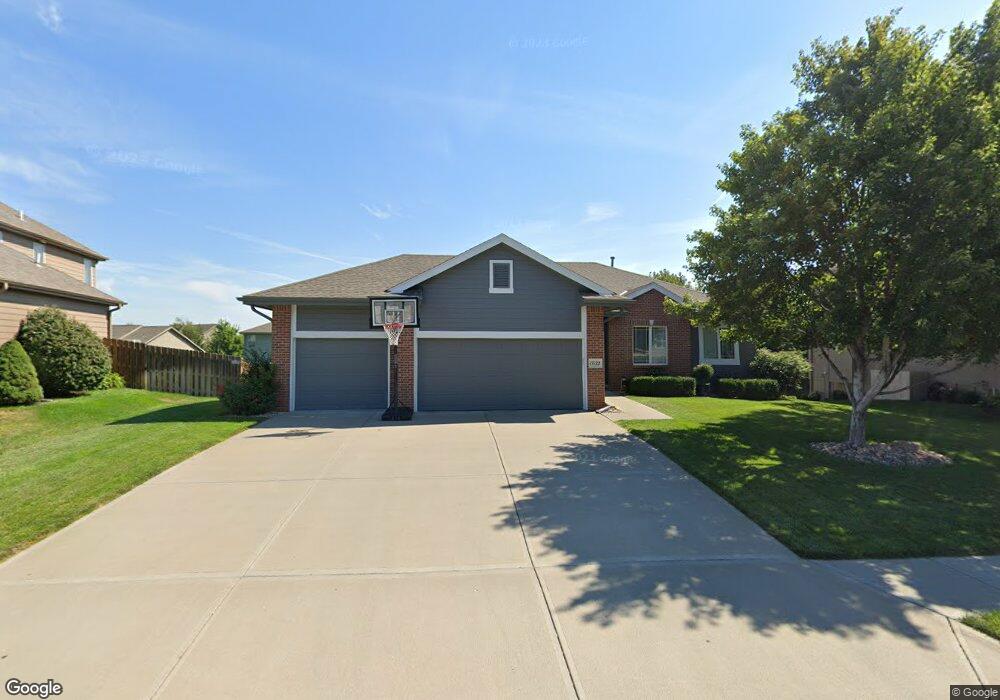
17122 Colony Dr Omaha, NE 68136
Southwest Omaha NeighborhoodEstimated Value: $426,000 - $487,000
3
Beds
3
Baths
1,761
Sq Ft
$256/Sq Ft
Est. Value
About This Home
This home is located at 17122 Colony Dr, Omaha, NE 68136 and is currently estimated at $451,237, approximately $256 per square foot. 17122 Colony Dr is a home located in Sarpy County with nearby schools including Palisades Elementary School, Gretna Middle School, and Gretna High School.
Ownership History
Date
Name
Owned For
Owner Type
Purchase Details
Closed on
Jun 23, 2011
Sold by
Mccaul Jeff T
Bought by
Siskow Clint R and Siskow Joyce M
Current Estimated Value
Home Financials for this Owner
Home Financials are based on the most recent Mortgage that was taken out on this home.
Original Mortgage
$234,650
Outstanding Balance
$155,874
Interest Rate
3.87%
Estimated Equity
$295,363
Purchase Details
Closed on
Oct 1, 2010
Sold by
Linden Paul and Linden Celeen
Bought by
Mccaul Jeff T and Mccaul Contracting
Create a Home Valuation Report for This Property
The Home Valuation Report is an in-depth analysis detailing your home's value as well as a comparison with similar homes in the area
Home Values in the Area
Average Home Value in this Area
Purchase History
| Date | Buyer | Sale Price | Title Company |
|---|---|---|---|
| Siskow Clint R | $247,000 | Nlta | |
| Mccaul Jeff T | $31,000 | Dakota Title & Escrow |
Source: Public Records
Mortgage History
| Date | Status | Borrower | Loan Amount |
|---|---|---|---|
| Open | Siskow Clint R | $234,650 |
Source: Public Records
Tax History Compared to Growth
Tax History
| Year | Tax Paid | Tax Assessment Tax Assessment Total Assessment is a certain percentage of the fair market value that is determined by local assessors to be the total taxable value of land and additions on the property. | Land | Improvement |
|---|---|---|---|---|
| 2025 | $7,923 | $421,193 | $77,000 | $344,193 |
| 2024 | $8,614 | $410,650 | $67,000 | $343,650 |
| 2023 | $8,614 | $372,777 | $62,000 | $310,777 |
| 2022 | $7,581 | $322,630 | $57,000 | $265,630 |
| 2021 | $7,204 | $311,578 | $57,000 | $254,578 |
| 2020 | $6,915 | $300,515 | $51,000 | $249,515 |
| 2019 | $6,837 | $297,810 | $51,000 | $246,810 |
| 2018 | $6,905 | $286,130 | $47,000 | $239,130 |
| 2017 | $6,918 | $274,770 | $47,000 | $227,770 |
| 2016 | $6,812 | $264,280 | $47,000 | $217,280 |
| 2015 | $6,658 | $259,883 | $47,000 | $212,883 |
| 2014 | $5,794 | $220,781 | $40,000 | $180,781 |
| 2012 | -- | $224,788 | $40,000 | $184,788 |
Source: Public Records
Map
Nearby Homes
- 17107 Chutney Dr
- 17125 Colony Dr
- 17130 Cypress St
- 16812 Colony Cir
- 9930 S 172nd Cir
- 17110 Palisades Dr
- 9902 S 173rd Cir
- 17161 Oakmont St
- 17221 Musket St
- 10101 S 173rd Cir
- 16660 Sage St
- 17025 Centennial Rd
- TBD Redwood St
- Lot 143 Garden Oaks
- 9711 S 176th St
- 9805 S 176th St
- 17609 Musket St
- 16517 Loop St
- 8903 S 167th St
- 8809 S 167th St
- 17126 Colony Dr
- 17118 Colony Dr
- 9618 S 171st Ave
- 17006 Colony Dr
- 9614 S 171st Ave
- 9622 S 171st Ave
- 17116 Chutney Dr
- 9613 172
- 17141 Colony Dr
- 9613 S 172nd St
- 9610 S 171st Ave
- 17119 Chutney Dr
- 17145 Colony Dr
- 17123 Chutney Dr
- 17120 Chutney Dr
- 17115 Chutney Dr
- 9609 S 172nd St
- 17133 Colony Dr
- 17111 Chutney Dr
- 9611 S 171st Ave