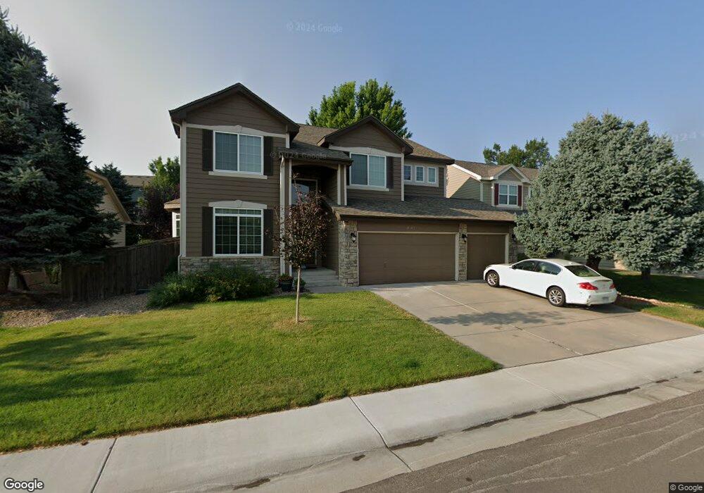
17126 Cornerstone Ln Parker, CO 80134
Estimated Value: $693,000 - $738,000
4
Beds
3
Baths
2,582
Sq Ft
$278/Sq Ft
Est. Value
About This Home
This home is located at 17126 Cornerstone Ln, Parker, CO 80134 and is currently estimated at $716,543, approximately $277 per square foot. 17126 Cornerstone Ln is a home located in Douglas County with nearby schools including Cherokee Trail Elementary School, Sierra Middle School, and Chaparral High School.
Ownership History
Date
Name
Owned For
Owner Type
Purchase Details
Closed on
Dec 4, 2002
Sold by
Fee Kenneth Scott and Fee Laurel J
Bought by
Ross Jeffrey N and Ross Victoria M
Current Estimated Value
Home Financials for this Owner
Home Financials are based on the most recent Mortgage that was taken out on this home.
Original Mortgage
$252,000
Outstanding Balance
$106,765
Interest Rate
6.05%
Estimated Equity
$609,778
Purchase Details
Closed on
May 25, 2001
Sold by
Fee Kenneth Scott
Bought by
Fee Kenneth Scott and Fee Laurel J
Home Financials for this Owner
Home Financials are based on the most recent Mortgage that was taken out on this home.
Original Mortgage
$230,000
Interest Rate
7.1%
Purchase Details
Closed on
Dec 22, 1998
Sold by
Ryland Group Inc
Bought by
Fee Kenneth Scott
Purchase Details
Closed on
Jul 27, 1998
Sold by
Stonegate Westerra
Bought by
Ryland Group Inc
Create a Home Valuation Report for This Property
The Home Valuation Report is an in-depth analysis detailing your home's value as well as a comparison with similar homes in the area
Home Values in the Area
Average Home Value in this Area
Purchase History
| Date | Buyer | Sale Price | Title Company |
|---|---|---|---|
| Ross Jeffrey N | $315,000 | Land Title | |
| Fee Kenneth Scott | -- | Land Title | |
| Fee Kenneth Scott | $251,000 | -- | |
| Ryland Group Inc | $216,600 | -- |
Source: Public Records
Mortgage History
| Date | Status | Borrower | Loan Amount |
|---|---|---|---|
| Open | Ross Jeffrey N | $252,000 | |
| Previous Owner | Fee Kenneth Scott | $230,000 |
Source: Public Records
Tax History Compared to Growth
Tax History
| Year | Tax Paid | Tax Assessment Tax Assessment Total Assessment is a certain percentage of the fair market value that is determined by local assessors to be the total taxable value of land and additions on the property. | Land | Improvement |
|---|---|---|---|---|
| 2024 | $4,957 | $49,980 | $9,790 | $40,190 |
| 2023 | $5,000 | $49,980 | $9,790 | $40,190 |
| 2022 | $3,821 | $34,610 | $6,580 | $28,030 |
| 2021 | $3,928 | $34,610 | $6,580 | $28,030 |
| 2020 | $3,700 | $33,420 | $7,170 | $26,250 |
| 2019 | $3,611 | $33,420 | $7,170 | $26,250 |
| 2018 | $3,283 | $29,980 | $6,490 | $23,490 |
| 2017 | $3,097 | $29,980 | $6,490 | $23,490 |
| 2016 | $3,021 | $28,790 | $5,570 | $23,220 |
| 2015 | $3,079 | $28,790 | $5,570 | $23,220 |
| 2014 | $2,910 | $24,530 | $5,410 | $19,120 |
Source: Public Records
Map
Nearby Homes
- 17130 Opal Hill Dr
- 17235 Opal Hill Dr
- 16745 Rockledge Cove
- 17351 Cornerstone Dr
- 10371 Knollside Dr
- 17071 Knollside Ave
- 10251 Hedge Ln
- 10414 Stonewillow Dr
- 16642 Autumn Rock Cove
- 10107 Riverstone Dr
- 16382 Maple Rock Ct
- 10318 Severance Dr
- 16341 Maple Rock Ct
- 10505 Berthoud Way
- 11626 Masonville Dr
- 17109 Campion Way
- 11613 Masonville Dr
- 16056 Quarry Hill Dr
- 9555 Deerhorn Ct Unit 1
- 16136 Sequoia Dr
- 17136 Cornerstone Ln
- 17112 Cornerstone Ln
- 17079 Opal Hill Dr
- 17144 Cornerstone Ln
- 17088 Cornerstone Ln
- 17065 Opal Hill Dr
- 17093 Opal Hill Dr
- 17049 Opal Hill Dr
- 17125 Cornerstone Ln
- 17111 Cornerstone Ln
- 17107 Opal Hill Dr
- 17156 Cornerstone Ln
- 17139 Cornerstone Ln
- 17099 Cornerstone Ln
- 17035 Opal Hill Dr
- 17070 Cornerstone Ln
- 17153 Cornerstone Ln
- 17121 Opal Hill Dr
- 17085 Cornerstone Ln
- 17168 Cornerstone Ln