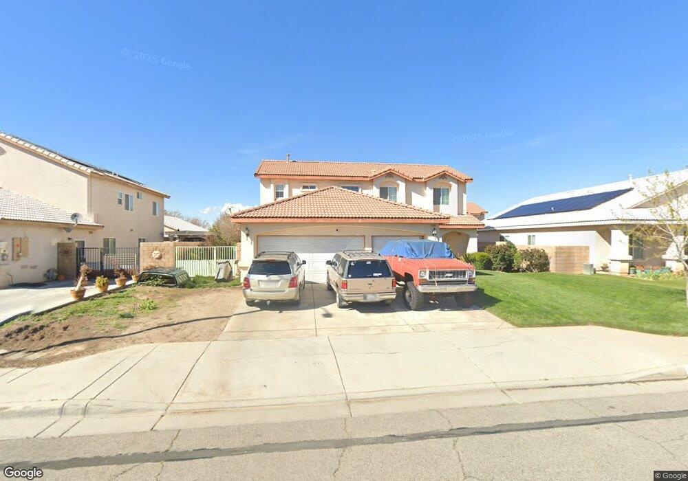
1713 E Avenue j10 Lancaster, CA 93535
East Lancaster NeighborhoodEstimated Value: $485,000 - $530,000
4
Beds
3
Baths
2,262
Sq Ft
$221/Sq Ft
Est. Value
About This Home
This home is located at 1713 E Avenue j10, Lancaster, CA 93535 and is currently estimated at $500,218, approximately $221 per square foot. 1713 E Avenue j10 is a home located in Los Angeles County with nearby schools including Lincoln Elementary School, New Vista Middle School, and Eastside High School.
Ownership History
Date
Name
Owned For
Owner Type
Purchase Details
Closed on
Jan 9, 2024
Sold by
Umana Eligio and Umana Estela
Bought by
Eligio Umana And Estela Hernandez Living Trus and Umana
Current Estimated Value
Purchase Details
Closed on
Jan 26, 2008
Sold by
Umana Eligio
Bought by
Umana Eligio
Purchase Details
Closed on
Jul 16, 2007
Sold by
Hernandez Estela
Bought by
Umana Eligio
Purchase Details
Closed on
May 8, 2007
Sold by
Cdr V Llc
Bought by
Umana Eligio
Home Financials for this Owner
Home Financials are based on the most recent Mortgage that was taken out on this home.
Original Mortgage
$340,100
Interest Rate
7.87%
Mortgage Type
Purchase Money Mortgage
Create a Home Valuation Report for This Property
The Home Valuation Report is an in-depth analysis detailing your home's value as well as a comparison with similar homes in the area
Home Values in the Area
Average Home Value in this Area
Purchase History
| Date | Buyer | Sale Price | Title Company |
|---|---|---|---|
| Eligio Umana And Estela Hernandez Living Trus | -- | None Listed On Document | |
| Umana Eligio | -- | None Available | |
| Umana Eligio | -- | Lawyers Title Company | |
| Umana Eligio | $358,000 | Lawyers Title Company |
Source: Public Records
Mortgage History
| Date | Status | Borrower | Loan Amount |
|---|---|---|---|
| Previous Owner | Umana Eligio | $340,100 |
Source: Public Records
Tax History
| Year | Tax Paid | Tax Assessment Tax Assessment Total Assessment is a certain percentage of the fair market value that is determined by local assessors to be the total taxable value of land and additions on the property. | Land | Improvement |
|---|---|---|---|---|
| 2025 | $7,122 | $470,222 | $116,893 | $353,329 |
| 2024 | $7,122 | $461,002 | $114,601 | $346,401 |
| 2023 | $6,964 | $451,963 | $112,354 | $339,609 |
| 2022 | $6,693 | $443,101 | $110,151 | $332,950 |
| 2021 | $5,468 | $370,200 | $92,000 | $278,200 |
| 2019 | $4,851 | $322,000 | $80,000 | $242,000 |
| 2018 | $4,488 | $293,000 | $72,800 | $220,200 |
| 2016 | $4,002 | $233,000 | $57,900 | $175,100 |
| 2015 | $3,899 | $225,000 | $55,900 | $169,100 |
| 2014 | $3,674 | $204,000 | $50,700 | $153,300 |
Source: Public Records
Map
Nearby Homes
- 43920 Comstock Ave
- 1642 Bisbee Place
- 1565 Astoria Ave
- 1768 Mesa Dr
- 1768 E Mesa Dr
- 1806 E Mesa Dr
- 43964 Fallon Dr
- 43927 Fallon Dr
- 44053 Canyon Way
- 43815 Silver Bow Rd
- 44103 Sundance Ct
- 1518 E Avenue j12
- 1518 E Avenue J-12
- 43711 16th St E
- 87 E Avenue J 12
- 117 E Avenue J 12
- 43850 20th St E Unit 83
- 43850 20th St E Unit 265
- 43850 20th St E Unit Spc 114
- 43850 20th St E Unit 88
- 1721 E Avenue J 10
- 1721 E Avenue j10
- 1707 E Avenue j10
- 1714 E Avenue j9
- 1714 E Avenue J 9
- 1720 E Avenue j9
- 1706 E Lancaster Ave Unit J-9
- 1706 E Avenue j9
- 1729 E Avenue j10
- 43851 Amy Ct
- 43856 17th St E
- 0 E Avenue J 102nd St Unit 19009333
- 0 E Avenue J 102nd St Unit SR19201369
- 1735 E Avenue j10
- 43843 Amy Ct
- 43848 17th St E
- 43907 17th St E
- 43901 17th St E
- 43915 17th St E
- 1732 E Avenue j10
Your Personal Tour Guide
Ask me questions while you tour the home.