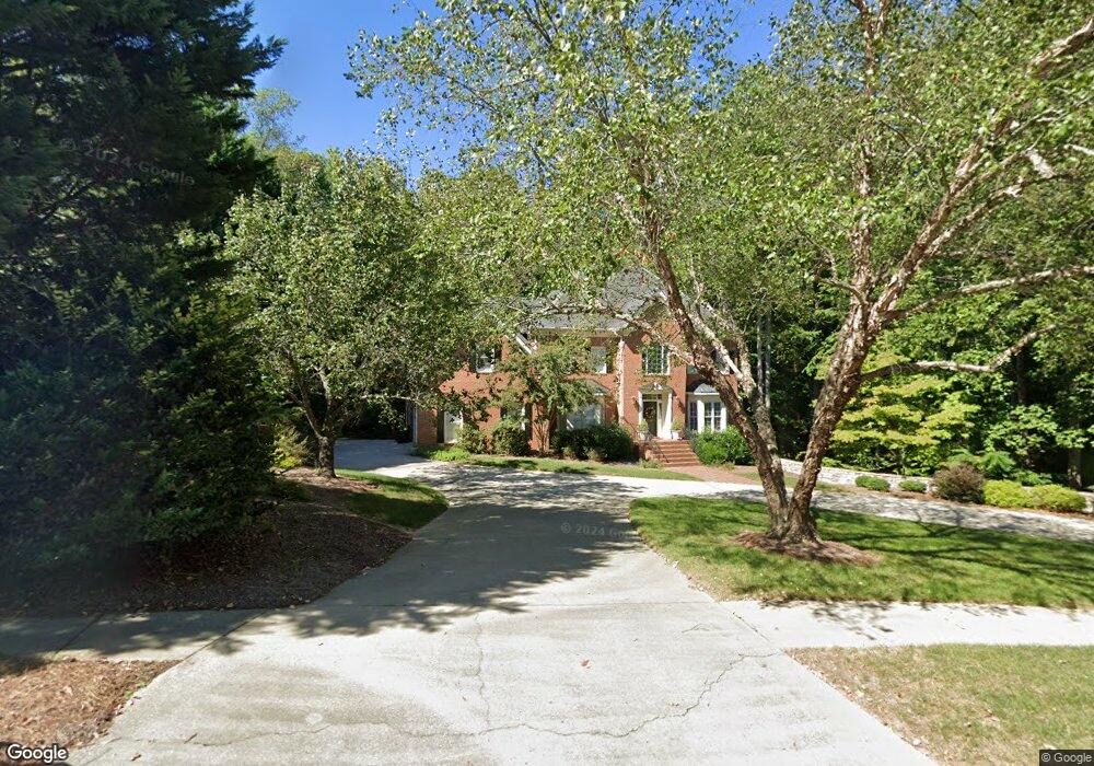
1713 Farnsworth Ct High Point, NC 27262
Greater High Point NeighborhoodEstimated Value: $513,432 - $649,000
4
Beds
3
Baths
3,192
Sq Ft
$180/Sq Ft
Est. Value
About This Home
This home is located at 1713 Farnsworth Ct, High Point, NC 27262 and is currently estimated at $574,858, approximately $180 per square foot. 1713 Farnsworth Ct is a home located in Guilford County with nearby schools including Northwood Elementary School, Ferndale Middle School, and High Point Central High School.
Ownership History
Date
Name
Owned For
Owner Type
Purchase Details
Closed on
Mar 7, 2003
Sold by
Cowen Nancy H and Cowen Peter M
Bought by
Sanders George and Sanders Julie
Current Estimated Value
Home Financials for this Owner
Home Financials are based on the most recent Mortgage that was taken out on this home.
Original Mortgage
$280,000
Interest Rate
5.88%
Mortgage Type
Purchase Money Mortgage
Create a Home Valuation Report for This Property
The Home Valuation Report is an in-depth analysis detailing your home's value as well as a comparison with similar homes in the area
Home Values in the Area
Average Home Value in this Area
Purchase History
| Date | Buyer | Sale Price | Title Company |
|---|---|---|---|
| Sanders George | $365,000 | -- |
Source: Public Records
Mortgage History
| Date | Status | Borrower | Loan Amount |
|---|---|---|---|
| Closed | Sanders George | $280,000 | |
| Closed | Sanders George | $52,500 |
Source: Public Records
Tax History Compared to Growth
Tax History
| Year | Tax Paid | Tax Assessment Tax Assessment Total Assessment is a certain percentage of the fair market value that is determined by local assessors to be the total taxable value of land and additions on the property. | Land | Improvement |
|---|---|---|---|---|
| 2025 | $5,500 | $399,100 | $72,000 | $327,100 |
| 2024 | $5,500 | $399,100 | $72,000 | $327,100 |
| 2023 | $5,500 | $399,100 | $72,000 | $327,100 |
| 2022 | $5,380 | $399,100 | $72,000 | $327,100 |
| 2021 | $5,094 | $369,700 | $60,000 | $309,700 |
| 2020 | $5,094 | $369,700 | $60,000 | $309,700 |
| 2019 | $5,094 | $369,700 | $0 | $0 |
| 2018 | $5,069 | $369,700 | $0 | $0 |
| 2017 | $5,094 | $369,700 | $0 | $0 |
| 2016 | $4,966 | $354,100 | $0 | $0 |
| 2015 | $4,993 | $354,100 | $0 | $0 |
| 2014 | $5,078 | $354,100 | $0 | $0 |
Source: Public Records
Map
Nearby Homes
- 1204 Ascot Ct
- 1509 Heathcliff Rd
- 1001 Nuthatch Ct
- 914 Flicker Ln
- 2235 Shadow Valley Rd Unit E
- 605 Westchester Dr
- 921 Flicker Ln
- 501 Westchester Dr
- 708 Rockspring Rd
- 508 Fisher Ave
- 1101 Robin Hood Rd
- 413 Greenwood Dr
- 1266 Dovershire Place
- 2630 Ingleside Dr Unit 2D
- 504 W Lexington Ave
- 506 Greenwood Dr
- 510 Greenwood Dr
- 1312 Gilbrook Ct
- 4099 Stallion St
- Bailey Plan at Canter Creek
- 1715 Farnsworth Ct
- 1709 Farnsworth Ct
- 1717 Farnsworth Ct
- 1710 Farnsworth Ct
- 1706 Farnsworth Ct
- 1708 Heathcliff Rd
- 1707 Farnsworth Ct
- 1718 Farnsworth Ct
- 1716 Farnsworth Ct
- 1710 Heathcliff Rd
- 1705 Farnsworth Ct
- 1700 Farnsworth Ct
- 1204 Brookfield Ct
- 1704 Heathcliff Rd
- 1703 Farnsworth Ct
- 1200 Brookfield Ct
- 1711 Heathcliff Rd
- 1702 Heathcliff Rd
- 1701 Farnsworth Ct
- 1707 Heathcliff Rd