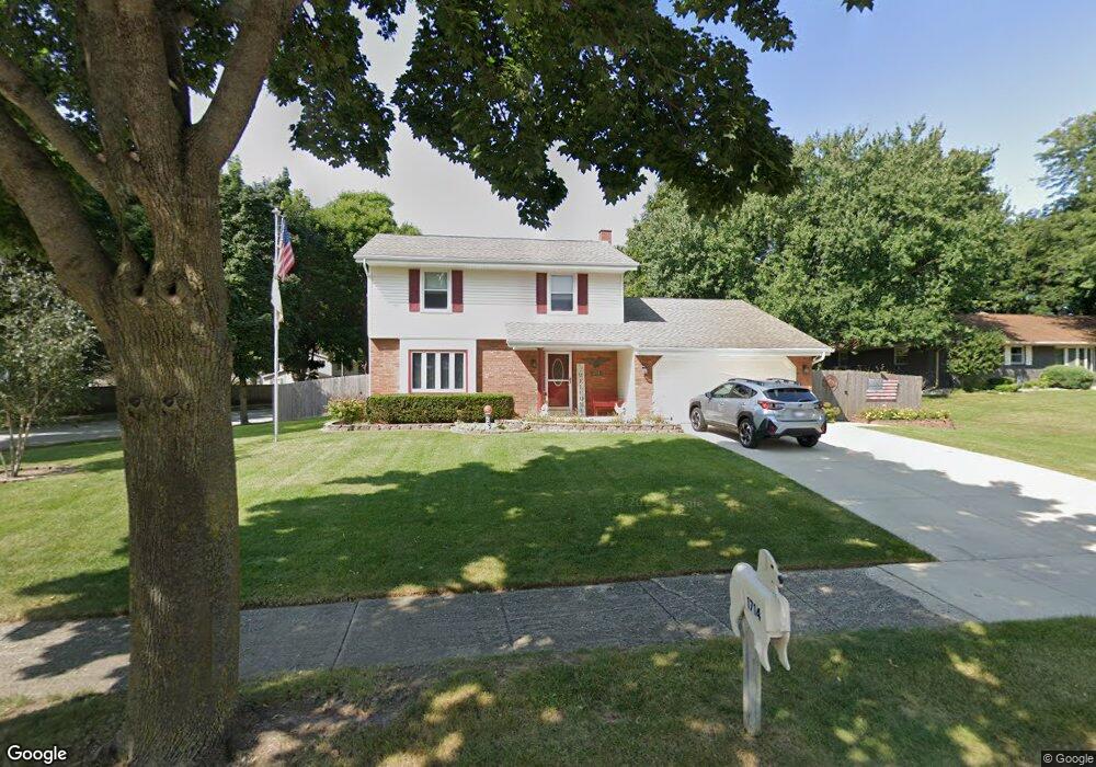
1714 Hemit Ave Waukesha, WI 53189
Estimated Value: $379,000 - $425,000
3
Beds
2
Baths
1,616
Sq Ft
$246/Sq Ft
Est. Value
About This Home
This home is located at 1714 Hemit Ave, Waukesha, WI 53189 and is currently estimated at $397,195, approximately $245 per square foot. 1714 Hemit Ave is a home located in Waukesha County with nearby schools including Prairie Elementary School, Les Paul Middle School - Central Campus, and West High School.
Ownership History
Date
Name
Owned For
Owner Type
Purchase Details
Closed on
Jul 19, 2017
Sold by
Lombardi Jeffery T
Bought by
Lombardi Jeffery T and Lombardi Linda S
Current Estimated Value
Purchase Details
Closed on
Oct 18, 2002
Sold by
Lombardi Jeffery T and Lombardi Lorraine M
Bought by
Lombardi Jeffery T
Home Financials for this Owner
Home Financials are based on the most recent Mortgage that was taken out on this home.
Original Mortgage
$88,500
Interest Rate
6.13%
Create a Home Valuation Report for This Property
The Home Valuation Report is an in-depth analysis detailing your home's value as well as a comparison with similar homes in the area
Home Values in the Area
Average Home Value in this Area
Purchase History
| Date | Buyer | Sale Price | Title Company |
|---|---|---|---|
| Lombardi Jeffery T | -- | None Available | |
| Lombardi Jeffery T | -- | -- |
Source: Public Records
Mortgage History
| Date | Status | Borrower | Loan Amount |
|---|---|---|---|
| Closed | Lombardi Jeffery T | $88,500 |
Source: Public Records
Tax History Compared to Growth
Tax History
| Year | Tax Paid | Tax Assessment Tax Assessment Total Assessment is a certain percentage of the fair market value that is determined by local assessors to be the total taxable value of land and additions on the property. | Land | Improvement |
|---|---|---|---|---|
| 2024 | $4,560 | $308,400 | $84,900 | $223,500 |
| 2023 | $4,431 | $308,400 | $84,900 | $223,500 |
| 2022 | $4,350 | $227,600 | $77,400 | $150,200 |
| 2021 | $4,451 | $227,600 | $77,400 | $150,200 |
| 2020 | $4,303 | $227,600 | $77,400 | $150,200 |
| 2019 | $4,168 | $227,600 | $77,400 | $150,200 |
| 2018 | $3,825 | $205,000 | $68,300 | $136,700 |
| 2017 | $3,938 | $188,300 | $68,300 | $120,000 |
| 2016 | $3,314 | $168,100 | $66,100 | $102,000 |
| 2015 | $3,296 | $168,100 | $66,100 | $102,000 |
| 2014 | $3,439 | $168,100 | $66,100 | $102,000 |
| 2013 | $3,439 | $168,100 | $66,000 | $102,100 |
Source: Public Records
Map
Nearby Homes
- 1101 Dogwood Ln
- 1722 Sycamore Dr
- 1909 Mallard Pointe Cir
- 2010 Dixie Dr
- 1706 Haymarket Rd
- 1027 River Place Blvd Unit 1027
- 1523 David Ln
- 1210 Woodbury Common Unit C
- 1203 Woodbury Common Unit B
- 1203 Woodbury Common Unit D
- 1277 Market Place
- LtD59 White Deer Trail
- 812 Timber Ridge Ct Unit 10
- 314 Coolidge Ave
- 838 Elise Ct Unit 23
- S31W26111 Sunset Dr
- S54W25487 Pebble Brook Ct
- S54W25436 Pebble Brook Ct
- 801 Timber Ridge Dr
- 1522 Big Bend Rd Unit G
- W250S3353 Hemit Ave
- 1711 Hemit Ave
- 1800 Hemit Ave
- 914 School Dr
- 1713 Dixie Dr
- 923 School Dr
- W250S3337 Hemit Ave
- 1804 Hemit Ave
- 1808 Hemit Ave
- 1709 Dixie Dr
- 1805 Dixie Dr
- 913 School Dr
- W250S3340 Hemit Ave
- 910 School Dr
- 1807 Hemit Ave
- 1809 Dixie Dr
- 1705 Dixie Dr
- W250S3327 Hemit Ave
- 1708 Dixie Dr
- 906 School Dr