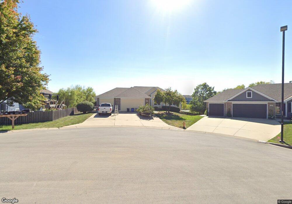
1715 Bobcat Ct Raymore, MO 64083
Estimated Value: $346,000 - $385,000
3
Beds
2
Baths
1,666
Sq Ft
$222/Sq Ft
Est. Value
About This Home
This home is located at 1715 Bobcat Ct, Raymore, MO 64083 and is currently estimated at $370,677, approximately $222 per square foot. 1715 Bobcat Ct is a home located in Cass County with nearby schools including Stonegate Elementary School, Raymore-Peculiar South Middle School, and Raymore-Peculiar Senior High School.
Ownership History
Date
Name
Owned For
Owner Type
Purchase Details
Closed on
Sep 14, 2012
Sold by
Bellah James W and Bellah Karen G
Bought by
Bellah James W and Bellah Karen G
Current Estimated Value
Purchase Details
Closed on
Jan 4, 2012
Sold by
Bellah James W and Bellah Karen G
Bought by
Bellah James W and Bellah Karen G
Purchase Details
Closed on
Jul 8, 2008
Sold by
Bellah James W and Bellah Karen G
Bought by
Bellah James W and Bellah Karen G
Create a Home Valuation Report for This Property
The Home Valuation Report is an in-depth analysis detailing your home's value as well as a comparison with similar homes in the area
Home Values in the Area
Average Home Value in this Area
Purchase History
| Date | Buyer | Sale Price | Title Company |
|---|---|---|---|
| Bellah James W | -- | None Available | |
| Bellah James W | -- | None Available | |
| Bellah James W | -- | -- |
Source: Public Records
Tax History Compared to Growth
Tax History
| Year | Tax Paid | Tax Assessment Tax Assessment Total Assessment is a certain percentage of the fair market value that is determined by local assessors to be the total taxable value of land and additions on the property. | Land | Improvement |
|---|---|---|---|---|
| 2025 | $3,709 | $52,110 | $5,210 | $46,900 |
| 2024 | $3,709 | $45,580 | $4,740 | $40,840 |
| 2023 | $3,704 | $45,580 | $4,740 | $40,840 |
| 2022 | $3,343 | $40,860 | $4,740 | $36,120 |
| 2021 | $3,343 | $40,860 | $4,740 | $36,120 |
| 2020 | $3,284 | $39,430 | $4,740 | $34,690 |
| 2019 | $3,171 | $39,430 | $4,740 | $34,690 |
| 2018 | $2,933 | $35,220 | $3,950 | $31,270 |
| 2017 | $2,690 | $35,220 | $3,950 | $31,270 |
| 2016 | $2,690 | $33,530 | $3,950 | $29,580 |
| 2015 | $2,692 | $33,530 | $3,950 | $29,580 |
| 2014 | $2,693 | $33,530 | $3,950 | $29,580 |
| 2013 | -- | $33,530 | $3,950 | $29,580 |
Source: Public Records
Map
Nearby Homes
- 816 Blue Grama Ct
- 1703 Rolling Rock Rd
- 1519 Colt Cir
- 1509 Saddlebrook Rd
- 1515 Fox Run Ln
- 1511 Fox Run Ln
- 1508 Bridlewood Ln
- 610 Roanke Dr
- 1112 Carlisle Dr
- 1312 Verbena Place
- 1228 Larkspur Place
- 1301 Larkspur Place
- 1222 Larkspur Place
- 300 Dean Ave
- 502 Woodview Dr
- 1220 Larkspur Place
- 411 Eagle Glen Dr
- 1225 Larkspur Place
- 415 Woodview Dr
- 500 Woodview Dr
- 1717 Bobcat Ct
- 834 Old Paint Rd
- 832 Old Paint Rd
- 1718 Bobcat Ct
- 1719 S Fox Ridge Dr
- 1716 Bobcat Ct
- 1714 Bobcat Ct
- 1712 Bobcat Ct
- 1717 S Fox Ridge Dr
- 833 Old Paint Rd
- 831 Old Paint Rd
- 1715 S Fox Ridge Dr
- 1715 Black Bear Ct
- 1800 Buffalo Grass Dr
- 824 Old Paint Rd
- 827 Old Paint Rd
- 1713 Black Bear Ct
- 1713 S Fox Ridge Dr
- 1802 Buffalo Grass Dr
- 1711 Black Bear Ct