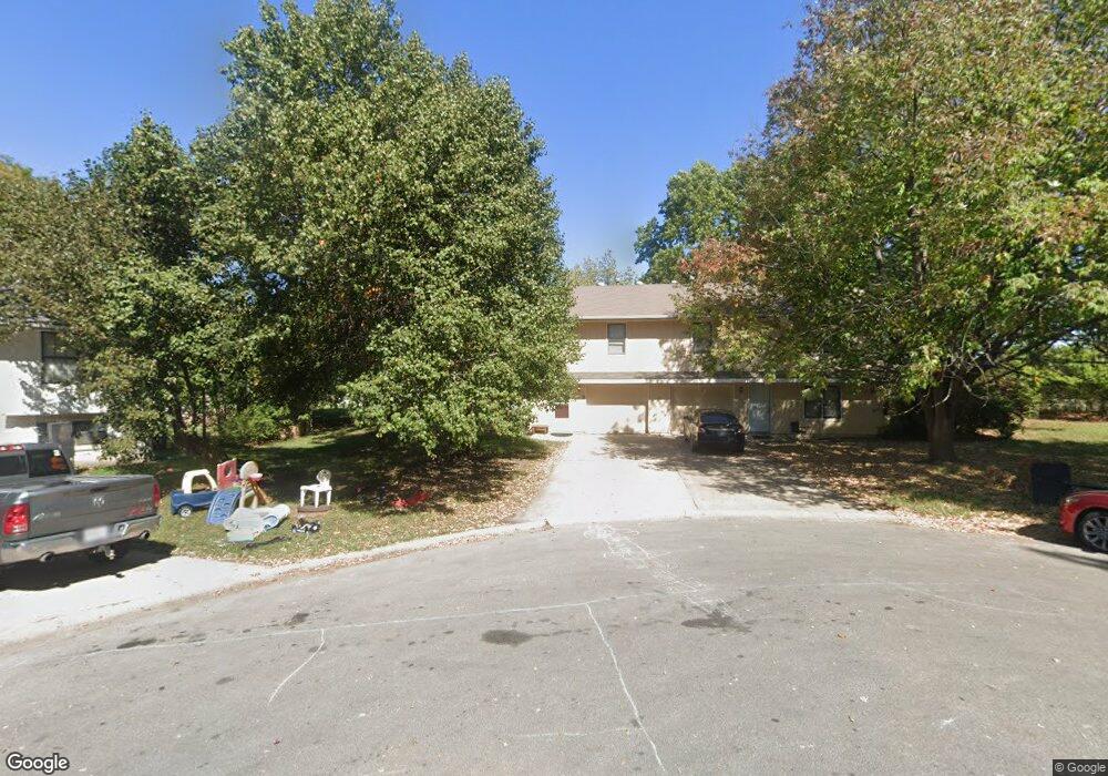
1715 NE White Dr Unit B Lees Summit, MO 64086
Estimated Value: $218,731 - $326,000
3
Beds
4
Baths
1,656
Sq Ft
$169/Sq Ft
Est. Value
About This Home
This home is located at 1715 NE White Dr Unit B, Lees Summit, MO 64086 and is currently estimated at $280,183, approximately $169 per square foot. 1715 NE White Dr Unit B is a home located in Jackson County with nearby schools including Meadow Lane Elementary School, Bernard C. Campbell Middle School, and Lee's Summit North High School.
Ownership History
Date
Name
Owned For
Owner Type
Purchase Details
Closed on
Sep 10, 2014
Sold by
Harmer Cynthia W
Bought by
Harmer Cynthia W
Current Estimated Value
Purchase Details
Closed on
Dec 22, 2005
Sold by
Marshall Richard A
Bought by
Simms Dennis and Harmer Cynthia W
Home Financials for this Owner
Home Financials are based on the most recent Mortgage that was taken out on this home.
Original Mortgage
$139,200
Outstanding Balance
$77,930
Interest Rate
6.3%
Mortgage Type
Fannie Mae Freddie Mac
Estimated Equity
$202,253
Create a Home Valuation Report for This Property
The Home Valuation Report is an in-depth analysis detailing your home's value as well as a comparison with similar homes in the area
Home Values in the Area
Average Home Value in this Area
Purchase History
| Date | Buyer | Sale Price | Title Company |
|---|---|---|---|
| Harmer Cynthia W | -- | None Available | |
| Simms Dennis | -- | Ort |
Source: Public Records
Mortgage History
| Date | Status | Borrower | Loan Amount |
|---|---|---|---|
| Open | Simms Dennis | $139,200 |
Source: Public Records
Tax History Compared to Growth
Tax History
| Year | Tax Paid | Tax Assessment Tax Assessment Total Assessment is a certain percentage of the fair market value that is determined by local assessors to be the total taxable value of land and additions on the property. | Land | Improvement |
|---|---|---|---|---|
| 2025 | $2,161 | $34,424 | $8,590 | $25,834 |
| 2024 | $2,161 | $29,935 | $4,368 | $25,567 |
| 2023 | $2,146 | $29,935 | $3,050 | $26,885 |
| 2022 | $2,132 | $26,410 | $4,313 | $22,097 |
| 2021 | $2,176 | $26,410 | $4,313 | $22,097 |
| 2020 | $1,930 | $23,198 | $4,313 | $18,885 |
| 2019 | $1,878 | $23,198 | $4,313 | $18,885 |
| 2018 | $1,467 | $16,819 | $1,640 | $15,179 |
| 2017 | $1,467 | $16,819 | $1,640 | $15,179 |
| 2016 | $1,445 | $16,397 | $1,691 | $14,706 |
| 2014 | $1,285 | $14,302 | $2,069 | $12,233 |
Source: Public Records
Map
Nearby Homes
- 810 NE Cedar St
- 1708 NE Balboa St
- 811 NE Mulberry St
- 715 NE Cambridge Dr
- 809 NE Mulberry St
- 1138 NE Mulberry St
- 1505 NE Deer Ct
- 510 NE Thames Dr
- 716 NE Thames Dr
- 1300 NE Browning Ln
- 1108 NE Ridgeview Dr
- 1400 NE Colbern Rd
- 1020 NE Woodbury Ln
- 1020 NE Lindsay Ave
- 27104 E Cedar Grove Dr
- 703 NE Swann Cir
- 1717 NE Luther Rd
- 1345 NE Foxwood Dr
- 1317 NE Foxwood Dr
- 1325 NE Foxwood Dr
- 1711 NE White Dr Unit A
- 1711 NE White Dr
- 1714 NE White Dr
- 1712 NE White Dr
- 1710 NE White Dr
- 1709 NE White Dr Unit A
- 835 NE Pollard St
- 832 NE Pollard St
- 1708 NE White Dr
- 831 NE Pollard St
- 1707 NE White Dr
- 1707 NE White Dr
- 1707 NE White Dr Unit A
- 828 NE Pollard St
- 1706 NE White Dr
- 1705 NE White Dr Unit A
- 832 NE Cambridge Dr
- 824 NE Pollard St
- 837 NE Cambridge Dr
- 823 NE Pollard St