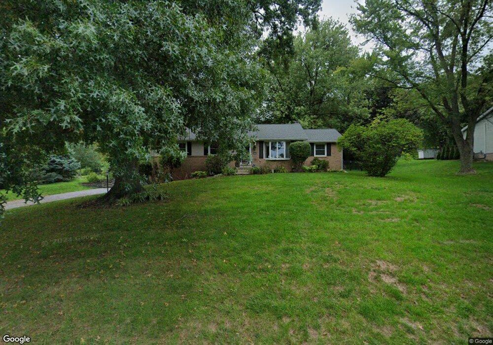
1716 Stony Battery Rd Lancaster, PA 17601
Oyster Point NeighborhoodEstimated Value: $361,000 - $387,000
3
Beds
3
Baths
1,496
Sq Ft
$248/Sq Ft
Est. Value
About This Home
This home is located at 1716 Stony Battery Rd, Lancaster, PA 17601 and is currently estimated at $370,534, approximately $247 per square foot. 1716 Stony Battery Rd is a home located in Lancaster County with nearby schools including Landisville Primary Center, Landisville Middle School, and Hempfield Senior High School.
Ownership History
Date
Name
Owned For
Owner Type
Purchase Details
Closed on
Jun 6, 2003
Sold by
Kauffman Janet W
Bought by
Pennington Shawn R
Current Estimated Value
Home Financials for this Owner
Home Financials are based on the most recent Mortgage that was taken out on this home.
Original Mortgage
$119,920
Outstanding Balance
$52,493
Interest Rate
5.77%
Mortgage Type
Purchase Money Mortgage
Estimated Equity
$318,041
Create a Home Valuation Report for This Property
The Home Valuation Report is an in-depth analysis detailing your home's value as well as a comparison with similar homes in the area
Home Values in the Area
Average Home Value in this Area
Purchase History
| Date | Buyer | Sale Price | Title Company |
|---|---|---|---|
| Pennington Shawn R | $149,900 | Fidelity National Title |
Source: Public Records
Mortgage History
| Date | Status | Borrower | Loan Amount |
|---|---|---|---|
| Open | Pennington Shawn R | $119,920 | |
| Closed | Pennington Shawn R | $22,485 |
Source: Public Records
Tax History Compared to Growth
Tax History
| Year | Tax Paid | Tax Assessment Tax Assessment Total Assessment is a certain percentage of the fair market value that is determined by local assessors to be the total taxable value of land and additions on the property. | Land | Improvement |
|---|---|---|---|---|
| 2025 | $3,946 | $175,000 | $46,600 | $128,400 |
| 2024 | $3,946 | $175,000 | $46,600 | $128,400 |
| 2023 | $3,871 | $175,000 | $46,600 | $128,400 |
| 2022 | $3,769 | $175,000 | $46,600 | $128,400 |
| 2021 | $3,694 | $175,000 | $46,600 | $128,400 |
| 2020 | $3,694 | $175,000 | $46,600 | $128,400 |
| 2019 | $3,634 | $175,000 | $46,600 | $128,400 |
| 2018 | $4,320 | $175,000 | $46,600 | $128,400 |
| 2017 | $3,692 | $143,600 | $32,200 | $111,400 |
| 2016 | $3,619 | $143,600 | $32,200 | $111,400 |
| 2015 | $729 | $143,600 | $32,200 | $111,400 |
| 2014 | $2,670 | $143,600 | $32,200 | $111,400 |
Source: Public Records
Map
Nearby Homes
- 27 Apple Ln
- 3210 Glengreen Dr
- 3142 Briarwood Blvd
- 11 Cedar Ln
- 667 Golden Eagle Way
- 1622 Stony Battery Rd
- 710 Dustin Dr
- 364 Primrose Ln
- Ethan Plan at Enclave at Independence Ridge
- Kipling Plan at Enclave at Independence Ridge
- Parker Plan at Enclave at Independence Ridge
- Addison Plan at Enclave at Independence Ridge
- Savannah Plan at Enclave at Independence Ridge
- Woodford Plan at Enclave at Independence Ridge
- Devonshire Plan at Enclave at Independence Ridge
- Magnolia Plan at Enclave at Independence Ridge
- Hawthorne Plan at Enclave at Independence Ridge
- Covington Plan at Enclave at Independence Ridge
- Lachlan Plan at Enclave at Independence Ridge
- Augusta Plan at Enclave at Independence Ridge
- 1712 Stony Battery Rd
- 1720 Stony Battery Rd
- 3203 Horizon Dr
- 3116 Greenridge Dr
- 3118 Greenridge Dr
- 1708 Stony Battery Rd
- 3114 Greenridge Dr
- 3120 Greenridge Dr
- 3112 Greenridge Dr
- 399 Jay Ln
- 3122 Greenridge Dr
- 1704 Stony Battery Rd
- 3205 Horizon Dr
- 3270 Horizon Dr
- 398 Jay Ln
- 3205A Horizon Dr
- 3124 Greenridge Dr
- 3110 Greenridge Dr
- 3111 Greenridge Dr
- 3117 Greenridge Dr