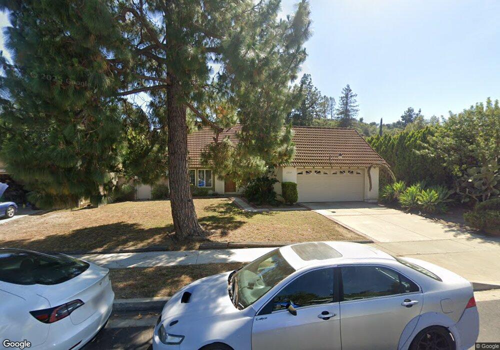
1719 Kiowa Crest Dr Diamond Bar, CA 91765
Estimated Value: $1,019,000 - $1,215,000
3
Beds
2
Baths
1,872
Sq Ft
$581/Sq Ft
Est. Value
About This Home
This home is located at 1719 Kiowa Crest Dr, Diamond Bar, CA 91765 and is currently estimated at $1,087,383, approximately $580 per square foot. 1719 Kiowa Crest Dr is a home located in Los Angeles County with nearby schools including Maple Hill Elementary School, Chaparral Middle School, and Diamond Bar High School.
Ownership History
Date
Name
Owned For
Owner Type
Purchase Details
Closed on
Sep 7, 2019
Sold by
Chou Elaine
Bought by
Chou Elaine and Chou Arng Joshua
Current Estimated Value
Home Financials for this Owner
Home Financials are based on the most recent Mortgage that was taken out on this home.
Original Mortgage
$480,000
Outstanding Balance
$421,302
Interest Rate
3.7%
Mortgage Type
New Conventional
Estimated Equity
$666,081
Purchase Details
Closed on
Apr 13, 2016
Sold by
Chou Joseph C and Chou Elaine
Bought by
Chou Elaine
Purchase Details
Closed on
Jul 6, 1993
Sold by
Chou Joseph C and Chou Elaine
Bought by
Chou Joseph C and Chou Elaine
Home Financials for this Owner
Home Financials are based on the most recent Mortgage that was taken out on this home.
Original Mortgage
$175,000
Interest Rate
6.25%
Create a Home Valuation Report for This Property
The Home Valuation Report is an in-depth analysis detailing your home's value as well as a comparison with similar homes in the area
Home Values in the Area
Average Home Value in this Area
Purchase History
| Date | Buyer | Sale Price | Title Company |
|---|---|---|---|
| Chou Elaine | -- | Stewart Title | |
| Chou Elaine | -- | None Available | |
| Chou Joseph C | -- | United Title Co |
Source: Public Records
Mortgage History
| Date | Status | Borrower | Loan Amount |
|---|---|---|---|
| Open | Chou Elaine | $480,000 | |
| Previous Owner | Chou Joseph C | $175,000 |
Source: Public Records
Tax History Compared to Growth
Tax History
| Year | Tax Paid | Tax Assessment Tax Assessment Total Assessment is a certain percentage of the fair market value that is determined by local assessors to be the total taxable value of land and additions on the property. | Land | Improvement |
|---|---|---|---|---|
| 2025 | $4,717 | $365,703 | $138,093 | $227,610 |
| 2024 | $4,717 | $358,534 | $135,386 | $223,148 |
| 2023 | $4,609 | $351,505 | $132,732 | $218,773 |
| 2022 | $4,511 | $344,614 | $130,130 | $214,484 |
| 2021 | $4,420 | $337,858 | $127,579 | $210,279 |
| 2019 | $4,282 | $327,839 | $123,796 | $204,043 |
| 2018 | $4,091 | $321,412 | $121,369 | $200,043 |
| 2016 | $3,786 | $308,933 | $116,657 | $192,276 |
| 2015 | $3,806 | $304,293 | $114,905 | $189,388 |
| 2014 | $3,813 | $298,334 | $112,655 | $185,679 |
Source: Public Records
Map
Nearby Homes
- 1522 Deerfoot Dr
- 1739 Shadehill Place
- 1806 Morning Canyon Rd
- 2119 Dublin Ln Unit 3
- 2256 Shady Hills Dr
- 2282 Shady Hills Dr
- 2221 Dublin Ln Unit 2
- 1826 Wellspring Dr
- 22455 Ridge Line Rd
- 22586 Pacific Ln
- 22536 Ridge Line Rd
- 1714 Roundtree Cir
- 2118 Tierra Loma Dr
- 22407 Birds Eye Dr
- 1721 Cliffbranch Dr
- 21600 Laurelrim Dr Unit B
- 22939 Ridge Line Rd
- 22517 Lazy Meadow Dr
- 22499 Birds Eye Dr
- 1779 Autumnglow Dr
- 1725 Kiowa Crest Dr
- 1711 Kiowa Crest Dr
- 1808 Tintah Dr
- 1731 Kiowa Crest Dr
- 1705 Kiowa Crest Dr
- 1816 Tintah Dr
- 1724 Kiowa Crest Dr
- 1710 Kiowa Crest Dr
- 1653 Kiowa Crest Dr
- 1800 Tintah Dr
- 1822 Tintah Dr
- 1702 Kiowa Crest Dr
- 1804 Tintah Dr
- 1738 Mensha Ct
- 1811 Kiowa Crest Dr
- 1715 Mensha Ct
- 1805 Tintah Dr
- 1652 Kiowa Crest Dr
- 1830 Tintah Dr
- 1707 Mensha Ct