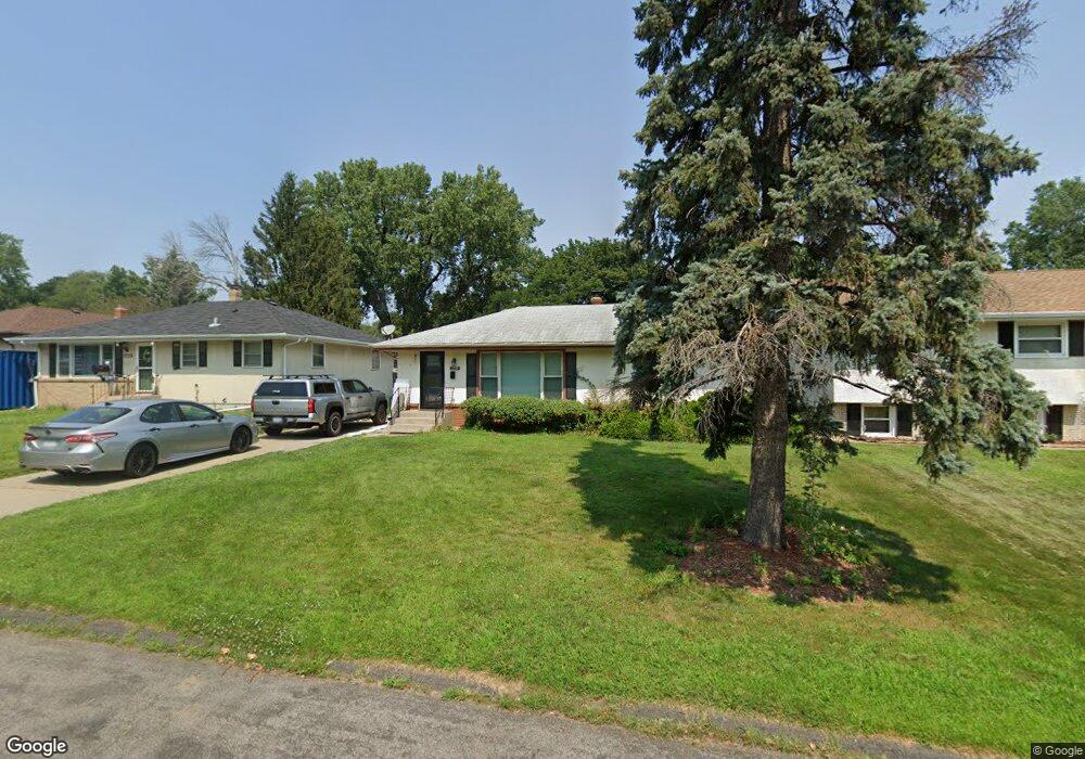
1719 Leone Ave Saint Paul, MN 55106
Battle Creek NeighborhoodEstimated Value: $281,000 - $296,000
3
Beds
2
Baths
679
Sq Ft
$428/Sq Ft
Est. Value
About This Home
This home is located at 1719 Leone Ave, Saint Paul, MN 55106 and is currently estimated at $290,438, approximately $427 per square foot. 1719 Leone Ave is a home located in Ramsey County with nearby schools including Highwood Hills Elementary School, Battle Creek Middle School, and Harding Senior High School.
Ownership History
Date
Name
Owned For
Owner Type
Purchase Details
Closed on
Jun 17, 2016
Sold by
Olson Catherine Ann
Bought by
Lee Andry
Current Estimated Value
Home Financials for this Owner
Home Financials are based on the most recent Mortgage that was taken out on this home.
Original Mortgage
$173,789
Outstanding Balance
$138,317
Interest Rate
3.57%
Mortgage Type
FHA
Estimated Equity
$152,121
Purchase Details
Closed on
May 26, 1999
Sold by
Hud
Bought by
Olson Catherine A
Create a Home Valuation Report for This Property
The Home Valuation Report is an in-depth analysis detailing your home's value as well as a comparison with similar homes in the area
Home Values in the Area
Average Home Value in this Area
Purchase History
| Date | Buyer | Sale Price | Title Company |
|---|---|---|---|
| Lee Andry | $177,000 | First American Title Ins Co | |
| Olson Catherine A | $98,900 | -- |
Source: Public Records
Mortgage History
| Date | Status | Borrower | Loan Amount |
|---|---|---|---|
| Open | Lee Andry | $173,789 |
Source: Public Records
Tax History Compared to Growth
Tax History
| Year | Tax Paid | Tax Assessment Tax Assessment Total Assessment is a certain percentage of the fair market value that is determined by local assessors to be the total taxable value of land and additions on the property. | Land | Improvement |
|---|---|---|---|---|
| 2025 | $5,326 | $265,800 | $34,900 | $230,900 |
| 2023 | $5,326 | $262,400 | $34,900 | $227,500 |
| 2022 | $4,794 | $258,900 | $34,900 | $224,000 |
| 2021 | $3,862 | $231,000 | $35,500 | $195,500 |
| 2020 | $3,518 | $207,600 | $35,500 | $172,100 |
| 2019 | $3,288 | $199,300 | $35,500 | $163,800 |
| 2018 | $2,950 | $206,200 | $35,500 | $170,700 |
| 2017 | $2,472 | $185,900 | $31,300 | $154,600 |
| 2016 | $2,260 | $0 | $0 | $0 |
| 2015 | $2,324 | $137,700 | $31,300 | $106,400 |
| 2014 | $2,228 | $0 | $0 | $0 |
Source: Public Records
Map
Nearby Homes
- 1747 Louise Ave
- 125 Battle Creek Place
- 237 Sigurd St
- 267 Hazelwood St
- 49 Battle Creek Place
- 1600 Old Hudson Rd
- 1935 Warbler Ln
- 201 Dora Ct W
- 1821 Wilson Ave
- 1538 Wilson Ave
- 1989 N Park Dr
- 138 Ruth St N Unit 9
- 1685 Fremont Ave
- 2059 Parkside Dr Unit 29
- 244 Point Douglas Rd N
- 465 Ruth St N
- 1935 Fremont Ave E
- 1333 Pacific St
- 1991 3rd St E
- 500 Etna St Unit 104
- 1725 Leone Ave
- 1715 Leone Ave
- 1731 Leone Ave
- 1709 Leone Ave
- 1735 Leone Ave
- 1720 Burns Ave
- 1712 Burns Ave
- 1745 Leone Ave
- 1697 Leone Ave
- 1726 Burns Ave
- 1712 1712 Burns-Avenue-
- 1722 Leone Ave
- 1722 1722 Leone-Avenue-
- 1722 1722 Leone Ave
- 1716 Leone Ave
- 1716 1716 Leone Ave
- 1702 Burns Ave
- 1728 Leone Ave
- 1728 1728 Leone Ave
- 1710 Leone Ave