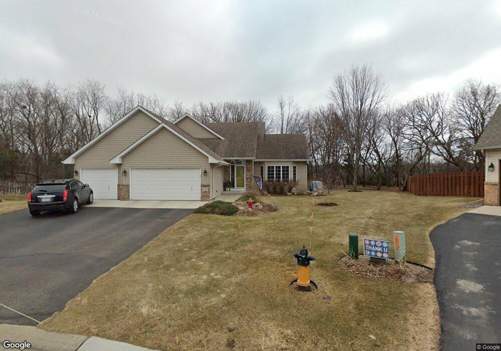
1719 Windsor Cir Shakopee, MN 55379
Estimated Value: $437,000 - $514,000
4
Beds
4
Baths
1,386
Sq Ft
$348/Sq Ft
Est. Value
About This Home
This home is located at 1719 Windsor Cir, Shakopee, MN 55379 and is currently estimated at $482,413, approximately $348 per square foot. 1719 Windsor Cir is a home located in Scott County with nearby schools including Red Oak Elementary School, Shakopee West Middle School, and Shakopee Senior High School.
Ownership History
Date
Name
Owned For
Owner Type
Purchase Details
Closed on
Mar 27, 2001
Sold by
Logeais Richard L and Logeais Jeanne A
Bought by
Pitschneider Thomas J and Pitschneider Michele A
Current Estimated Value
Purchase Details
Closed on
Jun 30, 2000
Sold by
Shakopee Crossings Ltd Partnership
Bought by
Logeais Richard L
Create a Home Valuation Report for This Property
The Home Valuation Report is an in-depth analysis detailing your home's value as well as a comparison with similar homes in the area
Home Values in the Area
Average Home Value in this Area
Purchase History
| Date | Buyer | Sale Price | Title Company |
|---|---|---|---|
| Pitschneider Thomas J | $219,900 | -- | |
| Logeais Richard L | $61,900 | -- |
Source: Public Records
Tax History
| Year | Tax Paid | Tax Assessment Tax Assessment Total Assessment is a certain percentage of the fair market value that is determined by local assessors to be the total taxable value of land and additions on the property. | Land | Improvement |
|---|---|---|---|---|
| 2025 | $4,560 | $450,300 | $192,100 | $258,200 |
| 2024 | $4,526 | $439,100 | $188,400 | $250,700 |
| 2023 | $4,526 | $423,400 | $178,500 | $244,900 |
| 2022 | $4,504 | $416,500 | $171,600 | $244,900 |
| 2021 | $3,832 | $358,900 | $145,500 | $213,400 |
| 2020 | $4,238 | $335,900 | $121,300 | $214,600 |
| 2019 | $4,168 | $327,200 | $112,500 | $214,700 |
| 2018 | $4,476 | $0 | $0 | $0 |
| 2016 | $4,532 | $0 | $0 | $0 |
| 2014 | -- | $0 | $0 | $0 |
Source: Public Records
Map
Nearby Homes
- 1693 Windsor Dr S
- 1955 Red Oak
- 1820 Foothill Trail
- 1999 Red Oak Path
- 1821 Foothill Trail
- 7506 Hampton Ln
- 1782 Switchgrass Cir
- 7427 Water St
- 1764 Fescue Ct
- 7459 Waters Edge Ave
- 1339 Yorkshire Ln
- 7343 Derby Ln
- 2087 Brookview St
- 7554 Waverly Ave
- 7660 Waverly Ave
- 7696 Waverly Ave
- 7142 22nd Ave S
- 7675 22nd Ave E
- 7698 22nd Ave E
- 7682 22nd Ave E
- 1707 Windsor Cir
- 1712 Windsor Cir
- 1695 Windsor Cir
- 1700 Windsor Cir
- 7288 Whitehall Rd
- 1683 Windsor Cir
- 1688 Windsor Cir
- 7306 Whitehall Rd
- 7270 Whitehall Rd
- 7324 Whitehall Rd
- 1677 Windsor Dr S
- 7340 Waterlily Way
- 1671 Windsor Cir
- 7252 Whitehall Rd
- 1681 Windsor Dr S
- 7320 Waterlily Way
- 7342 Whitehall Rd
- 1664 Windsor Dr S
- 7234 Whitehall Rd
- 1672 Windsor Dr S
Your Personal Tour Guide
Ask me questions while you tour the home.