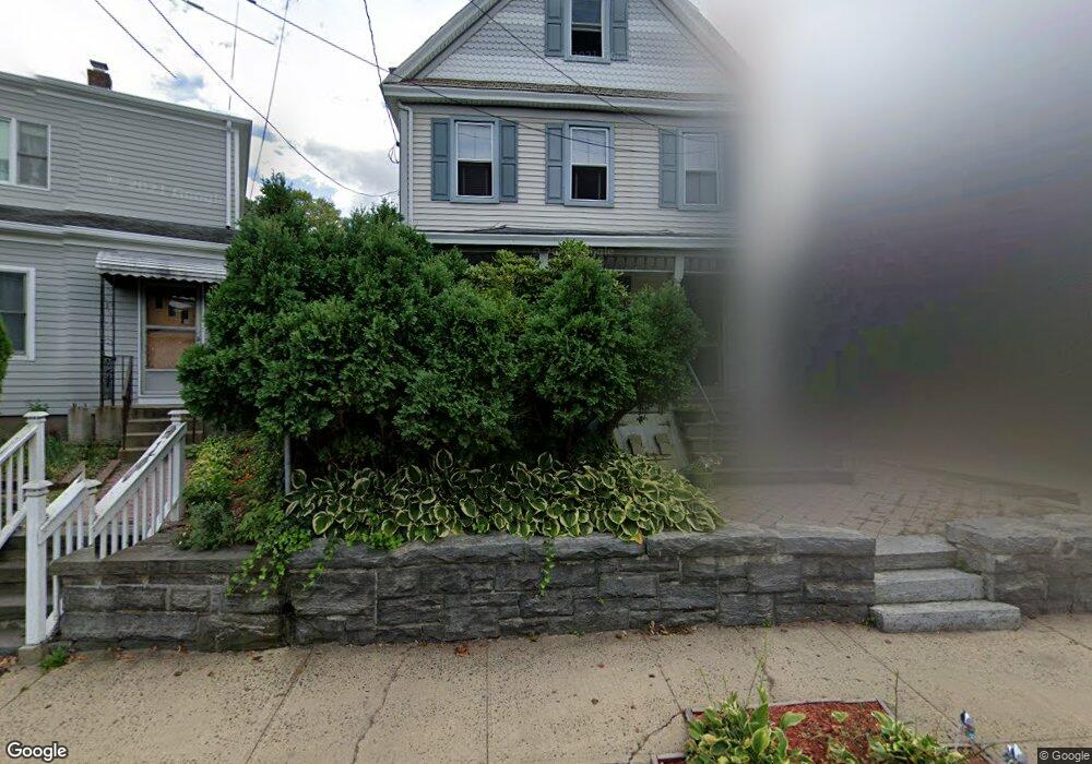
172 Ashford Ave Dobbs Ferry, NY 10522
Estimated Value: $690,000 - $876,000
3
Beds
2
Baths
1,356
Sq Ft
$597/Sq Ft
Est. Value
About This Home
This home is located at 172 Ashford Ave, Dobbs Ferry, NY 10522 and is currently estimated at $810,002, approximately $597 per square foot. 172 Ashford Ave is a home located in Westchester County with nearby schools including Springhurst Elementary School, Dobbs Ferry High School, and The Masters School.
Ownership History
Date
Name
Owned For
Owner Type
Purchase Details
Closed on
Jun 28, 2010
Sold by
Wallach Peter
Bought by
Romano William S and Romano Staci
Current Estimated Value
Home Financials for this Owner
Home Financials are based on the most recent Mortgage that was taken out on this home.
Original Mortgage
$434,153
Interest Rate
5.25%
Mortgage Type
FHA
Purchase Details
Closed on
Aug 11, 1995
Sold by
Keller Jonathan S and Keller Glori F
Bought by
Staton David and Ryan Kathleen N
Purchase Details
Closed on
Jul 27, 1995
Sold by
The Church Of The Immaculate Conception
Bought by
Keller Jonathan S and Keller Glori F
Create a Home Valuation Report for This Property
The Home Valuation Report is an in-depth analysis detailing your home's value as well as a comparison with similar homes in the area
Home Values in the Area
Average Home Value in this Area
Purchase History
| Date | Buyer | Sale Price | Title Company |
|---|---|---|---|
| Romano William S | $440,000 | Skyline Title Llc | |
| Staton David | $216,000 | Commonwealth Land Title Ins | |
| Keller Jonathan S | $322,000 | Chicago Title Insurance Co |
Source: Public Records
Mortgage History
| Date | Status | Borrower | Loan Amount |
|---|---|---|---|
| Previous Owner | Romano William S | $434,153 |
Source: Public Records
Tax History Compared to Growth
Tax History
| Year | Tax Paid | Tax Assessment Tax Assessment Total Assessment is a certain percentage of the fair market value that is determined by local assessors to be the total taxable value of land and additions on the property. | Land | Improvement |
|---|---|---|---|---|
| 2024 | $20,317 | $719,600 | $311,200 | $408,400 |
| 2023 | $19,529 | $701,000 | $296,400 | $404,600 |
| 2022 | $18,660 | $670,000 | $296,400 | $373,600 |
| 2021 | $16,440 | $620,300 | $296,400 | $323,900 |
| 2020 | $16,129 | $535,300 | $296,400 | $238,900 |
| 2019 | $17,260 | $535,300 | $296,400 | $238,900 |
| 2018 | $15,814 | $520,800 | $296,400 | $224,400 |
| 2017 | $6,018 | $501,600 | $296,400 | $205,200 |
| 2016 | $393,759 | $482,300 | $296,400 | $185,900 |
| 2015 | -- | $9,100 | $1,100 | $8,000 |
| 2014 | -- | $9,100 | $1,100 | $8,000 |
| 2013 | $5,421 | $9,100 | $1,100 | $8,000 |
Source: Public Records
Map
Nearby Homes
- 5 Forkland Ln
- 101 Beacon Hill Dr Unit 13
- 17 Manor House Dr Unit K13
- 14 Manor House Dr Unit G29
- 0 Ashford Ave Unit KEY885130
- 13 English Ln Unit B
- 63 Grandview Ave
- 0 Lyman Place Unit KEY923539
- 70 Washington Ave
- 118 Round Hill Rd
- 110 Round Hill Rd Unit 77
- 26 Round Hill Rd
- 50 Belden Ave
- 0 Sherman Ave Unit KEY841006
- 1402 Hunters Run
- 9 Round Hill Rd
- 36 Belden Ave
- 801 Hunters Run
- 164 Washington Ave
- 1001 Hunters Run
- 168 Ashford Ave
- 174 Ashford Ave
- 174 Ashford Ave Unit B
- 174 Ashford Ave Unit 2
- 8 Young St
- 164 Ashford Ave
- 164 Ashford Ave Unit 3
- 164 Ashford Ave Unit 2
- 180 Ashford Ave
- 12 Young St
- 177 Ashford Ave
- 177 Ashford Ave Unit 2
- 187 Ashford Ave Unit 187
- 160 Ashford Ave
- 182 Ashford Ave
- 182 Ashford Ave Unit 2
- 182 Ashford Ave Unit 3
- 182 Ashford Ave Unit 1
- 183 Ashford Ave
- 173 Ashford Ave