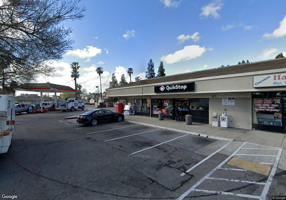
1721 S Cherokee Ln Lodi, CA 95240
East Lodi NeighborhoodEstimated Value: $1,957,360
3
Beds
--
Bath
6,110
Sq Ft
$320/Sq Ft
Est. Value
About This Home
This home is located at 1721 S Cherokee Ln, Lodi, CA 95240 and is currently estimated at $1,957,360, approximately $320 per square foot. 1721 S Cherokee Ln is a home located in San Joaquin County with nearby schools including Lois E. Borchardt Elementary School, Lodi Middle School, and Tokay High School.
Ownership History
Date
Name
Owned For
Owner Type
Purchase Details
Closed on
Feb 12, 2021
Sold by
Rae Linda and The Winje Family Trust
Bought by
Shergill Harbhajan and Shergill Devinder
Current Estimated Value
Home Financials for this Owner
Home Financials are based on the most recent Mortgage that was taken out on this home.
Original Mortgage
$600,000
Interest Rate
3%
Mortgage Type
Purchase Money Mortgage
Purchase Details
Closed on
Dec 29, 2016
Sold by
Winje George Henry and Winje Linda Ray
Bought by
Winje George Henry and Winje Linda Ray
Purchase Details
Closed on
Sep 10, 2015
Sold by
Miller Louise Vera and Winje George Henry
Bought by
Winje George Henry and Winje Linda Ray
Create a Home Valuation Report for This Property
The Home Valuation Report is an in-depth analysis detailing your home's value as well as a comparison with similar homes in the area
Home Values in the Area
Average Home Value in this Area
Purchase History
| Date | Buyer | Sale Price | Title Company |
|---|---|---|---|
| Shergill Harbhajan | $1,750,000 | Old Republic Title Company | |
| Winje George Henry | -- | None Available | |
| Winje George Henry | -- | None Available |
Source: Public Records
Mortgage History
| Date | Status | Borrower | Loan Amount |
|---|---|---|---|
| Previous Owner | Shergill Harbhajan | $600,000 |
Source: Public Records
Tax History Compared to Growth
Tax History
| Year | Tax Paid | Tax Assessment Tax Assessment Total Assessment is a certain percentage of the fair market value that is determined by local assessors to be the total taxable value of land and additions on the property. | Land | Improvement |
|---|---|---|---|---|
| 2025 | $19,591 | $1,802,629 | $936,302 | $866,327 |
| 2024 | $19,055 | $1,767,285 | $917,944 | $849,341 |
| 2023 | $12,941 | $1,194,715 | $512,020 | $682,695 |
| 2022 | $12,654 | $1,171,290 | $501,981 | $669,309 |
| 2021 | $12,885 | $1,148,325 | $492,139 | $656,186 |
| 2020 | $12,548 | $1,136,551 | $487,093 | $649,458 |
| 2019 | $12,294 | $1,114,267 | $477,543 | $636,724 |
| 2018 | $12,123 | $1,092,420 | $468,180 | $624,240 |
| 2017 | $11,852 | $1,071,000 | $459,000 | $612,000 |
| 2016 | $11,794 | $1,114,924 | $412,019 | $702,905 |
| 2015 | $11,670 | $1,098,179 | $405,831 | $692,348 |
| 2014 | $11,509 | $1,076,671 | $397,883 | $678,788 |
Source: Public Records
Map
Nearby Homes
- 1819 S Cherokee Ln Unit 58
- 471 Almond Dr Unit 22
- 471 Almond Dr Unit 89
- 445 Almond Dr Unit 64
- 445 Almond Dr Unit 106
- 713 E Century Place
- 348 Barrington Way
- 330 Finch Run
- 506 Mockingbird Dr
- 337 Acacia St
- 209 Elgin Ave
- 231 Dunsmuir Dr
- 325 Cypress St
- 337 Concord St
- 635 Ana St
- 1612 S Church St
- 21 Tamarack Dr
- 1245 S Church St
- 2606 Barrique Dr
- 1221 S Church St
- 511 Almond Dr
- 1651 S Cherokee Ln Unit 39
- 1651 S Cherokee Ln Unit 36
- 1651 S Cherokee Ln Unit 22
- 1651 S Cherokee Ln Unit 28
- 1800 S Cherokee Ln
- 1820 S Cherokee Ln
- 1819 S Cherokee Ln Unit 7
- 1819 S Cherokee Ln Unit 48
- 1819 S Cherokee Ln Unit 9
- 1819 S Cherokee Ln Unit 39
- 1819 S Cherokee Ln Unit 37
- 1819 S Cherokee Ln Unit 57
- 1819 S Cherokee Ln Unit 61
- 1819 S Cherokee Ln Unit 20
- 1819 S Cherokee Ln Unit 68
- 1819 S Cherokee Ln Unit 12
- 1819 S Cherokee Ln Unit 56
- 1819 S Cherokee Ln Unit 15
- 1819 S Cherokee Ln Unit 66
